

Seattle Weather: Warm Up by Wednesday

Seattle - A disturbance will drop south out of British Columbia, bringing a chance of some showers and storms to mainly the Cascades. Some spots east of the mountains will also have a chance at some much-needed rain.
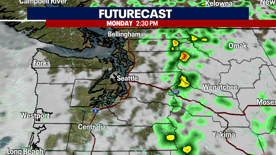
Showers and a few storms are possible in the mountains on Monday and Tuesday. (FOX13 Seattle)
A flood watch goes into effect around noon Monday until 9pm Monday. Slow-moving storms with heavy rain may cause flash flooding.
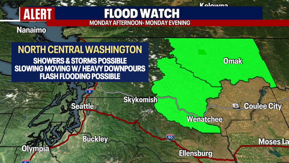
Slow-moving storms with heavy rain may cause flash flooding.
After a cloudier and cooler weekend, afternoon highs will again return to near normal by Monday and Tuesday. Take note if you are doing some hiking or camping the next couple of days, if you hear thunder, it's time to take cover!
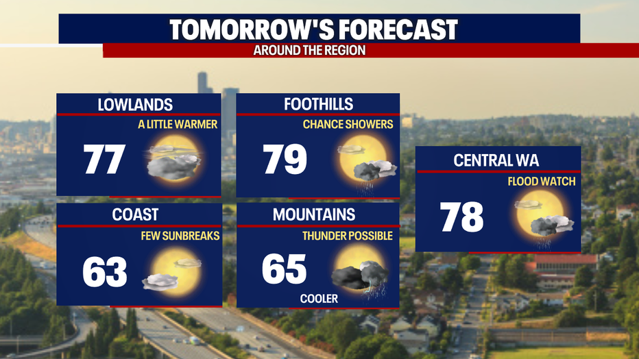
After a cloudy and cool weekend, afternoon highs will return to near normal.
Summer sunshine and warmth will return by midweek as afternoon highs climb into the mid-80s. Onshore flow will ramp up again, cooling temps into the 70s for next weekend.
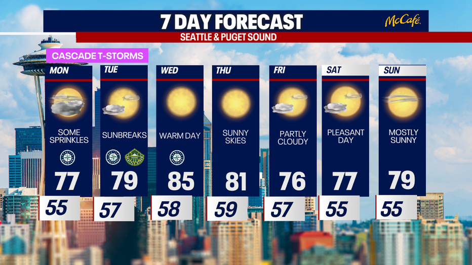
Sunshine and warmth return by Wednesday. (FOX13 Seattle)