

Smoke and warm sunshine to end the week
Mid-70s and hazy skies from Thursday through the weekend
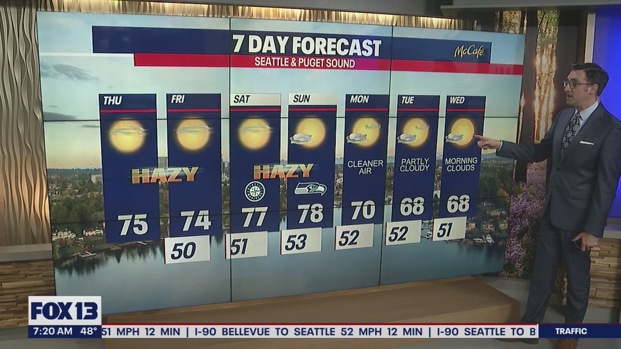
Mid-70s and hazy skies from Thursday through the weekend in the Seattle, Puget Sound Region.
Seattle - A persistent ridge of high pressure will stick around through the weekend bringing warm temperatures and hazy sunshine to the Puget Sound area.
High temps Thursday will be about 10 to 15 degrees above average for mid-October.

Thursday and Friday will bring the return of surface level smoke to Western Washington. This will likely impact air quality in some areas. Smoke will become even more widespread over the weekend as stronger easterly winds kick in. Strong winds, low humidity, and exceptionally dry weather for the past three and a half months are all ingredients for high wildfire danger in the Cascades and foothills.

The Mariners will take on the Houston Astros in game two of the ALDS Thursday. It will be another hot and humid day in Houston, with temps in the mid 80s at first pitch, however the stadium will likely have its retractable roof closed.

Temperatures the next four days will push into the mid to upper 70s, which is record-breaking territory. The record for Thursday is 75 degrees (1961), Friday's record is 80 degrees (1961), Saturday's record is 77 degrees (1991), and Sunday's record is 72 degrees (2018). A shift in the winds on Monday will result in cleaner air, more cloud cover, and cooler temperatures next work week.

If you are looking for rain, the long range models suggest we could finally see some more precipitation by late next week. The timing and how much are still up in the air for now, but we'll be watching it closely.
