

Soaking rain and mountain snow ahead

Lots of rain this week
FOX 13 Meteorologist Abby Acone is tracking on and off showers all week long.
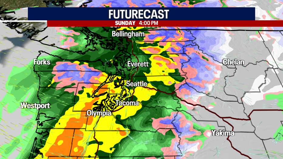
SEATTLE - Are you ready for the rain? An incoming cold front will trigger soaking lowland rain, gusty conditions and hefty mountain snow Sunday.
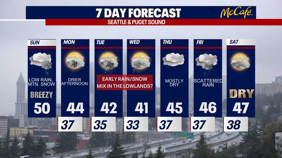
Highs today are expected to reach the upper 40s to low 50s. However, keep in mind: those temps will feel cooler with scattered rain, windy weather and cloudy skies. Dress warmly with waterproof layers as you step outside!

The heaviest rain will sweep through Puget Sound between 1-6 p.m. this afternoon. Gusts could reach 20-40 mph, too! The strongest winds are expected along the coast, North Sound, Island County, eastern Strait and the mountains, but winds won't be strong enough to warrant any official wind alerts.
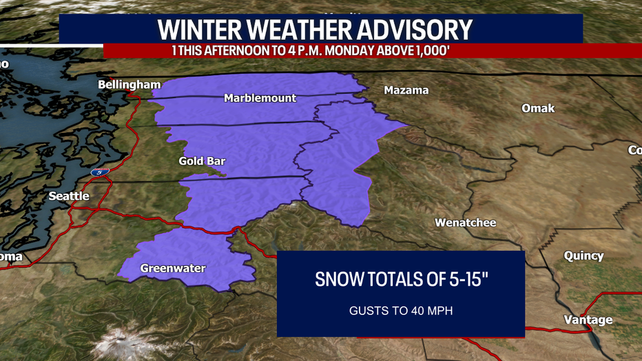
Mountain snow could be a big concern. A Winter Weather Advisory is in effect from 1 this afternoon to 4 p.m. Monday for areas above 1,000 feet in the Central and North Cascades -- that includes some of the Cascade valleys and foothills (like Baring, Darrington, Maple Valley and Index).
I can't entirely rule out a little graupel (soft, small snow pellets), snowflakes or hail mixing with rain the lowlands overnight and into Monday morning, but I think for the most part: precipitation should fall in the form of rain in the lower elevations. There's also a slight chance for a rain/snow mix for some in the lowlands Tuesday and Wednesday mornings.
Hope you catch FOX 13 this weekend! We really appreciate your viewership.
Warmly,
Meteorologist Abby Acone
Don't hesitate to reach out to me here:
Twitter @abbyacone, Instagram @abbyaconewx and Facebook (Meteorologist Abby Acone)
MORE FROM FOX 13 WEATHER:
DOWNLOAD: FOX 13 Weather and News Apps
WATCH: Forecast and Radar
READ: Closures and Delays
CHECK: Latest Weather Alerts and Live Traffic Map
INTERACT: Submit your Weather Photo
DAILY BRIEF: Sign Up For Our Newsletter
FOLLOW: Lisa Villegas, Erin Mayovsky, Brian MacMillan, Abby Acone and Scott Sistek