

Spring showers and sun, warmer for the weekend

Isolated thunderstorms possible Wednesday afternoon
More scattered showers, cooler temps and a chance for an afternoon thunderstorm
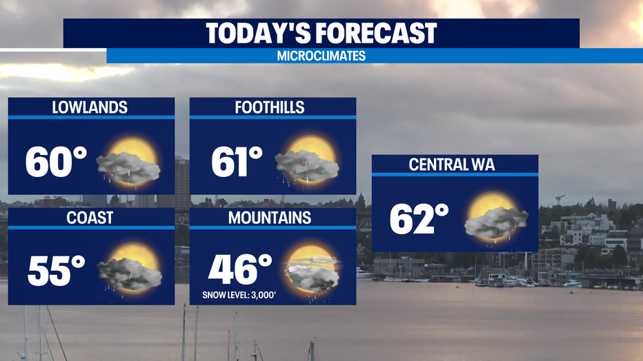
SEATTLE - Another day of on/off showers with sunshine and a slight chance of t-storms in the afternoon. Highs in the Puget Sound lowlands will get a touch warmer today than yesterday — most of us will land in the 60-65 range. (Normal is now 67.) A few of those showers up above 3,000 feet will be some snow showers, but very little will stick due to the warmth of the ground and strong May sun angle.
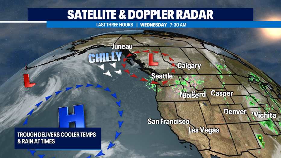
The low pressure center that's driving in the cooler than normal temps, atmospheric instability is moving slowly east. As it does so, we'll still see a chance of a few showers tomorrow. High pressure looks to nose in for about two and a half days at the end of the week. That will drive out the showers and bring back the sunshine and mild temps.
At this point it looks like that dry period falls on more Fri/Sat than Sat/Sun.
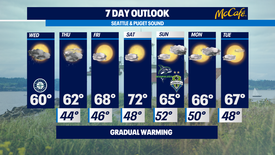
So I’ll be keeping a chance of afternoon showers in the Sunday outlook. Next week looks like we'll still see a few scattered showers to start off the last full week of May. -Tim Joyce
Q13 WEATHER RESOURCES:
DOWNLOAD: Q13 Weather and News Apps
WATCH: Forecast and Radar
READ: Closures and Delays
CHECK: Latest Weather Alerts and Live Traffic Map
INTERACT: Submit your Weather Photo
FOLLOW: Lisa Villegas, MJ McDermott, Tim Joyce, Erin Mayovsky, Grace Lim and Scott Sistek