

Seattle weather: Summer perfection on repeat for Seattle

Cloudy close to the weekend, then a cloudy week ahead
There will be some cloud cover Sunday morning, but FOX 13 Meteorologist Abby Acone is tracking another warm week ahead of us!
SEATTLE - Summer perfection is on repeat in Western Washington. Get ready for a seriously gorgeous forecast!
Highs today will lift to the mid to upper 70s for most. Some backyards are waking up to cloudy skies, but brilliant, glistening sunshine will reappear by noon for most.
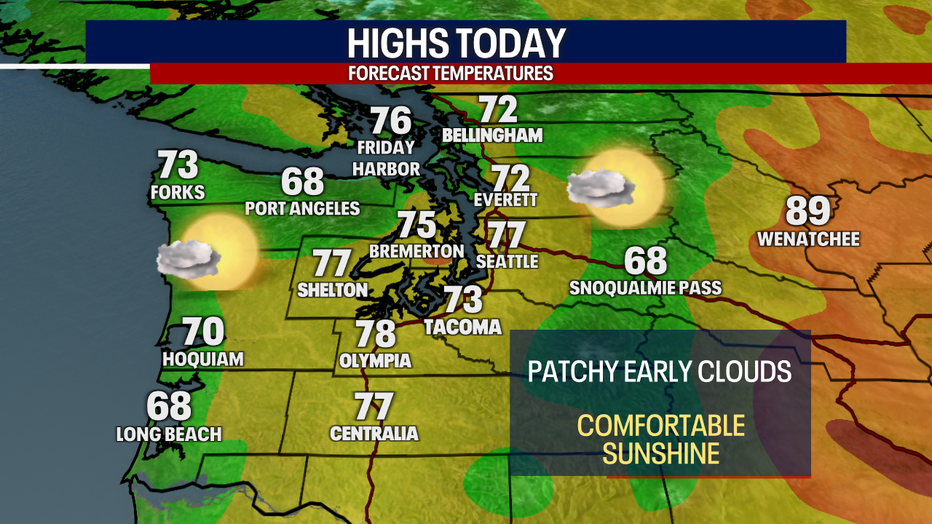

Unfortunately, fire danger is high in Eastern Washington today. In fact, a Red Flag Warning is in effect until 10 tonight for many places east of the Cascades. The Eagle Bluff Fire in Okanogan County continues to burn.
Here in Western Washington, the risk for fires is elevated, but the wildfire threat isn't super high. That's because we have westerly winds at times which give us a slight boost to our relative humidity levels.
The next few days, the South Sound and parts of the coast could start off the day with cloudy skies, but most in Puget Sound will enjoy sunshine from the jump.
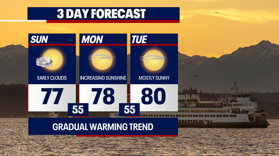
The low 80s stick around into next weekend. Thankfully, overnight temperatures will recover nicely, dropping to the mid to upper 50s. Even though the 80s can be uncomfortable for folks without air-conditioning, the cooler temps overnight should prevent the heat from being a huge threat.
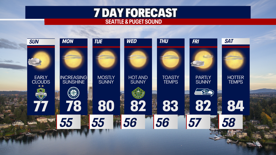
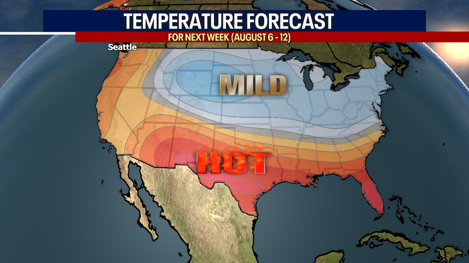
Next week, the long-range models are hinting that temperatures could be above average. We'll track the warmth for you closely!
Take good care!
Warmly,
Meteorologist Abby Acone
Follow me on Twitter @abbyacone, Instagram @abbyaconewx, TikTok @abbyaconetv and Facebook (Meteorologist Abby Acone)