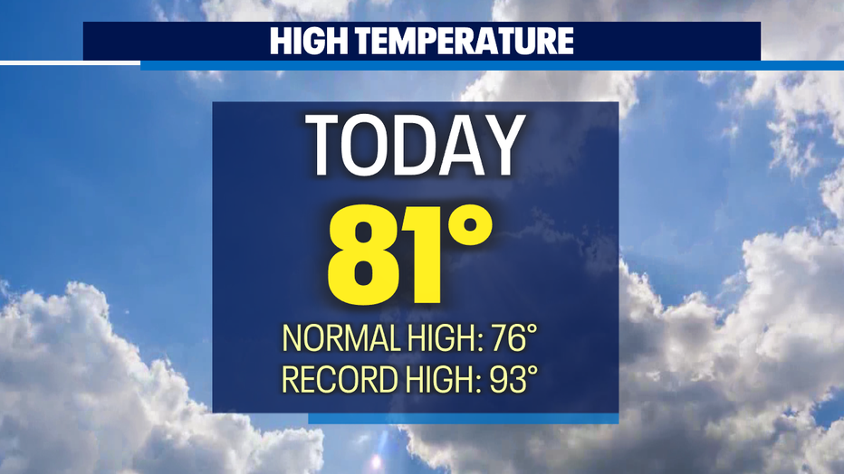
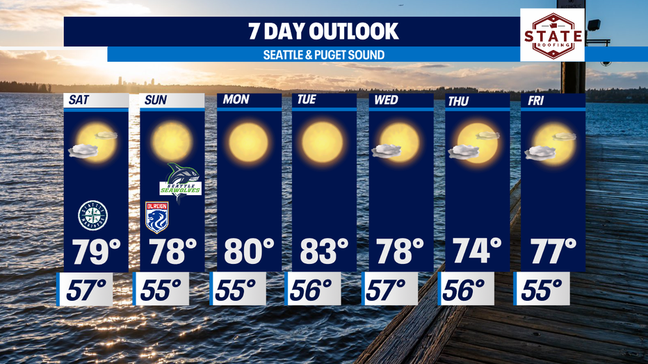
Summer sunshine and warmth continues with highs peaking Tuesday in the mid 80s!
Seattle - Happy weekend all!
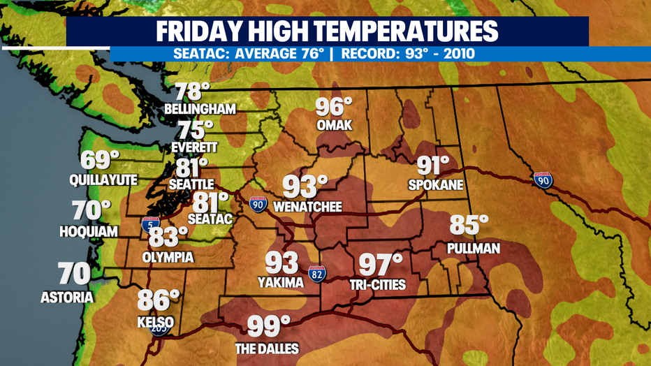
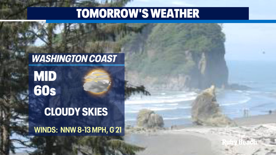
More summer sunshine on tap as we cruse deeper into our season. Highs Friday landing in the upper 60s to 70 at the coast with warmer temps inland. Check out Kelso at 86 matching the high for the Rose City.
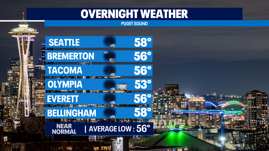
Overnight lows will cool into the low to upper 50s for most around the region. Some areas, like the coast, the SW interior and parts of Puget Sound will see clouds and patchy fog push in before sunrise. Skies will clear fairly quickly giving way to a gorgeous summer afternoon.
Weak high pressure will drive our forecast delivering plenty of sunshine and warmth. Highs will jump above average to start the work week with peak heating through Tuesday. By mid-week highs will fall off some into the 70s as our ridge is replaced by an upper trough that will deliver low level onshore flow.
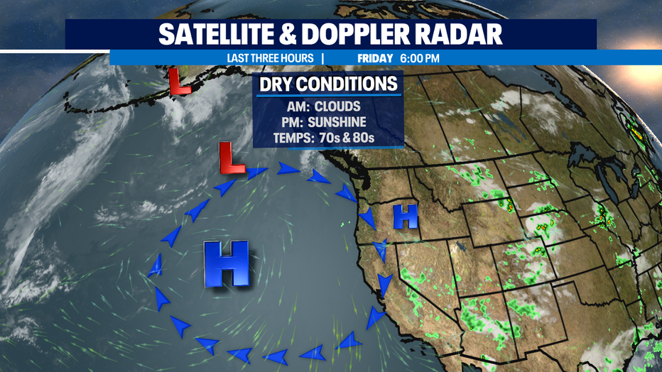
Looking over our long-range forecasts no real rain is in sight for at least a week, possibly two. We have not had any measurable rain since the middle of June. The National Weather Service reminding us of just how long this dry stretch has gone with a tweet Friday afternoon.
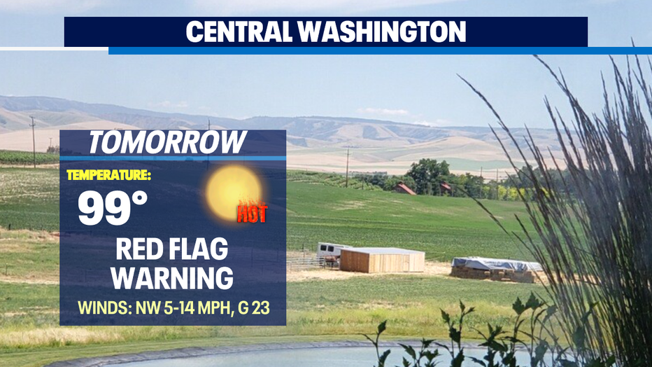
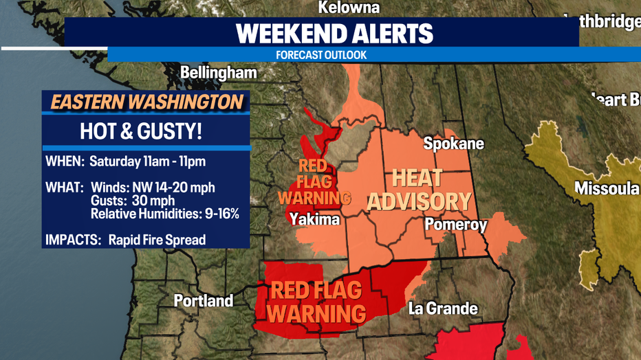
And with no rain in the forecast and extremely dry grounds NWS issuing a "Red Flag Warning" for areas in Eastern WA along with a "Heat Advisory" too.
The warning goes into effect tomorrow from 2pm -11pm for strong, gusty winds. Some spots could see gusts up to 30 mph and that will increase the risk for rapid fire spread.
The advisory goes into effect 11am - 8pm tomorrow with highs soaring into the upper 90s to near 105. Those extreme temperatures along with high humidity may cause heat illness. Drink plenty of fluids, stay in air-conditioned areas, stay out of the sun, and check up on relatives and neighbors.
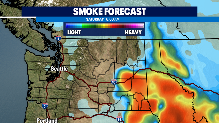
Smoke outlook for the weekend looks to affect SE WA into much of Idaho and Western Montana. The Puget Sound may see a little haze in the sky but won't last too long.
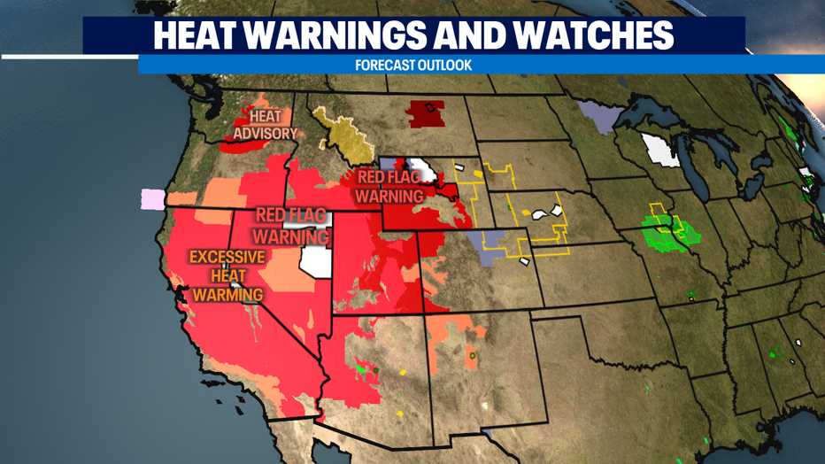
A look at the west shows extreme conditions for California, Nevada. Utah, and into Wyoming.
Our dry and warm trend will continue for some time. We will cool off late next week into the mid 70s before getting back to average by next weekend.
Have a great weekend all! ~Erin Mayovsky, Q13 Forecaster
*Beach Forecast
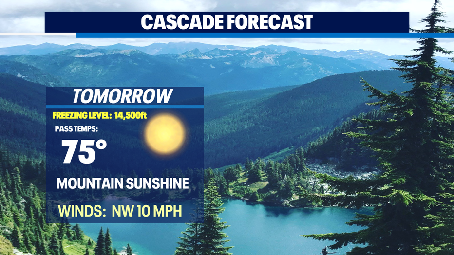
*Mountain Forecast
*Central WA Forecast