

Sunny and warm Sunday, dry week ahead
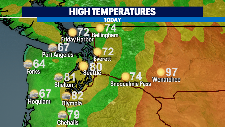
SEATTLE - We are putting the "SUN" in Sunday! It's going to be a warm one with highs in the 70s and lower 80s across Puget Sound. The coast will be cool in the mid-60s. Central and Eastern WA will once again be hot in and around the triple digits.
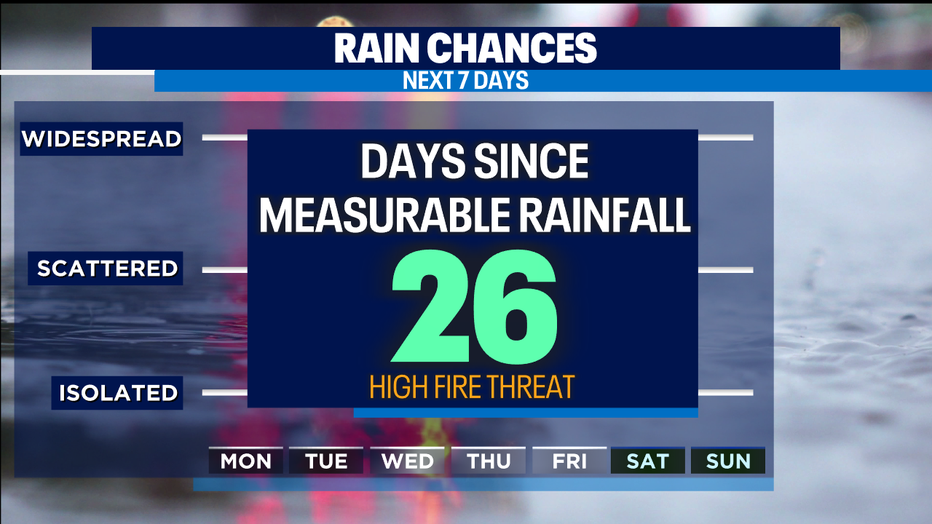
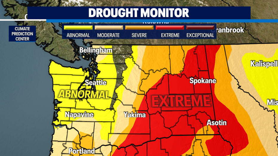
It has been 26 days since SeaTac received measurable rain. Abnormally dry conditions will continue to be a concern for fires as we're not expecting rain in the near future. Also, a disturbance may bring thunderstorms in Eastern WA tomorrow afternoon and evening which could spark lightning fires.
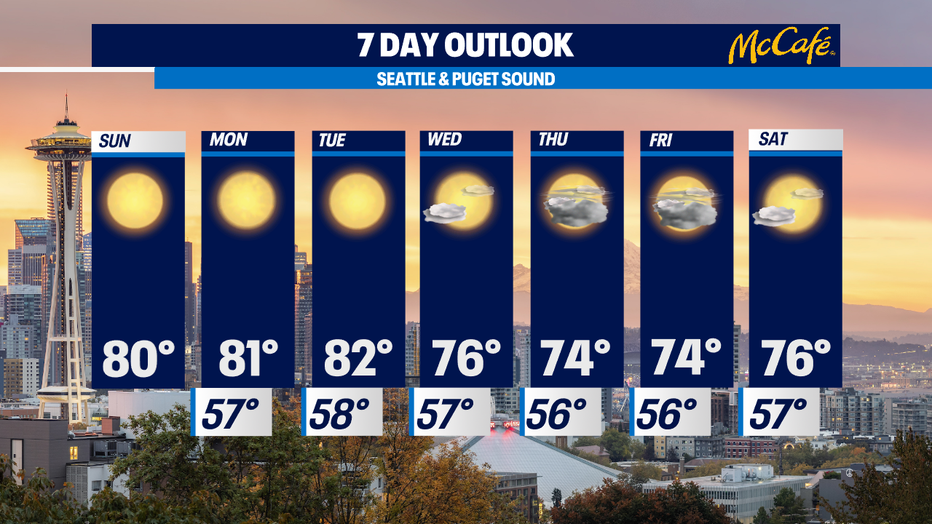
The new work week will be sunny and warm with highs in the lower 80s through Tuesday. Another disturbance will bring cloud cover by midweek and cool us down a bit in the mid-70s.
Have a great week!
-Q13 Meteorologist Grace Lim