

Tonight's Forecast: Snow and ice SLOWLY melting
Seattle - Temperatures will gradually start to warm up overnight. As this happens, ice will continue to be a problem! The good news is the ice and snow WILL melt - but we'll have to be on the lookout for urban flooding. Here is a look at the warmup taking place overnight:
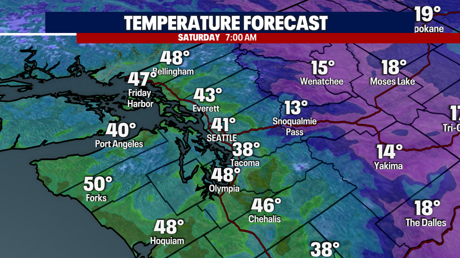
Temperatures will remain above freezing throughout the week and will be above normal (46F).
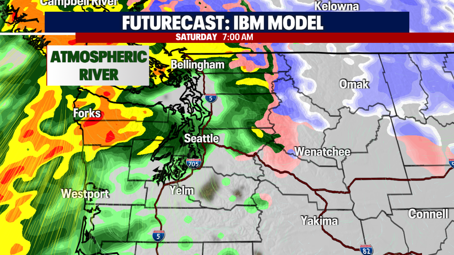
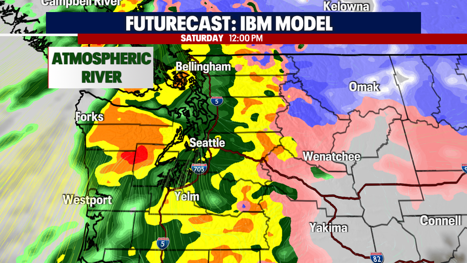
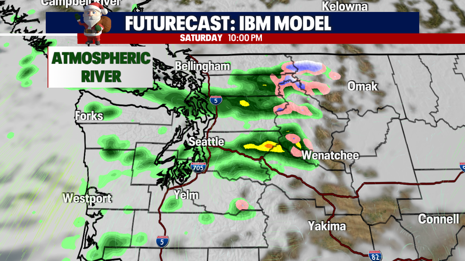
Rain chances will rapidly increase tomorrow. Expect moderate-heavy rain at times throughout the morning. This will taper off in the evening, and then we'll be left with isolated showers. Here is a look at your hour-by-hour forecast:
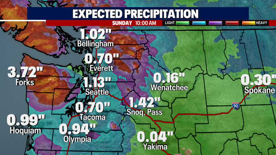
Here is a look at our rain totals through Christmas morning:
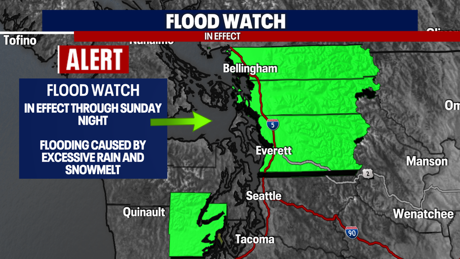
Due to moderate-heavy rain increasing on Saturday, Flood watches have popped up. This is because we're going to see a lot of ice/snow melt along with heavier downpours.
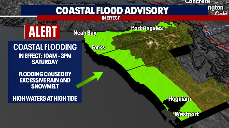
A *Coastal Flood Advisory will go into effect tomorrow too.
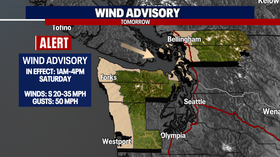
The new system will increase wind speeds as well. Most of the area will experience gust up to 20-25 mph. These areas, highlighted in the tan color, will be under an advisory with gusts up to 50 mph:
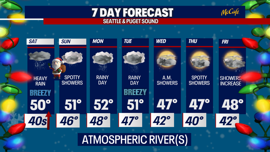
I'll leave you with a look at your 7-day forecast:
Happy holidays!