

Tuesday's Forecast: Elevated fire risk returns
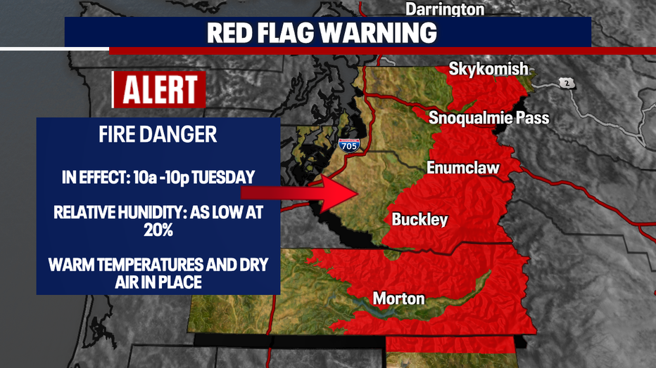
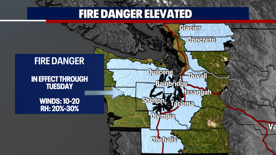
Seattle - The threat for fires will be elevated once again. The temperatures are going to increase significantly for us - which will aid in the danger. A *Red Flag Warning* will be issued for parts of the Cascades tomorrow. This is due to low humidity, warm temperatures, and the winds kicking up slightly. In fact, a *Special Weather Statement* for fire danger will be in effect tomorrow for most of Western Washington.
Here is a look at the alerts:
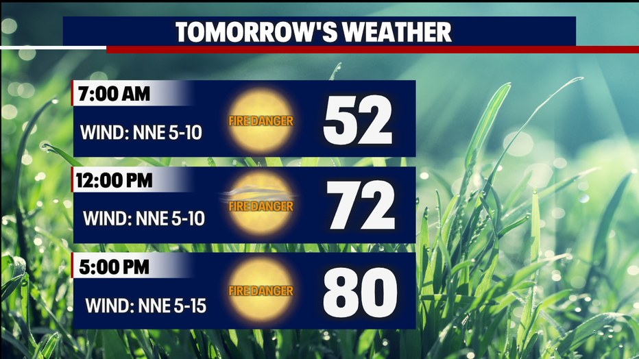
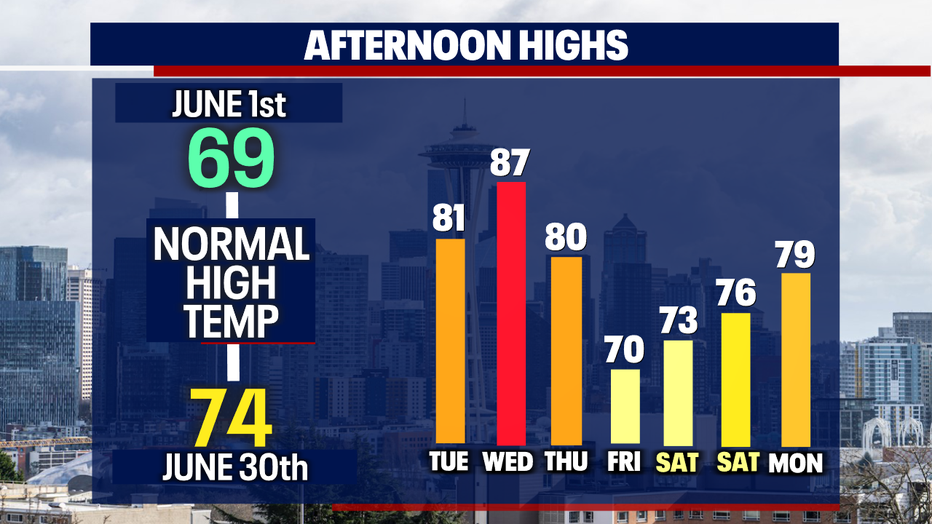
Temperatures on Monday peaked in the lower 70s (73F) and tomorrow we'll rise into the lower 80s! So if you're taking the jacket tomorrow morning, you won't need it in the afternoon. Here is a look at your forecast:
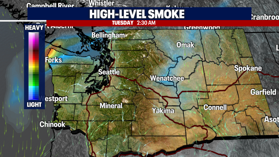
I also want you to be aware of some high level smoke across the parts of our NW EARLY tomorrow morning. This is caused by a wildfire up in Canada and reports of the smoke were seen across the North Sound late Monday night.
Now let's talk numbers! Temperatures are going to get toasty as we roll through the middle of the week. The good news is we'll see some "cooler" weather by the end of the work week! Its short-lived but it'll be helpful.
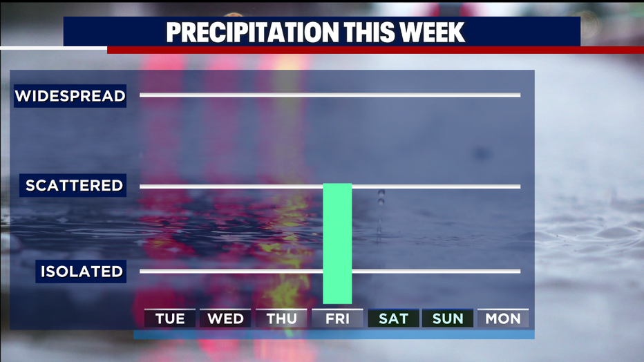
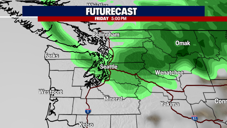
A new system heads our way and increase rain chances on Friday! We're talking about .10" of accumulation for those in the Central and North Sound.
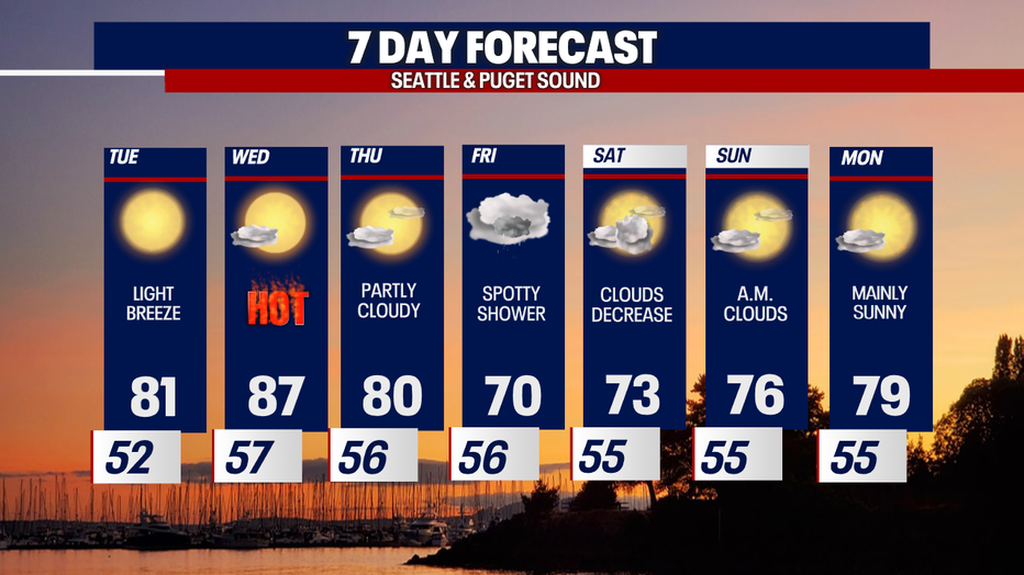
Here is a look at your full 7-day forecast:
Have a good one!