

Seattle weather: Turning hot later this week across the Pacific Northwest
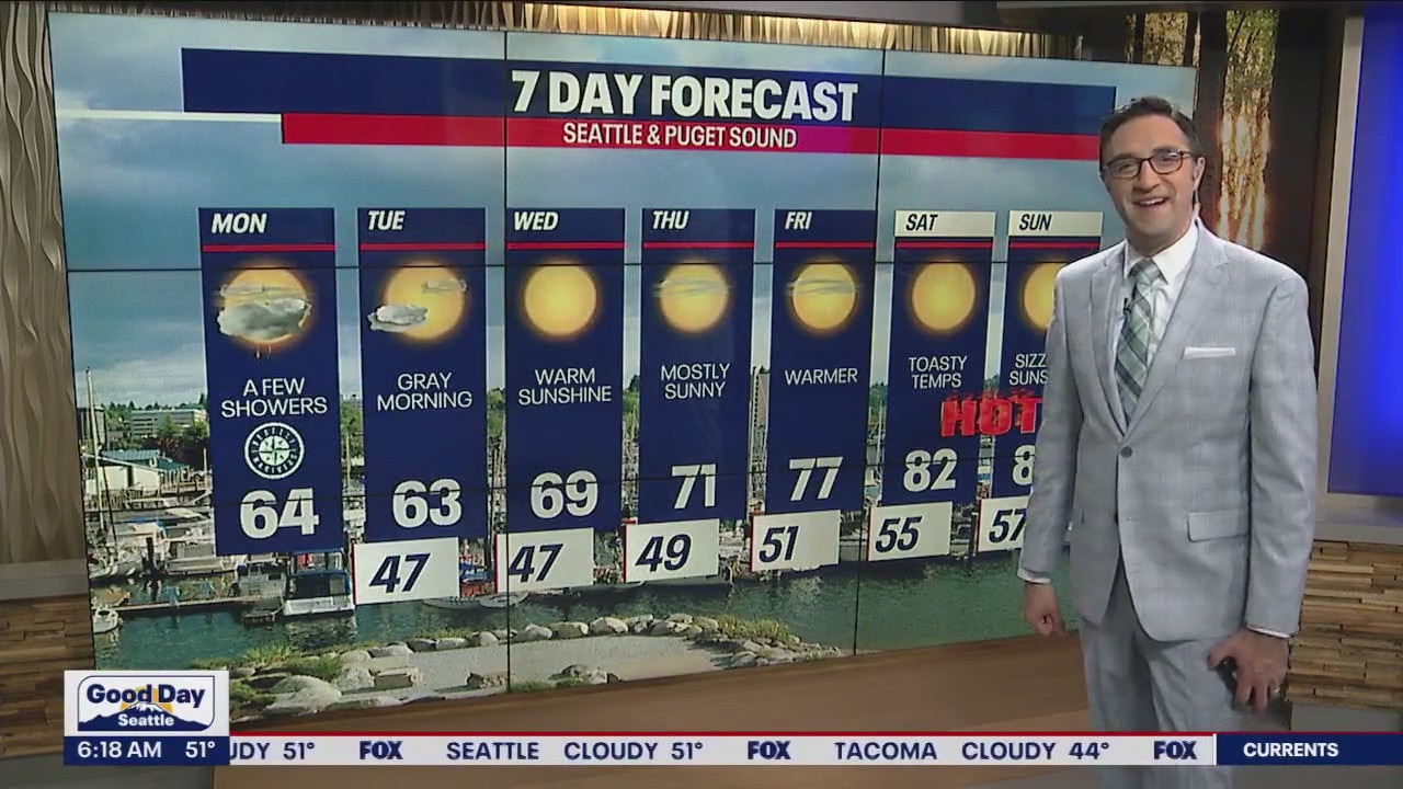
Mid 60s temps, drying out this week
We're about to dry out and heat up in the 7-day forecast. High pressure will strengthen and make a big return this weekend.
SEATTLE - The next two days will bring average temperatures and a mix of clouds and sunshine to Western Washington.
High temps will be in the mid 60s today, with the chance for a brief quick-hitting shower or even a weak thunderstorm. Those showers will be very isolated if we see anything west of the Cascades. Most of the action the next two days will be over the Cascades or east of the mountains.


The big weather story is happening later this week as a strong ridge of high pressure builds over the Pacific Northwest. Temps will climb into the 70s Thursday and Friday with highs soaring into the 80s Saturday through Monday. This will be our hottest stretch of the year so far.
Enjoy the warm week!
