Very wet Friday and Saturday for the coast and north sound
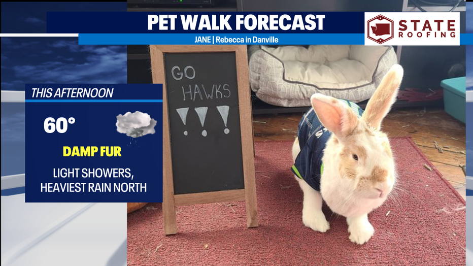
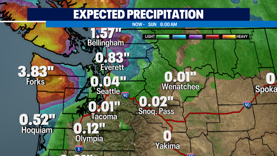
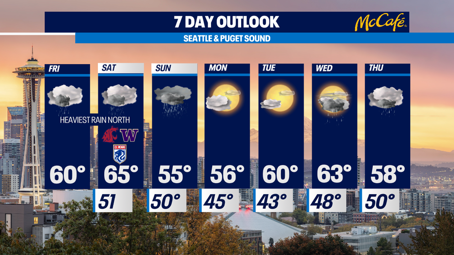
Seattle - Rain has returned this morning as a wet system takes aim on the northern Washington Coast and the northern Puget Sound area. The Seattle area and south sound will get hit with some lighter showers today, but the bulk of the rain will be aimed farther north. The northern Washington Coast will be hit the hardest with 2-3+ inches of rain possible. A half inch to an inch and a half is expected from Snohomish County north to the border. Highs today will be around 60°.
Saturday will bring more of the same, with the rain pushing a little farther north. It will also be noticeably warmer, with highs in the mid 60s.
Sunday will bring more widespread rain to western Washington and a much cooler airmass. That will send temps plummeting back down into the mid 50s. Snow levels will also crash, down to around 4,000-5,000 feet. Isolated thunderstorms are also possible Thursday afternoon.
A weak ridge of high pressure will set up for Monday and Tuesday bringing dry conditions and more sunshine.
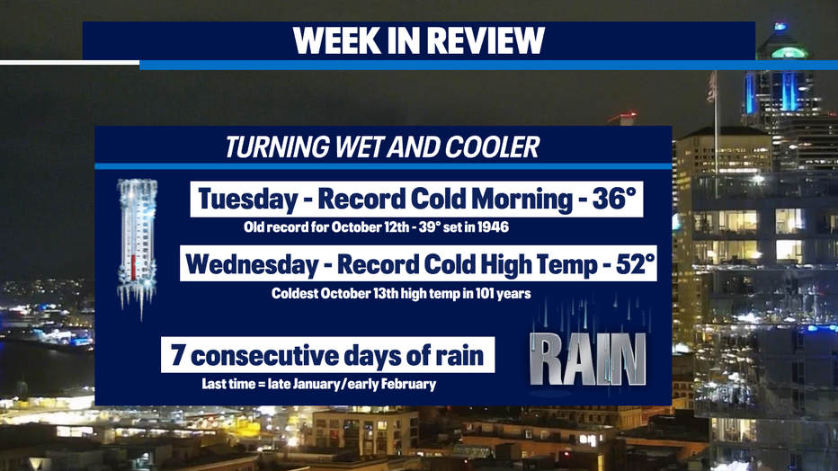
It feels like the switch has been flipped for fall. This week brought a couple of record low temperatures and seven consecutive days of rain. That hasn’t been done since late January/early February.
It’s Blue Friday and Jane the rabbit is ready for the big Seahawks game this weekend. She’ll have damp fur if she goes out for a walk today.