

Wet and breezy weekend, heavy mountain snow on the way

Rainy, overcast Saturday
Expect breezy conditions in Puget Sound area continued into Sunday. Mostly overcast with scattered rain showers Saturday. Q13's Grace Lim has the full forecast.
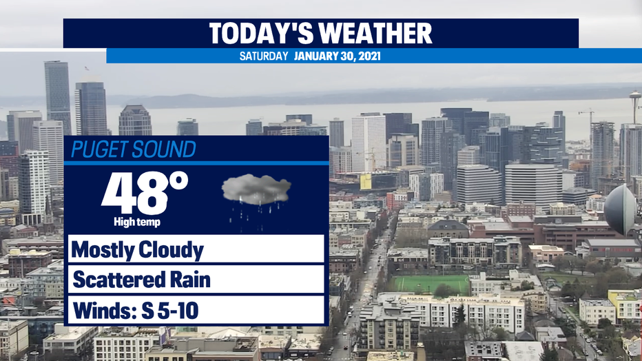
SEATTLE - A pair of systems will be responsible for this weekend's wet and breezy conditions. The first front is sitting just offshore bringing scattered showers this morning and light mountain snow.
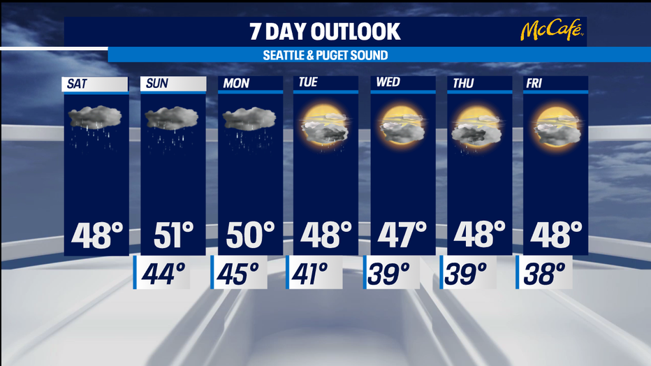
We'll hang onto scattered activity this afternoon and tonight, breezy conditions, and highs around 48 degrees.
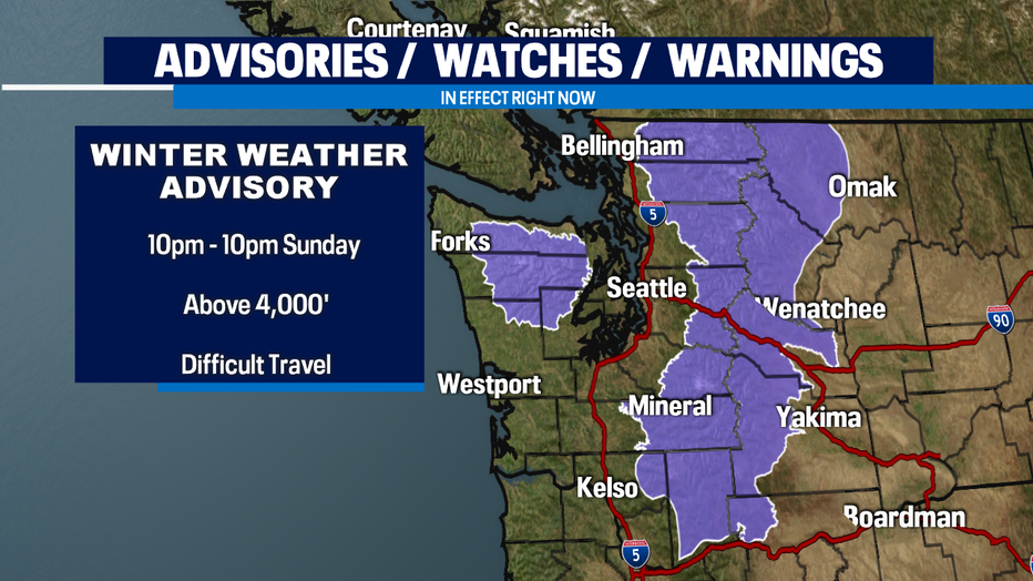
The next system is right behind today's front and looks to squeeze out widespread rain, more mountain snow, and gusty conditions tomorrow. A Winter Weather Advisory goes into effect starting at 10 p.m. tonight through 10 p.m. Sunday above 4,000' where snow accumulations will be between 4"-12" for the Cascades and the Olympics.
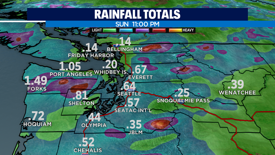
Rainfall totals through Sunday night look to be in the half-inch range for the Seattle metro area, but closer to an inch for the coast and Mason County, so we'll have to monitor the Skokomish River for potential flooding. Right now, it's forecasted to be just shy of flood stage by tomorrow night but additional rain can push it above flood stage.
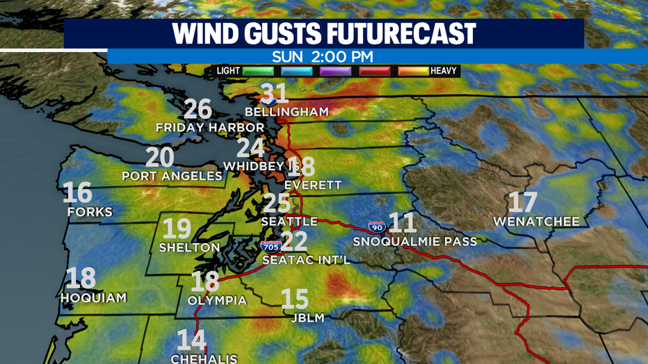
Tomorrow looks gusty, especially in the afternoon with gusts of 25-30mph. Winds will calm by the evening as Sunday's system exits the area.
Monday looks to be wet too and aside from a few showers on Tuesday, we'll dry out by Wednesday. Another shot of rain comes Thursday and for now, Friday looks to be dry.
Have a great day!
-Q13 Meteorologist Grace Lim