Seattle weather: Warm and dry Sunday with cooler air Monday
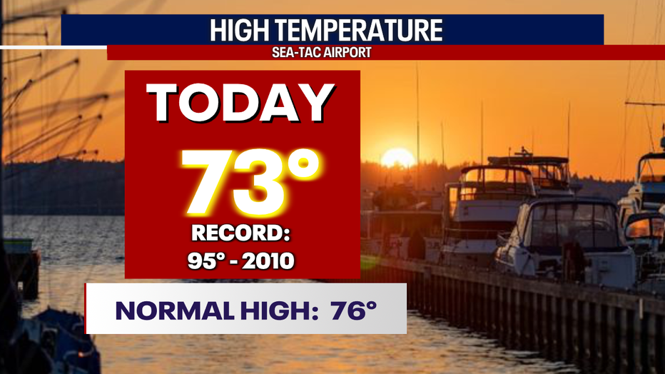
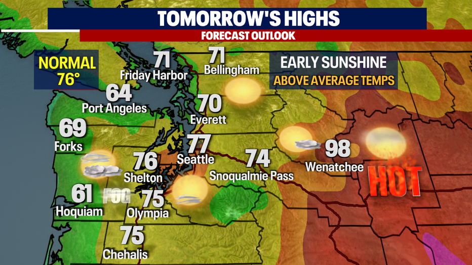
SEATTLE - Beautiful conditions across the region on Saturday! SeaTac hit 73 at the airport with slightly warmer highs south. Normal for this time of year is 76.
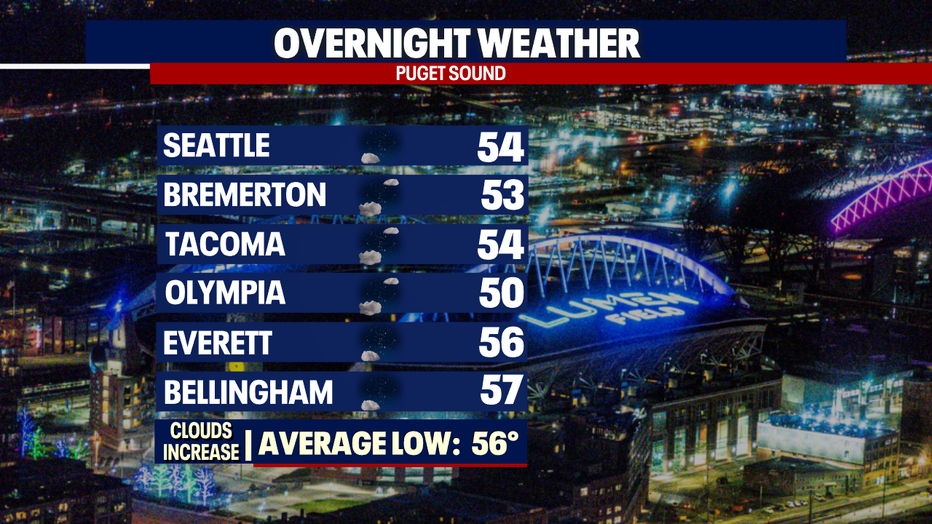
Overnight skies are clear to partly cloudy with temperatures cooling into the low to mid 50s.
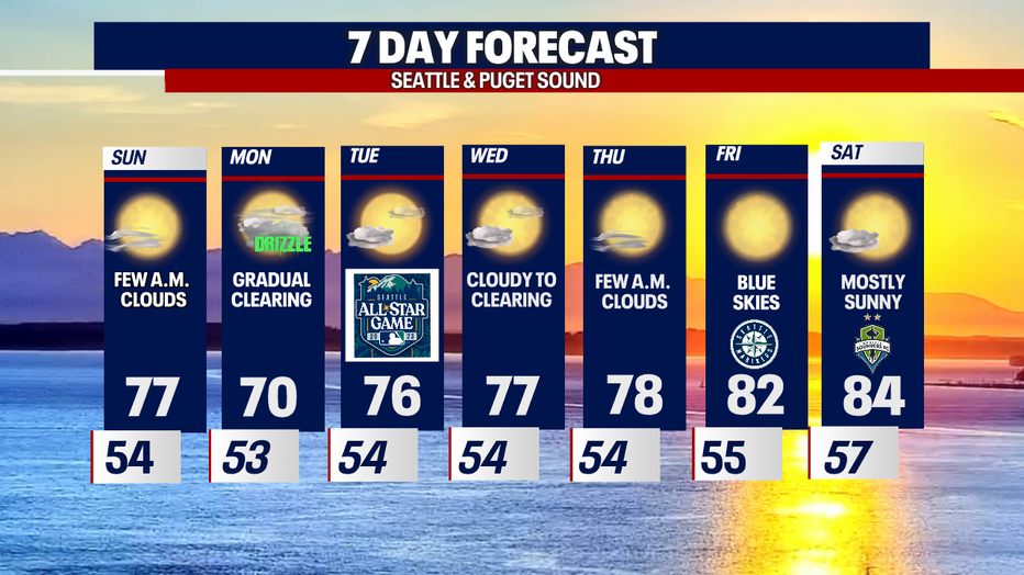
We'll see less cloud cover tomorrow morning and more sunshine as we sat hello to Sunday!
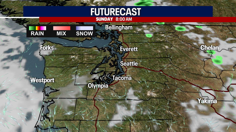
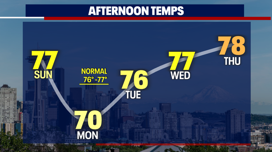
Highs Sunday should warm fairly quick landing near 80 for Seattle.
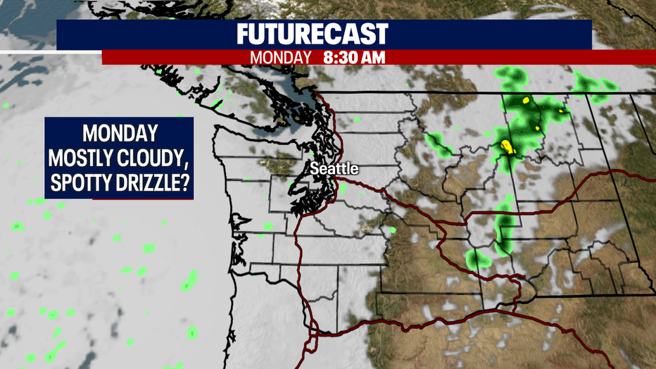
Expect more clouds Monday as stronger onshore flow cools us off a bit. This thanks to a weak cold front passing through Western WA.
There is a slight chance of spotty sprinkles earlier in the day otherwise we will stay dry. Highs only warm into the upper 60s to low 70s.
Tuesday starts out mostly cloudy but finishes with afternoon sunshine… perfect conditions for the MLB All-Star game at T-Mobile Park. Catch all the action on FOX 13.

The marine layer will stick with us through the middle of the week leaving us with late night and early clouds.
As we head into the weekend models are hinting at a warm-up with clearer skies. Highs heat into the low to mid 80s. Enjoy!
Have a great rest of the weekend all! ~Erin Mayovsky, FOX 13 Forecaster
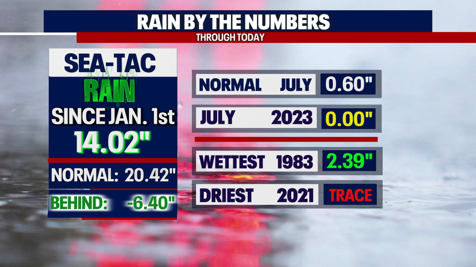
*SeaTac Rain Almanac
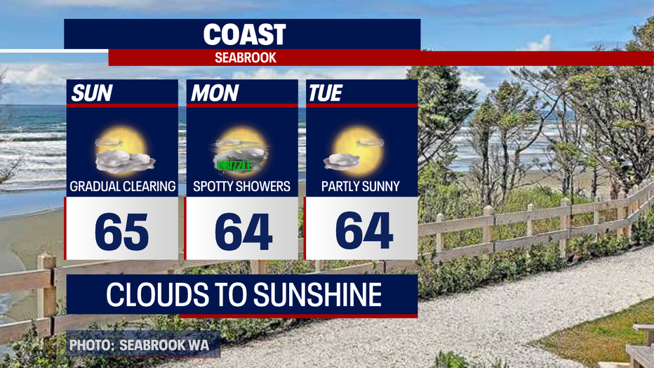
*Coast Forecast
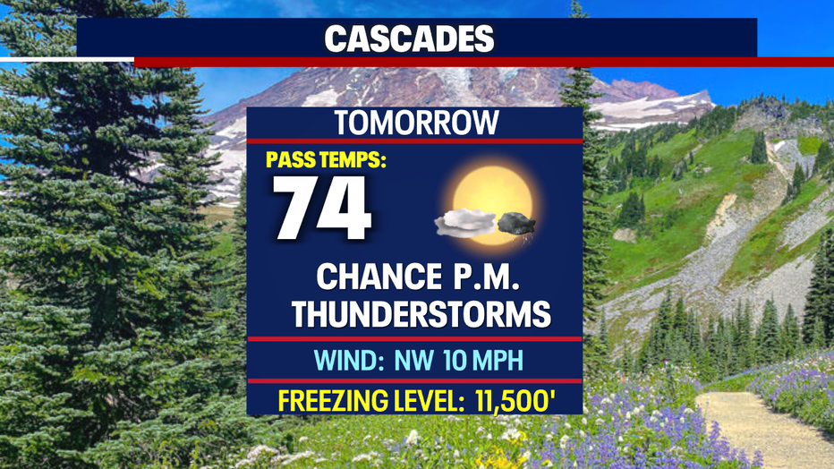
*Mountain Forecast
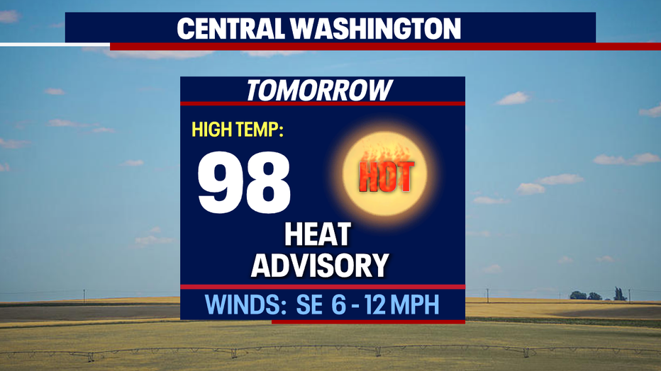
*Central WA Forecast