Seattle weather: Some dry days before pattern shift to bring back rain
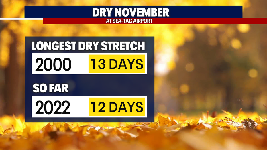
SEATTLE - More dry conditions on tap for the Pacific Northwest. Saturday marks the 12th day in a row without measurable rain. The longest dry stretch in November dates back to 2000 where we saw 13 days. Sunday we will tie that record and potentially break it Monday if we can keep rain out of the SeaTac area, which looks very possibly.
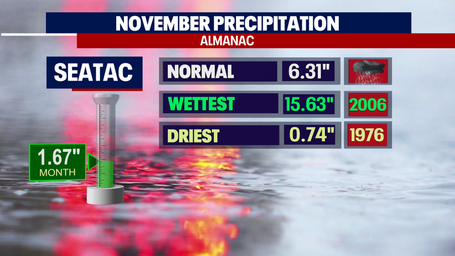
This month we're way behind on rainfall as the dry stretch has not helped our totals. Normal November rain is just over six inches and so far, this month we only have 1.67".
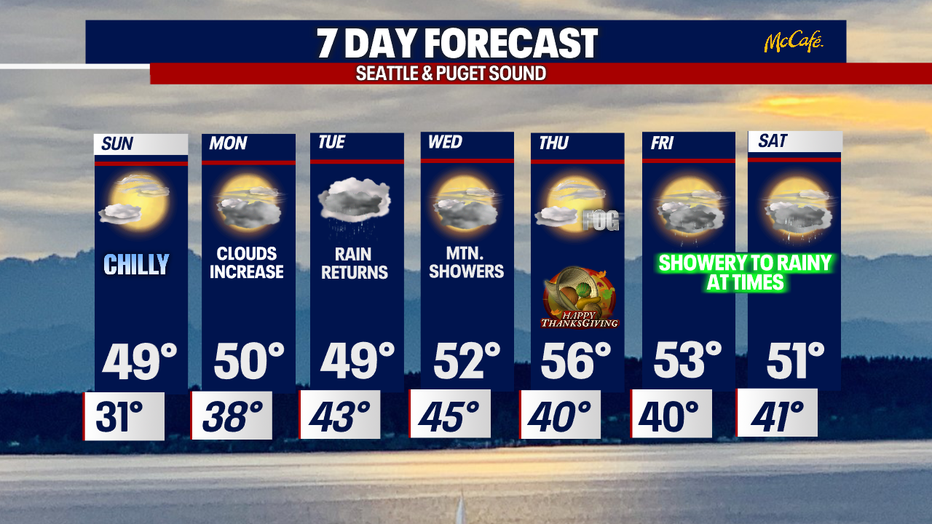
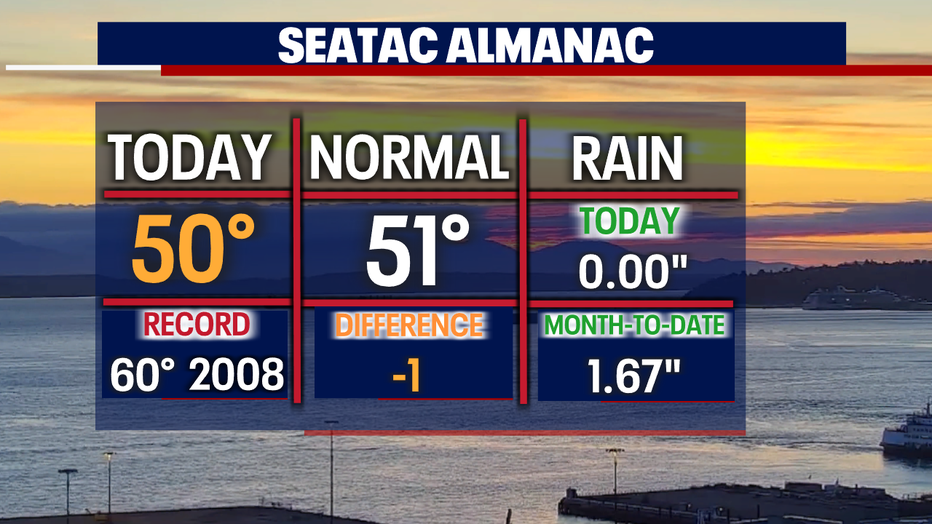
High temps Saturday hit at 50 for the airport. Not bad with plenty of beautiful blue skies.
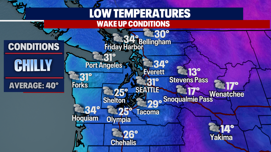
Another frosty start on tap as temperature dip into the mid 20s to mid 30s overnight. Brr! Bundle up!
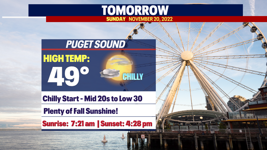
Sunday we'll see a little more cloud cover usher into the area as our ridge of high pressure slowly moves along. This will allow clouds and rain to find their way back into Western WA. Look for highs to land near 50 Sunday.
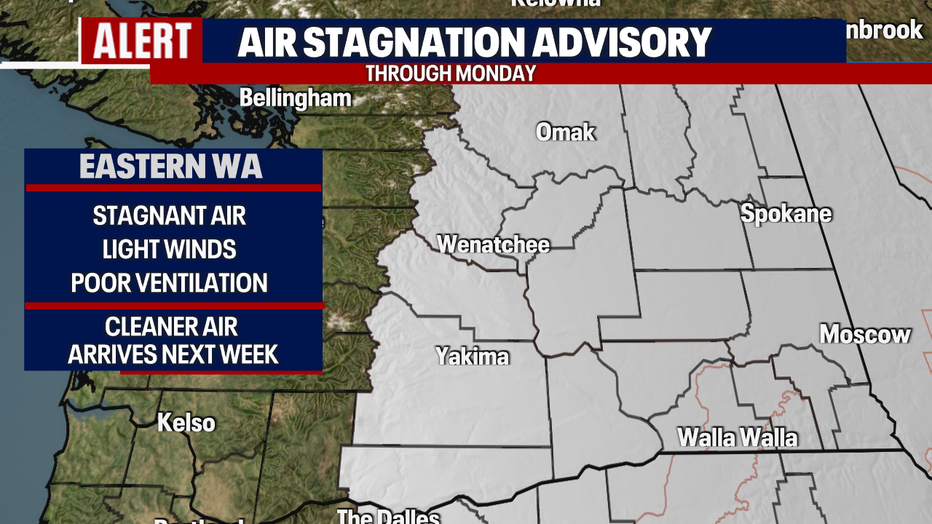
An Air Stagnation Alert is up through Monday for Eastern WA as winds remain fairly calm with poor ventilation. Cleaner air will arrive late Monday into Tuesday.
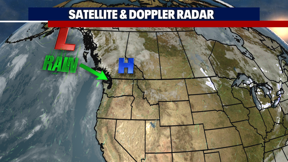
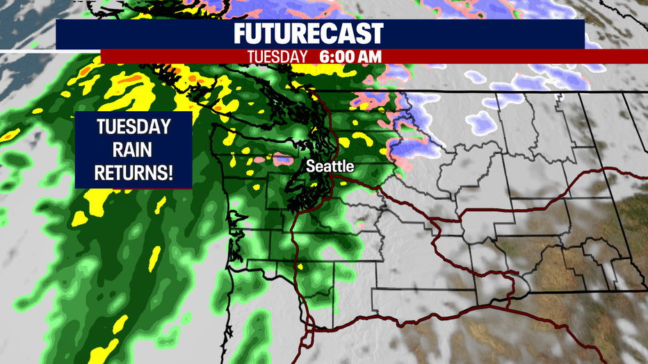
Finally, we're tracking RAIN! This is the first system we've seen in a very long time, November 7th to be exact! That day we pulled down 0.23" and since then we've remained dry, so Tuesday's rain is a welcome sight! Enjoy!
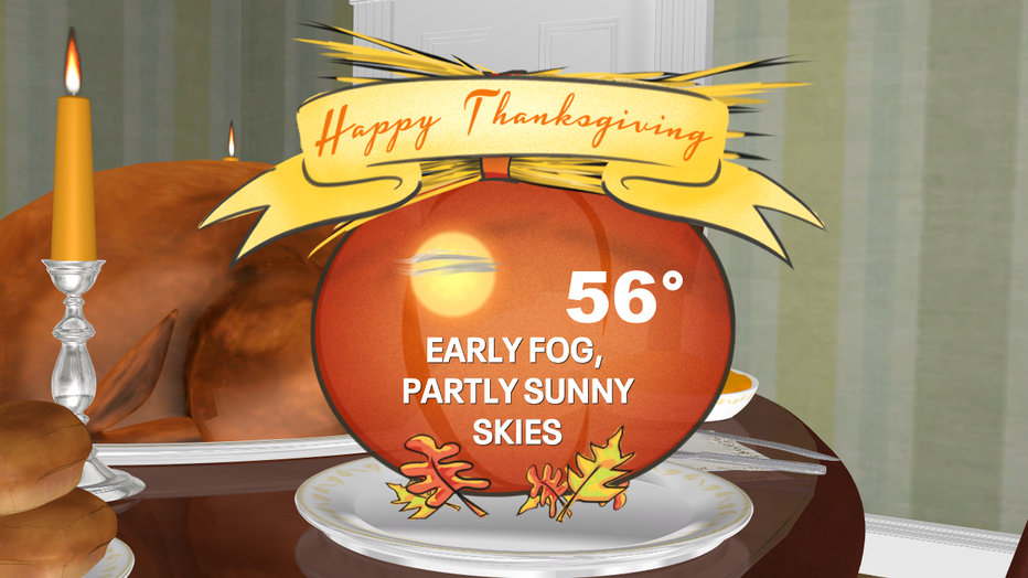
At this point we're looking a little foggy out of the gate for the Thanksgiving holiday. We expect partly to mostly cloudy skies with highs warmer than average in the upper 50s.
Showery conditions return for the weekend with cooler highs in the low to mid 50s.
Have a great rest of the weekend all! ~Erin Mayovsky, FOX 13 Forecaster