

Briefly cooler before dangerous heat returns to the PNW

SEATTLE - We've got some relief from the summer heat, but it will be short lived.
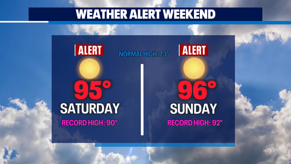
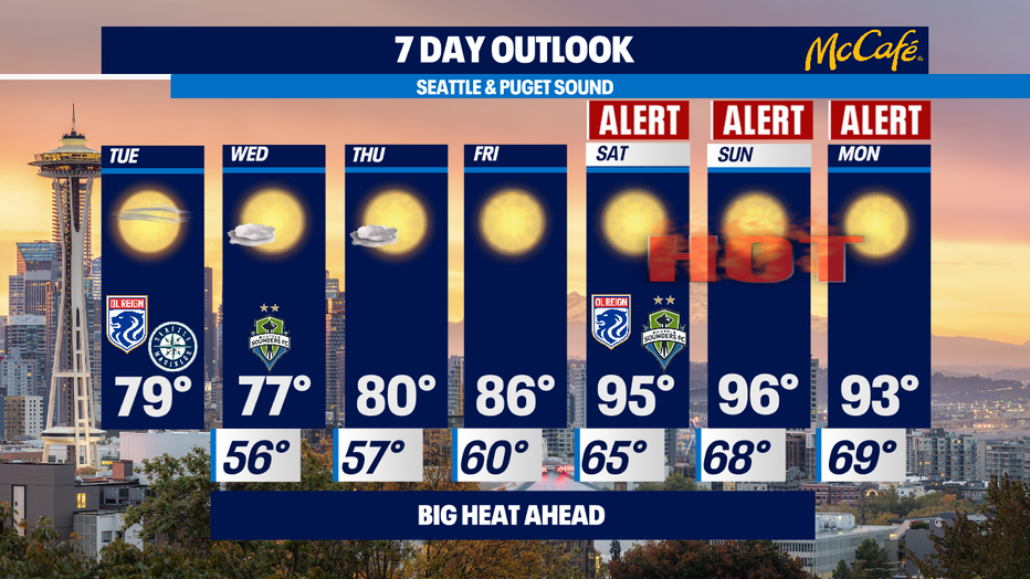
We have several Weather Alert Days for temps in the 90s for this coming weekend and beyond. High temps will be in the 90s and even more concerning for folks without A/C, we will have overnight lows in the upper 60s, which is very uncomfortable sleeping weather. Records will fall for afternoon highs as well as warm overnight lows.
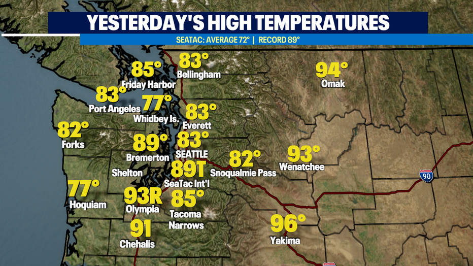
But yesterday was our hottest day of the year so far in several places. We tied the record from 1992 at Sea-Tac Airport of 89 degrees and Olympia broke their record by a degree when they hit 93 yesterday. That's a record that's been in the books for almost 5 decades.
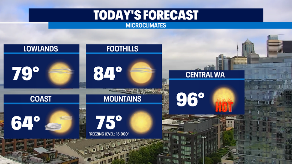
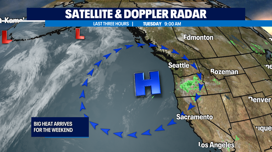
Today we’ll knock those afternoon high temps down to the 75-80 range for most of us. We’ll see any cloud cover evaporate for sunny skies by the mid-morning, except for the coastal areas where cloudy skies could be a bit more stubborn. We'll see some high clouds courtesy of thunderstorms brewing to our south into Oregon.
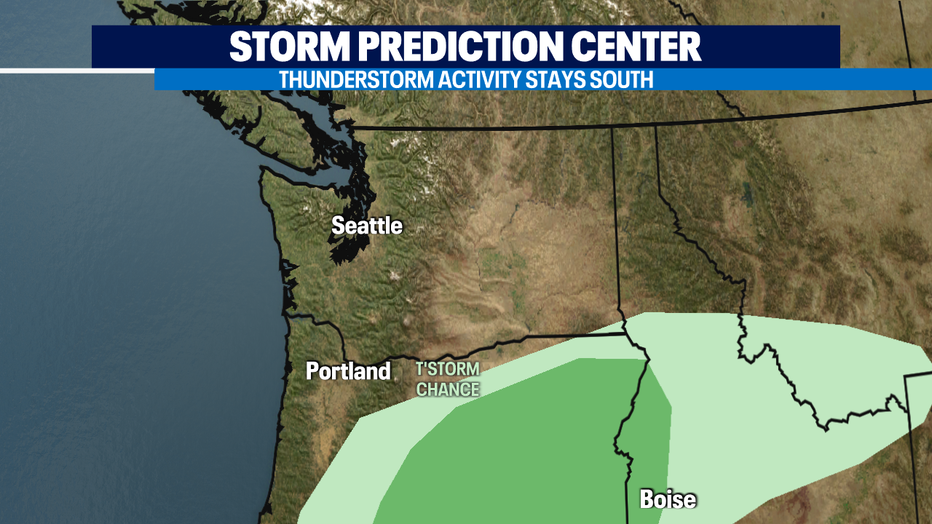
Guidance from the National Storm Prediction Center puts the thunderstorms well to the south of Puget Sound. This time of year, these thunderstorms often lack beneficial rain but have plenty of lightning to start wildfires. That's why you'll often hear us weather folks talk about "dry lightning" storms.
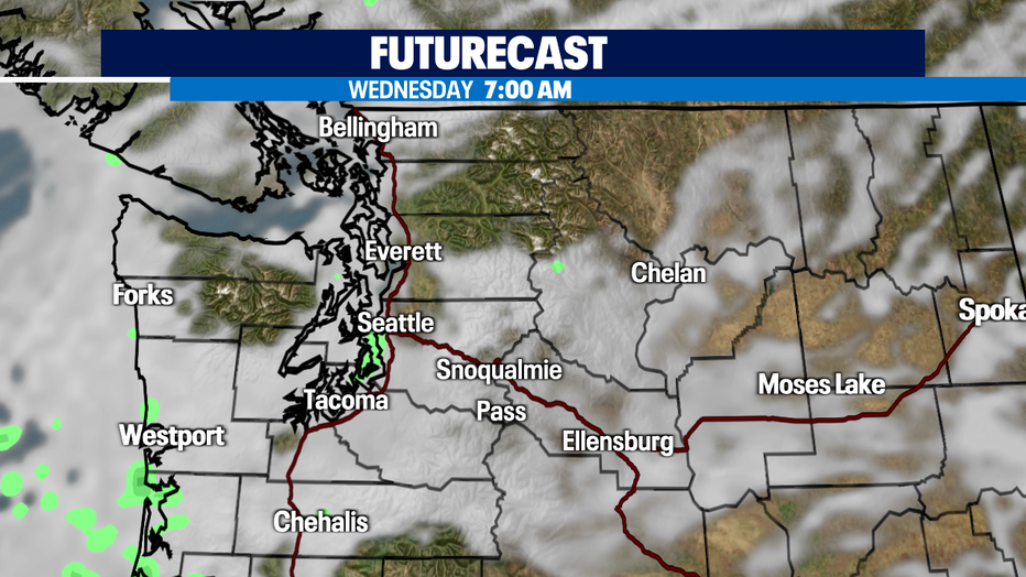
Tomorrow will be a bit cooler than today. Many of us will be waking up to cloudy skies around Western Washington thanks to westerly winds that will pull in more cool air off the Pacific Ocean. Most around Puget Sound will get into the mid 70s.
Then we start to turn up the heat. High pressure looks to re-amplify coming up towards Thursday and Friday we’ll be around 80 as winds turn out of the north. As the winds turn out of the NE/E is when we see what looks like impressive warmth for this time of year. The high pressure ridge will drive our temps into the mid 90s for both weekend days. Some of the forecast models are hinting at getting close to 100 for some areas in the South Sound and foothills communities.
A bit cooler starting next Monday, but still in the 90s. When we see several really hot days in a row, not only is it hard to cool down our houses without A/C, the overnight lows in the mid to upper 60s can make for awful sleeping weather so we're continuing the Weather Alert Days into Monday as well.
Today will also be our 8th dry day in a row without any measurable precipitation. Not a drop of rain seems likely in the 10 day outlook. Next week's Cascade thunderstorm potential could be of the dry variety and start off wildfire season with a bang. Stay tuned. -Tim Joyce
Q13 FOX WEATHER RESOURCES:
DOWNLOAD: Q13 Weather and News Apps
WATCH: Forecast and Radar
READ: Closures and Delays
CHECK: Latest Weather Alerts and Live Traffic Map
INTERACT: Submit your Weather Photo
FOLLOW: Lisa Villegas, MJ McDermott, Tim Joyce, Erin Mayovsky, Grace Lim and Scott Sistek