

More 'Weather Alert' days ahead as we head into a deep freeze through mid-week

Snow is here! How much will we see in the Puget Sound area?
FOX 13 Meteorologist Brian MacMillan is tracking SNOW in Seattle! We're expecting to see around 2 inches in Seattle, 2.8 in Tacoma, 1.7 in Olympia and 1.4 in Bellingham—and more may be on the way. Drive safe!
Seattle - A Christmas weekend snow storm brought several inches of snow to the Puget Sound area Sunday.
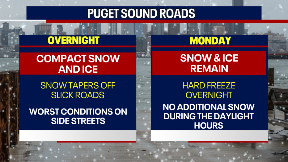
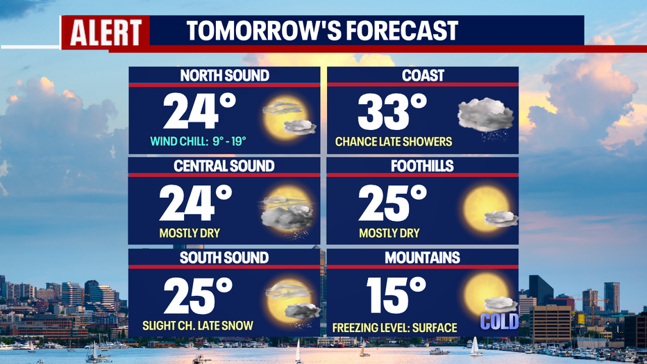
Widespread snow should taper off heading into Sunday afternoon, but bands of flurries and light snow showers will persist for some until sunset. Snow on the ground won't be going anywhere as a hard freeze develops overnight. Temps will drop into the teens for overnight lows.
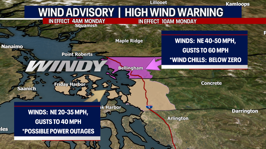
In north Puget Sound area, extremely gusty winds have sent wind chills well below zero. The Fraser Valley outflow sent winds into Bellingham gusting to 61 mph this morning around 11:30 AM. Strong winds continue up north.
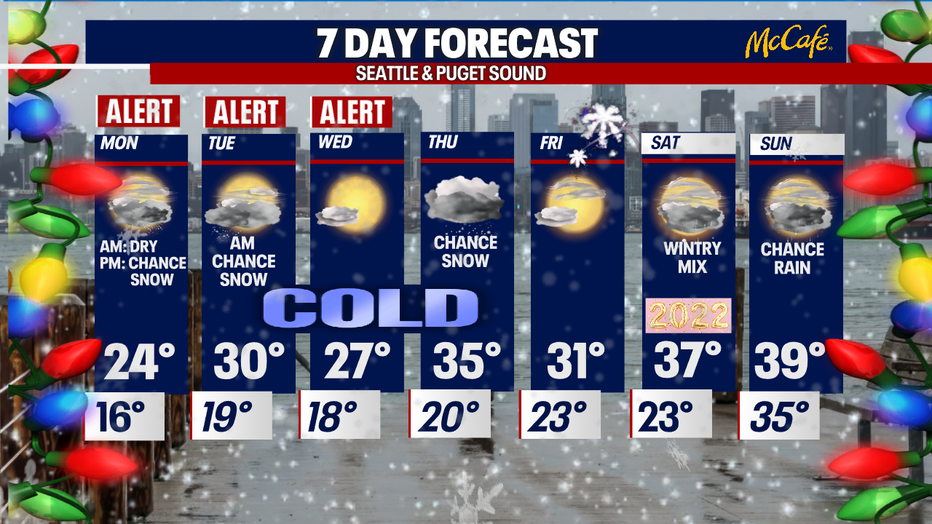
Monday, temps will be frigid with high temps only in the mid 20s and overnight lows in the teens. Here are the high temperatures forecast for Monday.
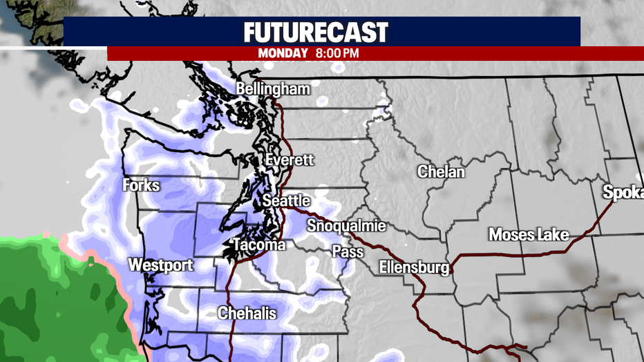
Another round of snow could impact areas from Seattle into the south sound after sunset Monday evening into early Tuesday morning. This will also impact the Olympic Peninsula.
Tuesday and Wednesday will be dry with a mix of clouds and sunshine. That should allow for some improvement on the main roads, but neighborhoods and side streets will still be very icy. The big thaw won't happen until Thursday and Friday when temps finally make their way above freezing.
READ MORE: Snow falls in Western Washington
Get breaking news alerts in the FREE FOX 13 Seattle app. Download for Apple iOS or Android.
Stay connected with FOX 13 News on all platforms:
DOWNLOAD: FOX 13 News and Weather Apps
WATCH: FOX 13 News Live
SUBSCRIBE: FOX 13 on YouTube
DAILY BRIEF: Sign Up For Our Newsletter
FOLLOW: Facebook | Twitter | Instagram
Watch FOX 13 Seattle for the latest news: