

Expect a wet and gusty start to the day
A new frontal system will trigger overnight rain, mountain snow and gusty winds. If you commute early in the morning except it all!
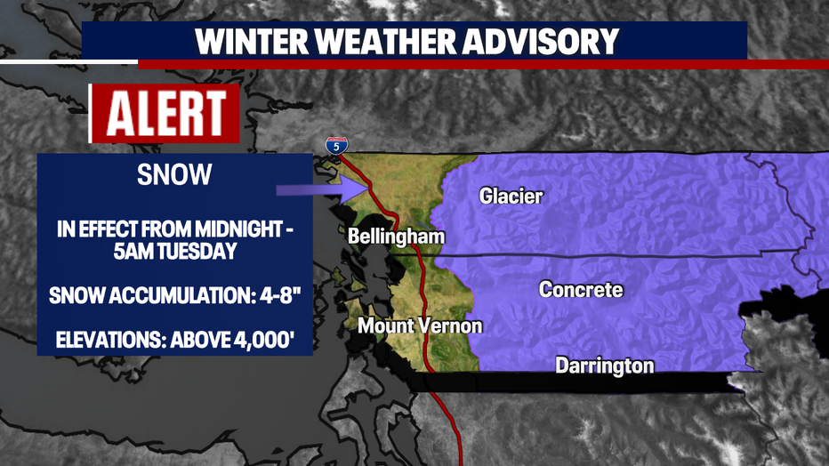
This first round of rain (Monday) could bring between .20-.50" of rain accumulation for most of the area. Higher totals are expected across the Olympic Peninsula (.50-1.00"). In addition to rain across the Foothills and lowlands - mountain snow will be expected and add up for those in higher elevation. A *Winter Weather Advisory* will go into effect overnight for those in the highlighted area below.
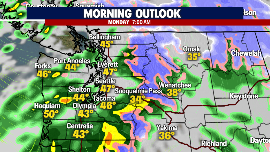
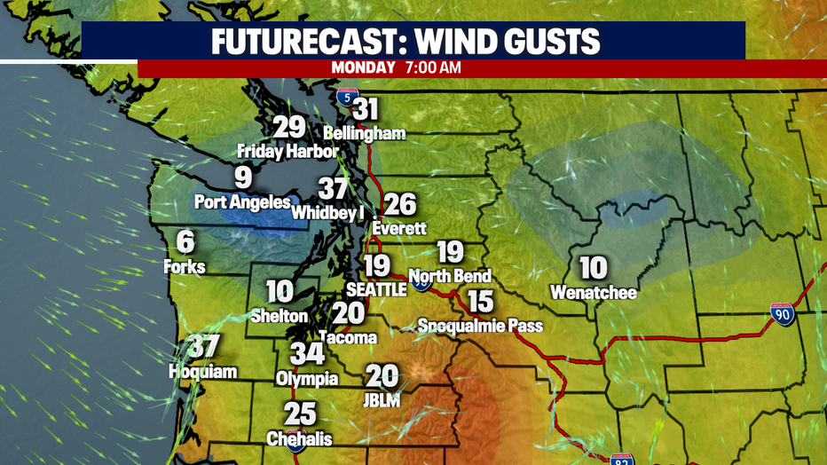
Here is a look at the details:
As the precipitation increases, the winds will whip! Expect gusty winds late tonight and early tomorrow morning as the front passes. Gusts will exceed 20-25 mph at times and die off throughout the day.
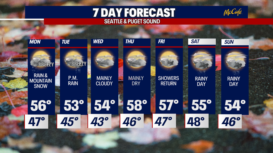
Another frontal system will arrive on Tuesday afternoon increasing rain chances, mountain snow and gusty winds once again. in fact, we'll have a few more rounds (rain, mountain snow) as we head into the weekend too!
I'll leave you with a look at your 7-day forecast:
Have a good one!