

Expect low visibilities, wintery mix, and gusty winds tomorrow morning
Rain/snow mix on the way for Thursday
Temps will remain in the mid to upper 40s for the week as rain and snow comes in.
SEATTLE - Our next system is on the move and increases winterly mix across the lowlands/foothills, gusty winds, and heavy mountain snow. Temperatures will be in the upper 30 and lower 40s tomorrow morning as the frontal system tracks across Western Washington. Here is a look at your morning commute forecast:

Winds will peak overnight/tomorrow morning. A Wind Advisory will go into effect for the highlighted area below. This is where we can expect winds gusting up to 50 mph at times. The rest of Western Washington will notice an increase in wind speeds too. Expect winds sustained between 15-25 mph early tomorrow, for the rest of the area.

Heavy snow will ramp up as well. A Winter Storm Warning will go into effect tomorrow morning due to this. Here is a look at the details for our mountain passes:


Temperatures will remain on the "mild" side tomorrow. We'll remain below normal but at least we'll see those temperatures rise into the upper 40s.

Here is a look at the futurecast showing the winter mix/mountain snow increasing tomorrow:


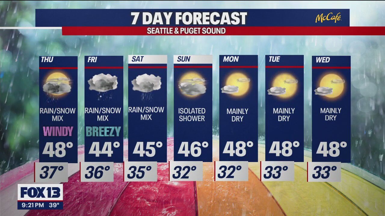
I'll leave you with a look at your 7-day forecast:

Have a good one!