

Forceful winds, power outages possible east of Seattle Monday night
Seattle weather: Skies will be dry for most of Monday
Showers will slowly taper overnight, with lows by Monday morning staying very mild.
SEATTLE - Yet another "bomb cyclone" storm will likely develop in the Pacific Ocean today, and while this will trigger strong winds in the east Puget Sound lowlands – thankfully, winds won’t be nearly as strong or long-lasting as the last bomb cyclone from November. Even though this is a very different scenario, people need to be prepared for the possibility of some tree damage and power outages.
A Wind Advisory is posted for the Cascade gap communities, including places like Monroe, Gold Bar, Maple Valley, Enumclaw, Buckley and North Bend from 6 p.m. Monday to 2 a.m. Tuesday.

A Wind Advisory is posted for the Cascade gap communities, including places like Monroe, Gold Bar, Maple Valley, Enumclaw, Buckley and North Bend from 6 tonight to 2 a.m. Tuesday. (FOX 13 Seattle)
It's important to remember that as with any storm, winds can be more or less powerful than we expect depending on the strength, timing and track of the low pressure system. That said, gusts to 50 mph do look likely for the Cascade gap neighborhoods.
Here are my recommendations for these communities in the Wind Advisory: first, make sure you keep your phone charged. Don’t spend time outside during this windstorm if possible (in the event that weak trees or tree branches fall). In the same vein, you might consider not driving through heavy forests late Monday night.
You can also download the FOX Local app on your phone so you can watch our weather coverage and forecast. Lastly, if you have yet to do grocery shopping for the holidays and you have the luxury of waiting, I’d advise you to hold off until tomorrow (just in case the power goes out Monday night and your food goes bad). Remember to keep the fridge shut during a power outage to maintain the cool air there.

People in Seattle: get ready for a damp, active and stormy week ahead. (FOX 13 Seattle)
Gusts could reach 20-35 mph elsewhere in Puget Sound with slightly stronger gusts for the Admiralty Inlet area and the coast. However, we don’t expect damages in communities other than those highlighted in the Wind Advisory.

Temperatures will reach the low 50s on Monday afternoon in Seattle. (FOX 13 Seattle)
Let’s talk about the "bomb" aspect of this storm. This area of low pressure will undergo bombogenesis today (yes, that’s a real meteorological term): all that means is that the storm will rapidly intensify. It’s expected to drop 24 millibars in pressure or more in less than 24 hours. It’s critical to keep in mind that this storm will be far less impactful than the bomb cyclone in November due to a few reasons: one, it’s not as powerful as the last one and two, it’ll be a fast-mover. In fact, it'll be moving to the northwest through late Monday and tomorrow. As it shifts away from our region, winds will ease by Tuesday morning.

It’s critical to keep in mind that this storm will be far less impactful than the bomb cyclone in November due to a few reasons. (FOX 13 Seattle)
Get ready for a dynamic and active weather pattern for the holidays.
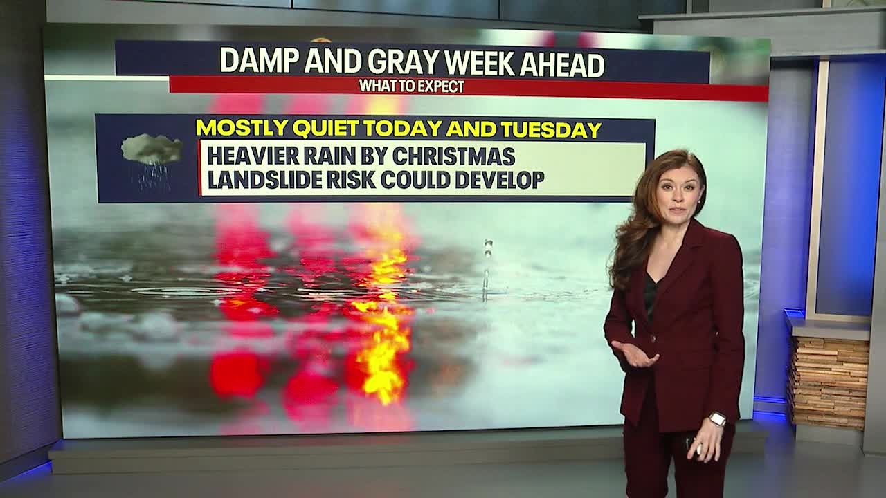
There will be rounds of mountain snow ahead this week. Significant impacts to travel are possible by the middle to end of this week. Snow is forecast for the passes Monday night, but so far, it doesn’t look bad enough in the short term to warrant any official weather alerts. Snow could become a problem for pass travelers beginning Christmas and lingering on-and-off in the days that follow.
River levels will be rising this week as we experience a series of storm systems and atmospheric rivers. Right now, any river flooding looks to be minor and not widespread. Stay tuned because this could change!
The threat for landslides will be elevated later this week as the region experiences rounds of soaking rain.
Today through Wednesday, high surf could also be an issue along the coast. Keep a healthy distance from the water and don’t turn your back to the waves! The ocean conditions will be very treacherous in the days to come.

You’ll notice on the seven day forecast that wind will be a factor Christmas and thereafter.
Make sure to check our forecast daily for regular updates. It’ll be stormy at times and there will be new updates to relay to you throughout the week.


Top 25 search queries of 2024
A look back at the top 25 search queries that brought people to FOX 13 Seattle's website in 2024.
MORE NEWS FROM FOX 13
Summit at Snoqualmie announces opening day for skiers in WA
'Light Show Spectacular' in Lake Forest Park, WA
‘My heart is exploding with joy’: Holiday Hero’s Toy Run hits Federal Way Walmart
Sneak peek: Black artists market in Seattle
Visit Santa's toy lab at 'Kringle's Inventionasium' in Seattle
To get the best local news, weather and sports in Seattle for free, sign up for the daily Fox Seattle Newsletter.
Download the free FOX Seattle FOX LOCAL app for mobile in the Apple App Store or Google Play Store for live Seattle news, top stories, weather updates and more local and national coverage, plus 24/7 streaming coverage from across the nation.