

Seattle weather: Likely record dry weather for November in Western Washington

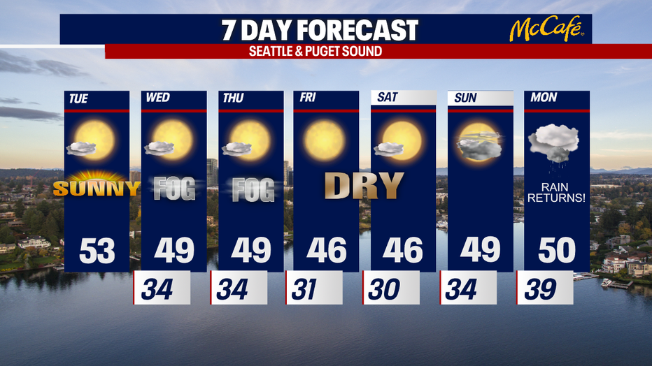
Freezing fog to remain for next few mornings
As the fog develops, be on the lookout for refreezing fog. Freezing fog will remain in the forecast for the next few mornings.
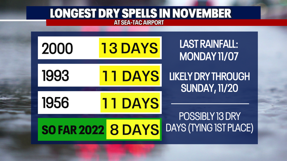
SEATTLE - Despite November typically being the wettest month of the year at Sea-Tac Airport, we will likely tie the all-time record for the longest dry spell in November.
In November 2000, there were 13 consecutive dry days. So far in 2022, we have had eight back-to-back days of no measurable rain. We are forecasting shower-free skies through Sunday, November 20th. This means Sea-Tac could tie the record for dry days this month.
This morning, some communities woke up to fog, freezing fog and frost. This time of year, these kinds of conditions can give way to slick spots (especially on bridges, overpasses and sidewalks).
Tomorrow and Thursday mornings, we have yet another chance for freezing fog in some areas. This could create slippery roads once again. Morning temperatures will quite cold. Bundle up and drive carefully!
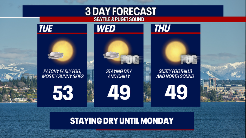
Once the fog clears, we'll enjoy beautiful, crisp sunshine. Highs will stay below-average.
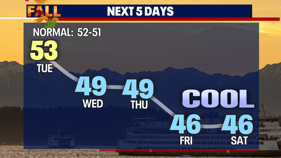
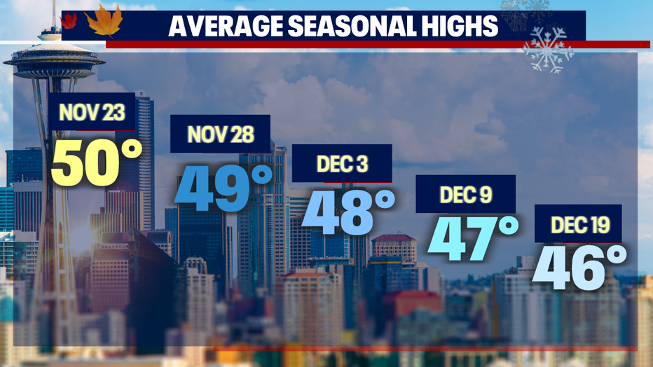
Here's a look at the typical highs going into December:
So why is Western Washington so dry? A ridge of high pressure is dominating the forecast pattern.
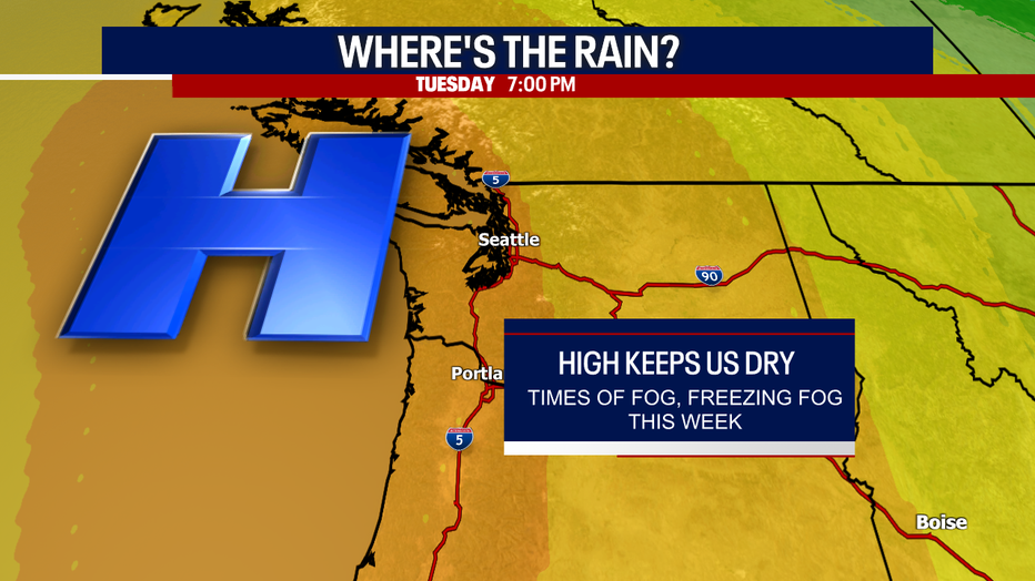
While we stay dry through Sunday, there will be some changes on Thursday. An area of low pressure in the upper atmosphere will dive into Eastern Washington. This will kick up the winds over the Cascade foothills (e.g. Enumclaw, North Bend, Black Diamond, etc.): these spots could be slightly breezy today and tomorrow, too. It could also be gusty in the North Sound, particularly Thursday, due to those northerly Fraser River Valley winds. Right now, we're not forecasting any damaging winds this week. We'll let you know if that changes.
By Monday, the wet weather makes a comeback! Rain returns just in time for Thanksgiving week. Next week is looking rather damp and cozy :)
Take good care,
Meteorologist Abby Acone
Follow me on Twitter @abbyacone, Instgram @abbyaconewx, TikTok @abbyaconetv and Facebook (Meteorologist Abby Acone)