

Lowland rain, mountain snow ahead Friday
Shower to become scattered by Friday afternoon
Friday morning showers will be widespread and the snow levels will start around 4500'.
We're tracking lowland rain, mountain snow, breezy weather and isolated thunderstorms Friday! We'll be dry Saturday and Sunday. Rain returns just in time for Christmas.
Most backyards have already hit their high temperatures for the day – here's a look at the highs so far (just before 9 a.m.). Temperatures will range in the low to mid 40s this afternoon. With mostly cloudy skies and blustery pockets, temperatures will feel cooler.

In the purple areas on the map below, a Winter Weather Advisory is in place today from 10 a.m. to 10 p.m. for between five and ten inches of snow above 4,000 feet. This includes Stevens Pass.

Here's the breakdown of specific forecast snow totals for some of the mountain passes today. If you're driving over the higher elevations, check WSDOT conditions before you go!

Over the ski slopes, we're not expecting any new snow Saturday or Sunday. Here's a check of the forecast:

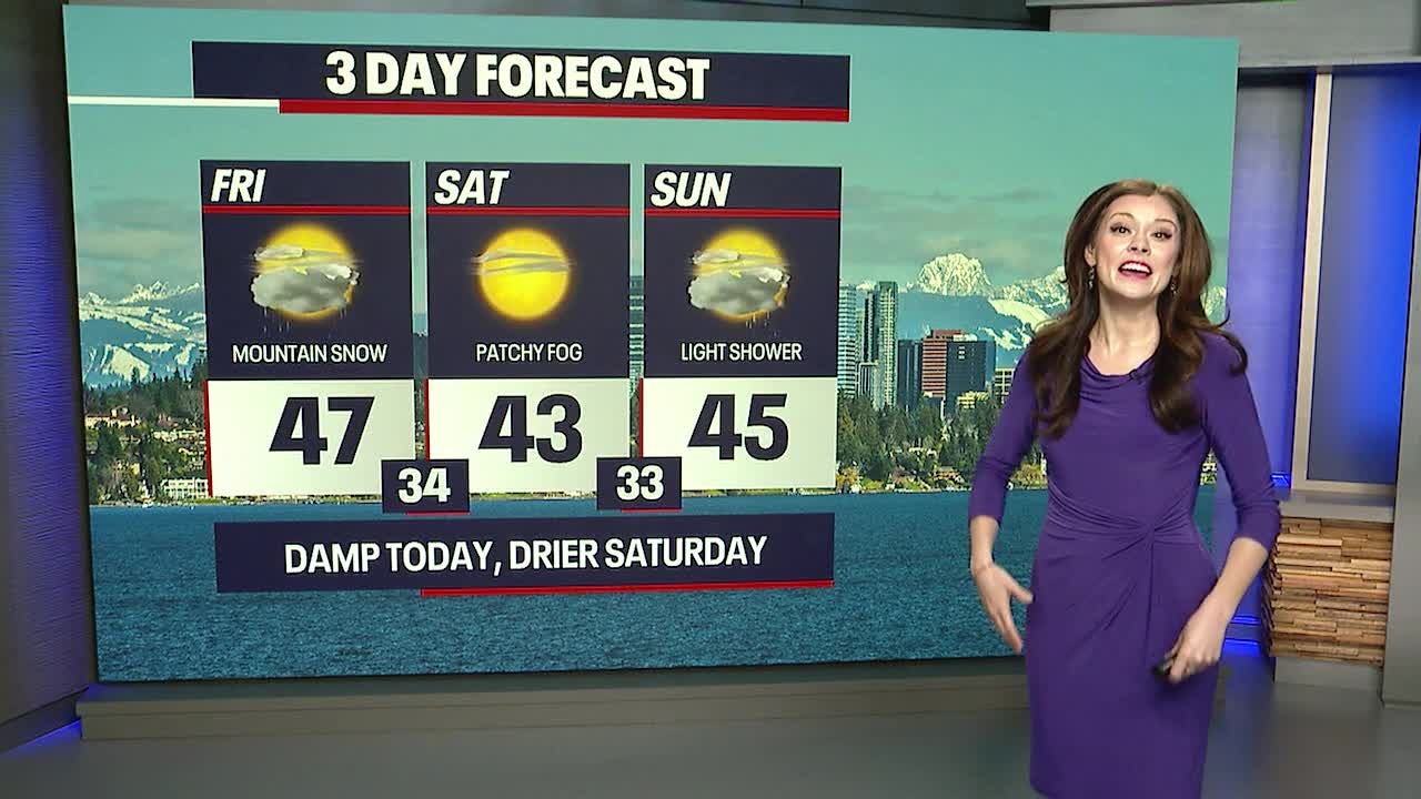
Tomorrow morning, there could be spots of fog or freezing fog. Be on the lookout for slick spots on bridges and overpasses. Otherwise, Saturday is looking lovely with mostly sunny skies. Sunday will be mostly cloudy. There might be a brief shower late Sunday, but the day will be mainly dry.

Christmas morning is looking dry, but rain sweeps through Western Washington at some point in the afternoon and evening. This is due to an atmospheric river which is a corridor of moist air. Right now, this weather pattern doesn't look particularly strong or major. While some communities could see morning temperatures around the freezing mark Christmas morning, the precipitation shouldn't arrive until the afternoon. Bottom line: the chances of having a white Christmas are almost nonexistent at this point unless there's a huge change (which is unlikely). Stay tuned for any updates!
The wet weather lingers through next week. At the current moment, we're not anticipating widespread river flooding from the rain, but this forecast could change. The Skokomish River could see minor flooding on Monday.
Note: there will be some King Tides next week; however, we're not expecting flooding at this time. Sometimes when the atmospheric pressure is lower than average, flooding is possible, but conditions next week don't look strong enough for flooding.

Take good care and have a wonderful holiday weekend! We're very thankful for you.
Warmly,
Meteorologist Abby Acone
Follow me on Twitter @abbyacone, Instagram @abbyaconewx, TikTok @abbyaconetv and Facebook (Meteorologist Abby Acone)