

Seattle weather: Isolated lowland snow wraps up Tuesday morning
SEATTLE - It has been an active evening! Western Washington got a big dose of hail, lightning, and snow on Monday night. As the precipitation continues to be spotty, be on the lookout for icy pockets as temperatures drop around freezing. We'll continue to clear out by Tuesday morning with more sunshine.

Until we clear out completely, I want to give you a look at the FutureCast and time out the lowland snow potential. Here is a break down through tomorrow morning:


Reports are already coming in for snow accumulation. Isolated areas in the lowlands have been reporting between 1-2" of snow accumulation with isolated areas (especially in the foothills) exceeding that. Winter Weather Advisories will remain in place until early tomorrow morning. Here is a look:


Most of the heavy snow hs been accumulating across the passes. Area along the Cascades have seen over 10" of accumulation! Snoqualmie Pass is currently closed due to deteriorating road conditions and will need time to reopen.

The Winter Storm Warning has been extended until 2am for the highlighted area below. An additional 3-6" of accumulation will possible overnight.

On top of all the snow, the winds have been whipping! Here is a look at some of the strongest wind gusts today:

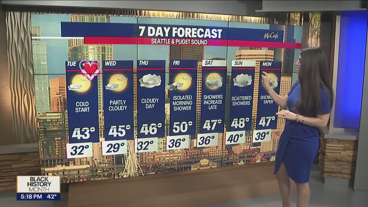
Luckily, the wind speeds will relax as we head into Valentine's Day. It'll be chilly but very sunny and dry!

I'll leave you with a look at your 7-day forecast:

Have a good one and be safe tomorrow morning as you hit the roadways!