

Seattle weather: Picture-perfect summer forecast

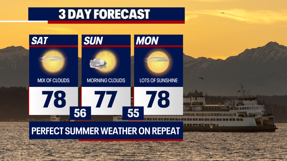
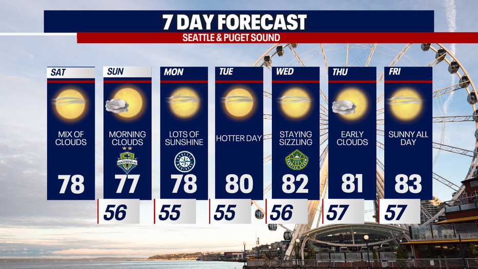
We're truly enjoying some of the best weather in the entire country! We're forecasting picture-perfect highs in the upper 70s this weekend.
This afternoon, you can plan on a mixture of sunshine and clouds. Just like today, Sunday could start cloudy for some backyards. Monday will feature sunshine from the start to the finish.
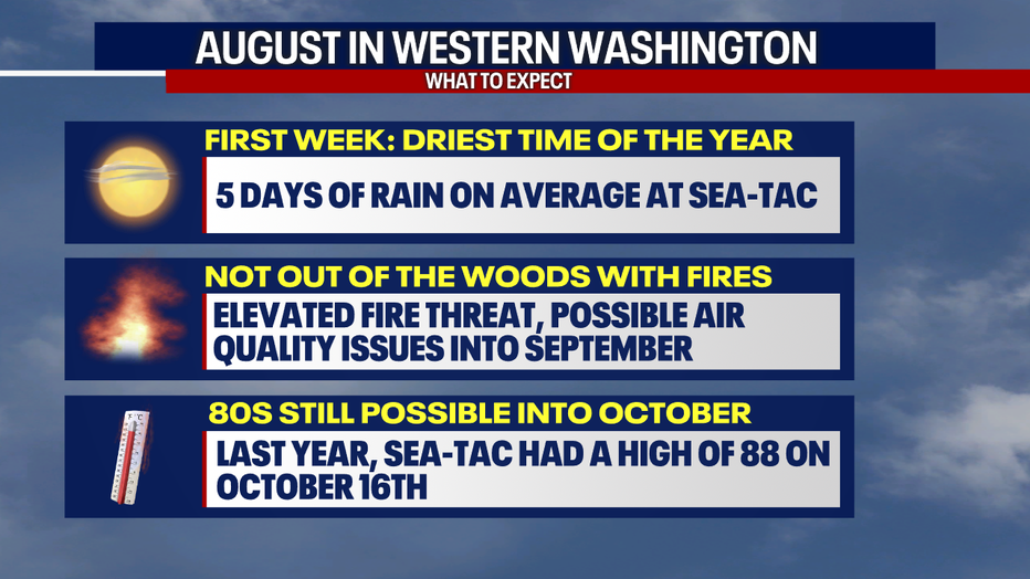
Believe it or not, August arrives on Tuesday. On the whole, we expect above-average temperatures for much of the country, including here in Western Washington and Oregon. Normal highs range in the 70s in August.

Sea-Tac Airport averages five days of measurable rain every August. The last week of July and first week of August is climatologically the driest stretch of the entire year in the Seattle region.
Even though air quality will probably be good all week, we're not out of the woods yet when it comes to smoke and air quality problems this season. Keep in mind: fire season typically lasts into September.
If you've lived in Western Washington for long, you know that autumn weather can really be a toss-up. However, there are years when the nice and mild weather sticks around into September and October. You may remember that Sea-Tac skyrocketed to 88 degrees on October 16 last year (which is super above the norm).
Gorgeous weather continues all week. Enjoy the beautiful sunshine!
Take good care,
Meteorologist Abby Acone
Follow me on Twitter @abbyacone, Instagram @abbyaconewx, TikTok @abbyaconetv and Facebook (Meteorologist Abby Acone)