

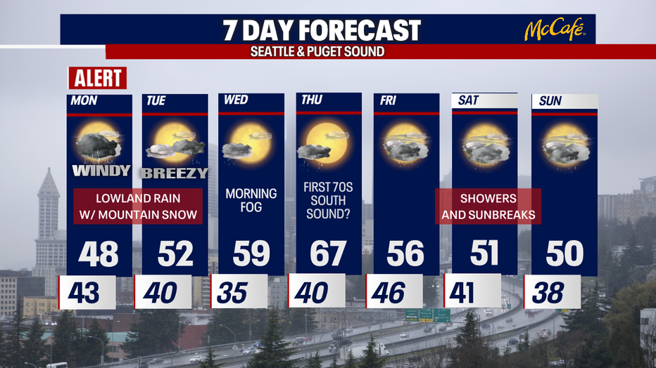
Powerful spring storm Monday in Western Washington
Get ready for super soaking rain, strong winds and intense mountain snow heading into Monday. We've issued a weather alert to account for the active weather.
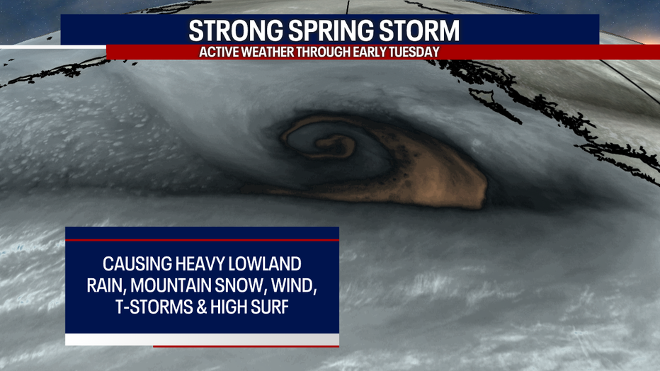
Here are the biggest factors we're tracking through Monday:
Mountain snow:
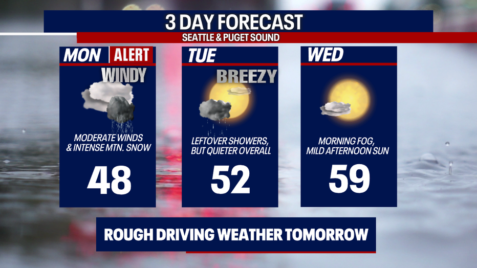
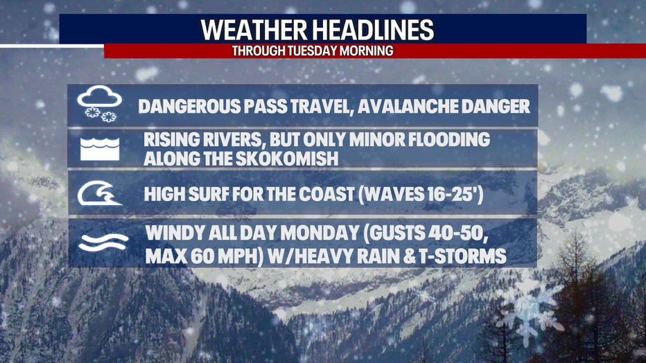
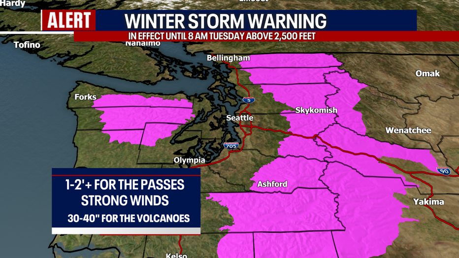
I'm most concerned about the possibility for significant, high-impact snow for the passes. Between one and two feet of snow is possible for the mountain highways. Upwards of 30 to 40 inches could stack up over the volcanoes! A Winter Storm Warning is in effect. Travel through the passes could be difficult if not impossible. Avalanche danger will also be high.
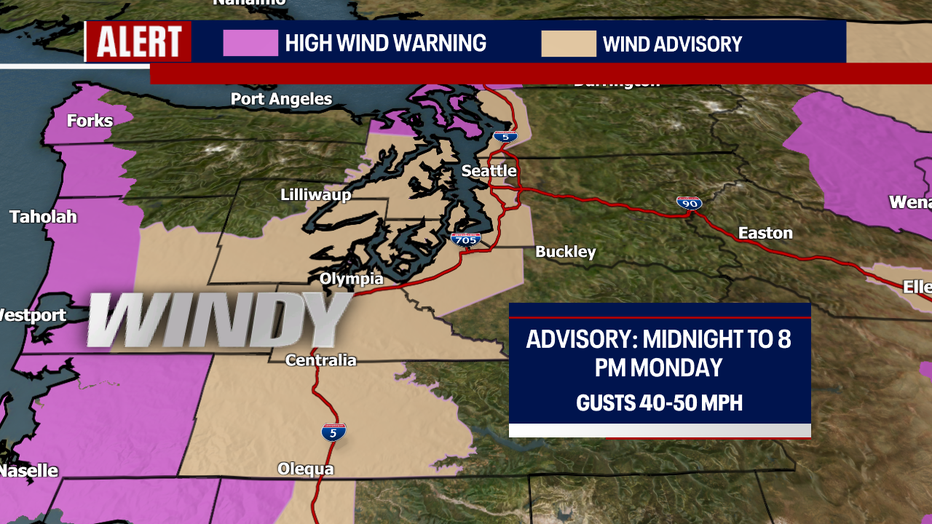
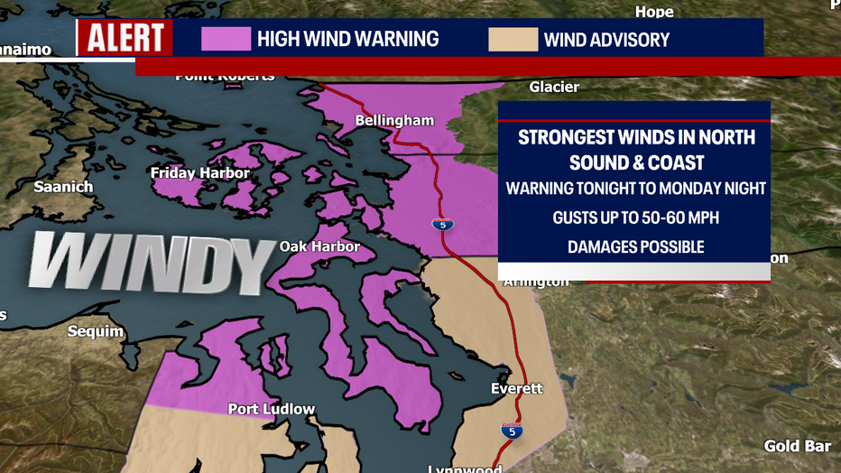
Winds:
Even though winds from this event aren't particularly impressive for everybody in the "Wind Advisory" - I'm worried that because it's going to stay windy for a long time (basically all day), there could be more damages than usual for gusts of this range (40-50 mph) This could include downed tree limbs. Power outages are possible, too.
For the areas in the "High Wind Warning" - gusts to 50-60 mph could be even more impactful.
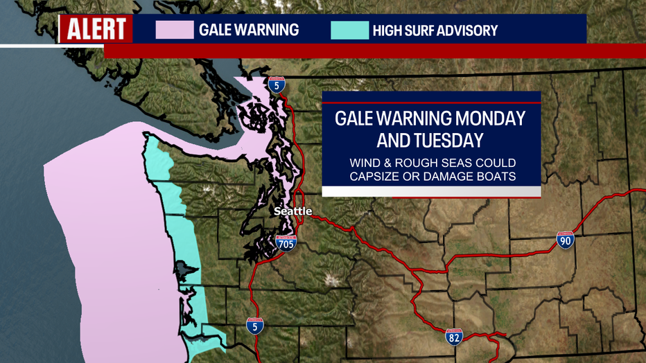
Rough seas:
Forceful winds and low pressure will make for high surf along the coast. Many waters now have a "Gale Warning" posted, too.
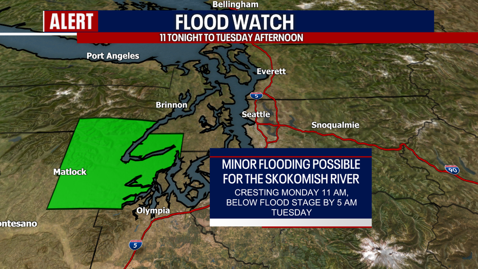
Lowland rain:
While river levels will be rising quickly, we're only expecting minor flooding for the Skokomish River right now. That's where a Flood Watch is in place. Thankfully, we're not forecasting widespread river flooding.
Quieter weather is on tap by Tuesday afternoon. Highs will soar to near 70 degrees in Seattle on Thursday! Some communities in the South Sound could even see their first 70 degree day of the season :)
Warmly,
Meteorologist Abby Acone
MORE FROM FOX 13 WEATHER:
DOWNLOAD: FOX 13 Weather and News Apps
WATCH: Forecast and Radar
READ: Closures and Delays
CHECK: Latest Weather Alerts and Live Traffic Map
INTERACT: Submit your Weather Photo
DAILY BRIEF: Sign Up For Our Newsletter
FOLLOW: Lisa Villegas, Erin Mayovsky, Brian MacMillan, Abby Acone and Scott Sistek