

Seattle Weather: Dry Valentine's Day, showers return by evening
Evening showers for Valentine's Day, wet week drags on
If you've got Valentine's Day plans tomorrow, we hope they're indoors! FOX 13 Meteorologist Ilona McCauley is tracking rain all through the week.
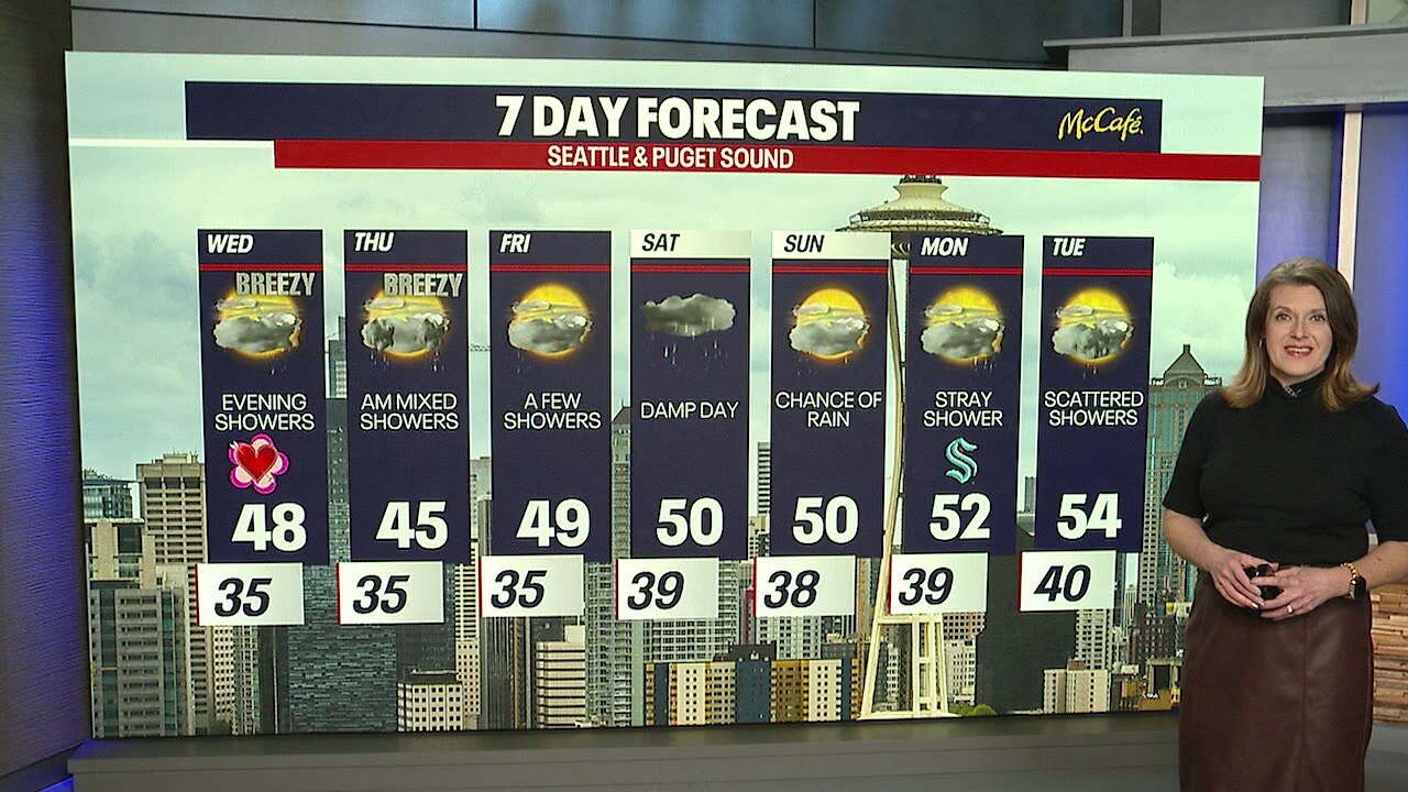
A nice sunny day for the Pacific Northwest this afternoon with highs in the upper 40s. We are going to see some changes heading into Wednesday evening with the chance of rain/snow showers into Thursday morning. Also, heavier mountain snow!

Tonight we will see clear skies with cooler overnight temperatures. Winds will be a bit breezy from the north.

Waking up on Wednesday, we will see dry skies and a few sunbreaks. Skies will start to get cloudy as the day goes on. Rain returns by evening commute time, starting in the south sound moving northward.

High temperatures Wednesday will be in the upper 40s, but cooler temperatures will continue to filter in from the Fraser River outflow and the Cascades gaps. This will create the potential for rain/snow mix and even light snow showers by Wednesday night.

Mixed rain and snow showers are possible through Thursday morning. Showers transition over to rain by midday. A wet snowflake is possible for the Puget Sound lowlands, most likely sticking around the Kitsap Peninsula and Hood Canal areas.

Expect to see winter driving conditions for the Cascade Mountain passes Wednesday evening through Thursday PM. Up to 15 inches of snow is possible for the south cascades.

Looking at warming temperatures into the weekend with chances of scattered showers each day.
