

Seattle weather: Rain and gusty winds to hit Friday night
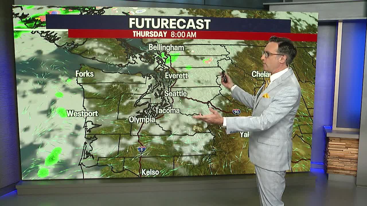
Cool morning, dry afternoon for Thursday
Temperatures will cool again tonight with more low clouds and fog into Thursday morning.
SEATTLE - Stormy weather is set to hit Friday through the weekend as a series of weather systems take aim at the Pacific Northwest.
Thursday will feel a lot like Wednesday, with partly to mostly sunny skies in the afternoon. Temperatures will remain below average, in the mid 50s.
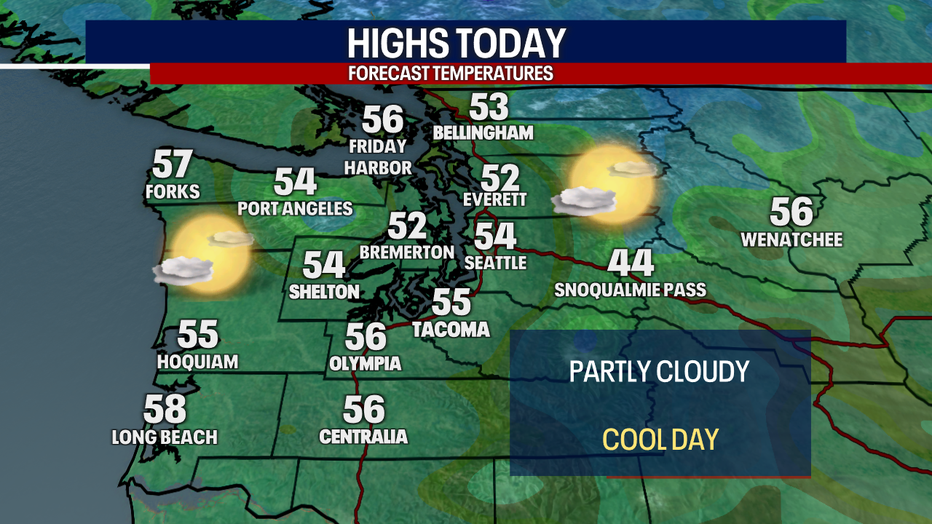
Western Washington will be cool, with plenty of afternoon sunshine Thursday. (FOX 13 Seattle)
As a ridge of high pressure moves east, strong gap winds will develop in the Cascades. Areas like North Bend, Enumclaw and Gold Bar could see strong easterly gusts through the Cascade gaps during the day Friday. Gusts of 40-45 mph are possible.
The next round of widespread rain will arrive Friday night into Saturday morning.
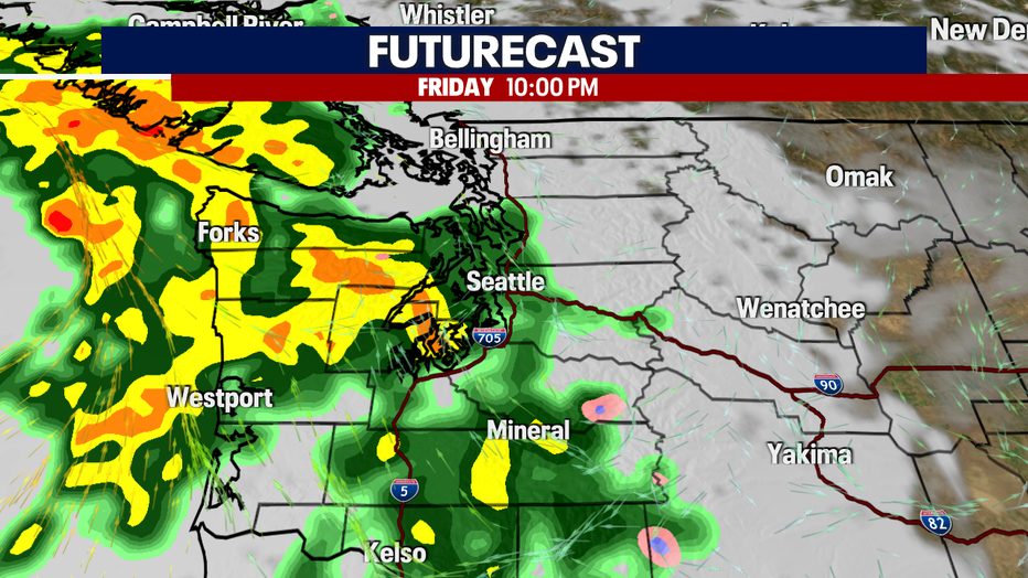
Widespread rain will hit the Puget Sound area Friday night. (FOX 13 Seattle)
On the back end of that wet system will be more gusty wind; this time coming from the south. Areas in the north Puget Sound could see gusts up to 55 mph, while the central and south Puget Sound will see gusts in the 30-40 mph range. There are still plenty of leaves on the trees, so isolated power outages are possible.
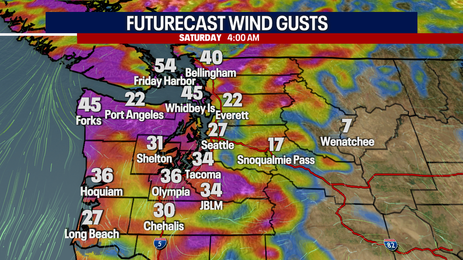
Gusty south winds are expected Saturday morning in the Puget Sound area. (FOX 13 Seattle)
A deep trough will bring in cooler air to start next week, dropping snow levels. We could see our first snow of the season at Snoqualmie Pass by the middle of next week.
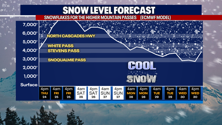
We could see some of the lowest snow levels of the season in the Washington Cascades by the middle of next week. (FOX 13 Seattle)
If you're looking for some dry time, enjoy Thursday. Our next completely dry day could be next Tuesday.
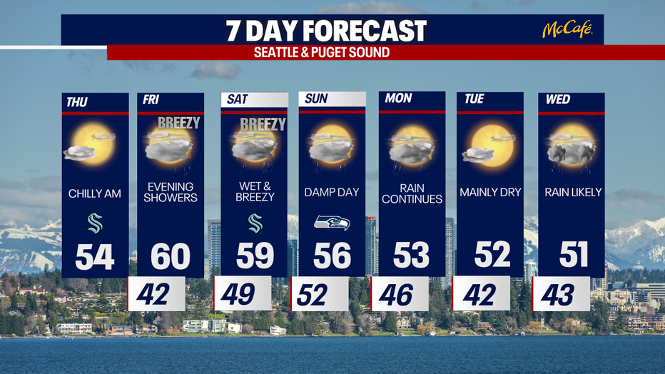
The next seven days will bring cool showers to the Seattle area at times. (FOX 13 Seattle)