

Seattle Weather: Seasonal temperatures return Friday
Today we saw more sunshine and milder temperatures around the Pacific Northwest. The first of a two-day dry stretch for Washington.

Queen Anne Camera
Highs today were a few degrees warmer compared to Wednesday, but it was still below average.

TODAY HIGH TEMP
Tonight we will see partly cloudy skies with overnight lows dropping into the low to mid 40s.

Regional Overnight Lows
Skies will start with mostly clear conditions in the morning. Dry and mild temperatures for the end of the week.

FUTURECAST
Highs Friday will be back to the seasonal average if not a little above, upper 60s to low 70s.

Map Around the Sound (FOX 13 Seattle)
The north sound will be slightly cooler, topping out in the mid 60s.

Map Around the Sound North Interior
The coast will see high temperatures in the low to mid 60s. Clouds will increase by midday and a chance of light showers return late Friday night.

Map Coast Strait
High clouds will start to increase around Puget Sound by the early evening, with mostly cloudy skies overnight.

Futurecast 5pm
We are in for a lot more rainfall Sunday through Tuesday as an atmospheric river sets up for the Pacific Northwest.
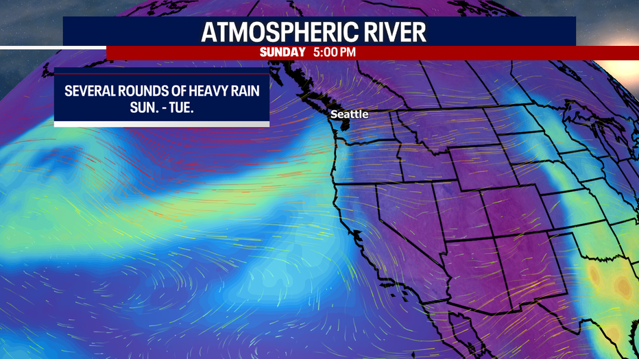
Atmospheric River GRAPH (FOX 13 Seattle)
We could see some beneficial rain with several inches possible across Western Washington, as we are already in a state of drought for Washington. We will have to watch for potential flooding concerns to local rivers and low lying areas.

WET WEATHER AHEAD
We will start to dry out Wednesday as the skies will clear out by the afternoon. The trend is looking warmer and drier for the extended forecast into the next weekend.

7 Day Forecast