Seattle weather: Sunday showers around the region

Seattle weather: Sunday showers around the region
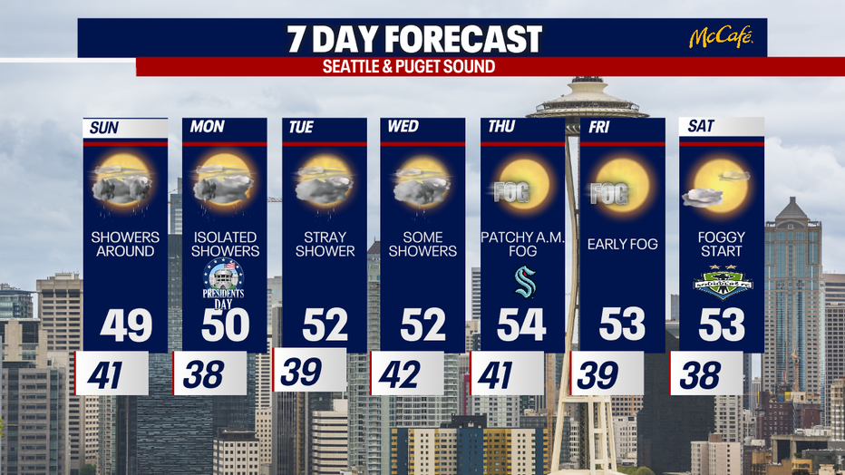
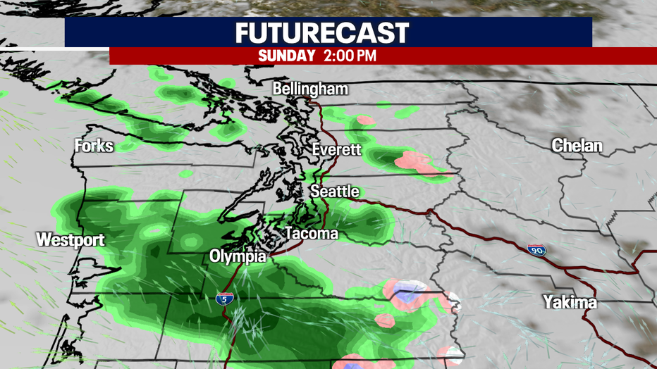
Rain showers will likely make an appearance around the region for Sunday!
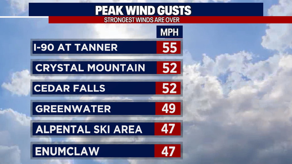
Seattle - The gusty, Cascadia Gap winds which were impacting our foothill communities are finally relaxing tonight. Several locations did report power outages during the height of the wind event overnight. Power has been restored to many spots. Crews are working hard to get everyone back online as quickly as possible. Peak gusts in some spots were over 50mph!
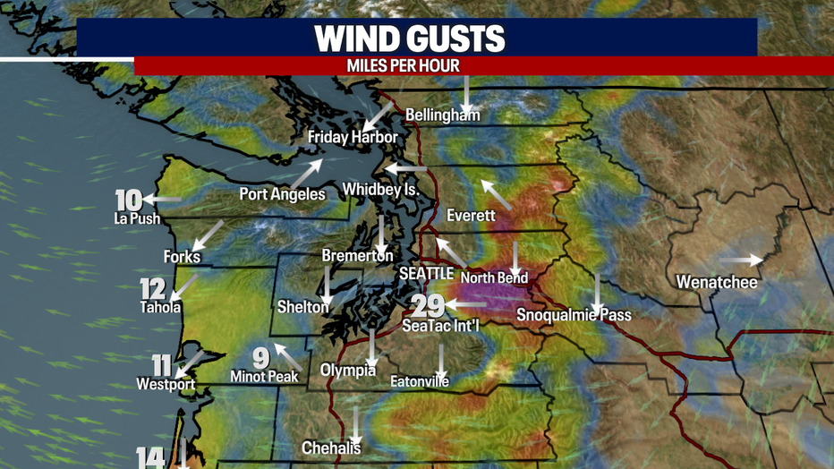
All High Wind Warnings and advisories have been allowed to expire for the day. We are still seeing a few gusts around 30mph, but the winds will continue to decrease through the night.
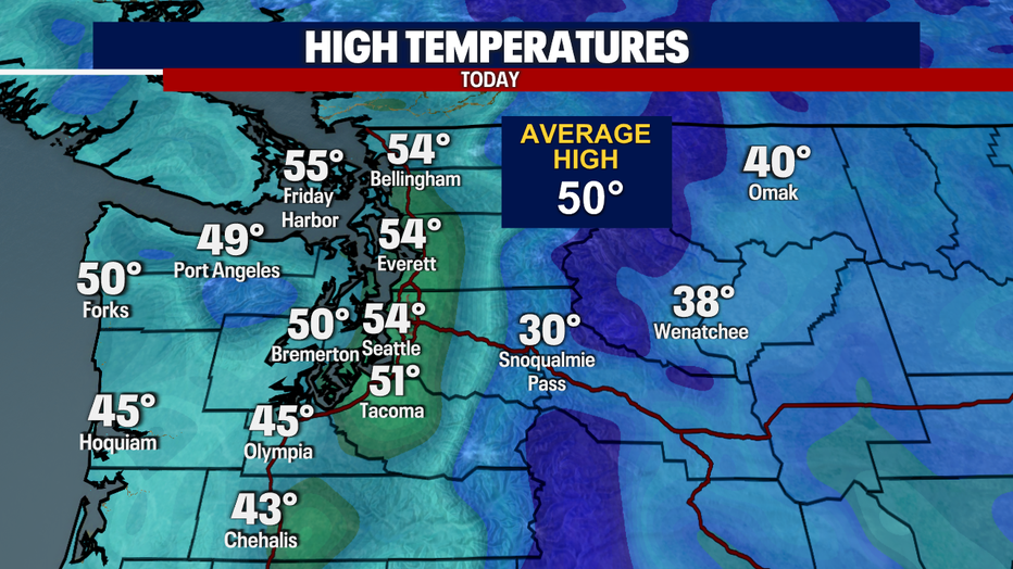
Saturday's skies were partly to mostly cloudy with a warm front hanging just off the coastline. Temperatures warmed to near 55 degrees in many spots.
A weak disturbance to our south is sending some light moisture into Western Washington. Scattered showers are possible tomorrow with light amounts of rain totaling between .10"-.25".
Stray showers are possible through about Wednesday with highs in the low 50s. By Thursday, a weak ridge of high pressure will build in leading to drier skies, but also some foggy mornings.