Seattle weather: Sunshine and warmer temperatures return

Seattle weather: Sunshine returns, temperatures climb
Seattle weather: Sunshine returns, temperatures climb
A big shift in the weather pattern starts Wednesday as high pressure builds over the Pacific Northwest.
After some morning clouds cover, the Puget Sound area will enjoy lots of afternoon sunshine. Temperatures will be warmer, back into the mid to upper 60s.
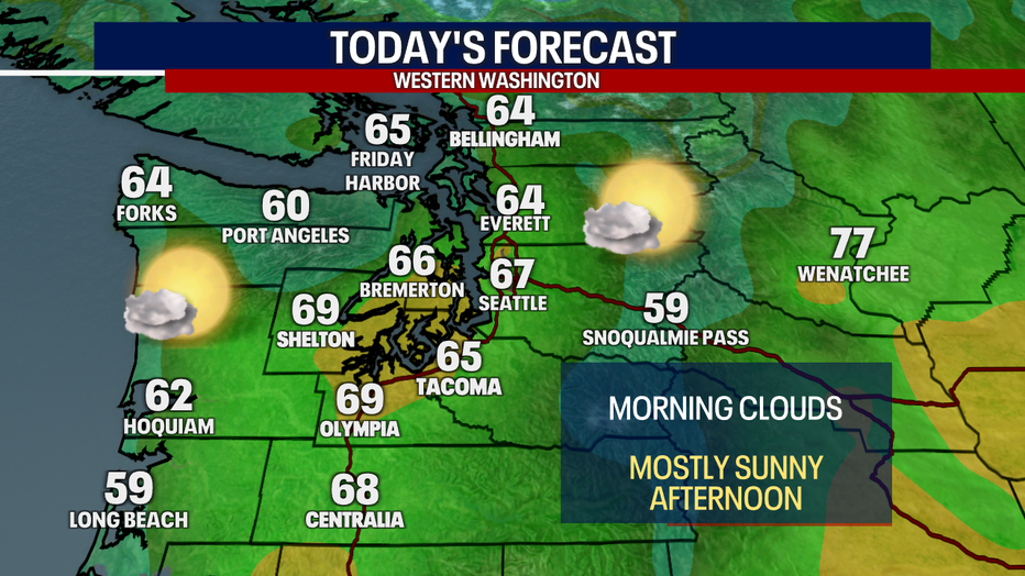
A map showing the forecasted high temperatures for Western Washington cities Wednesday. (FOX 13 Seattle)
This strong ridge will dominate the West Coast over the next several days. You may have been hearing the term "heat dome." That's when high pressure lingers in a spot for more than a week. Air can become stagnant and temps slowly climb, with no relief from the heat.
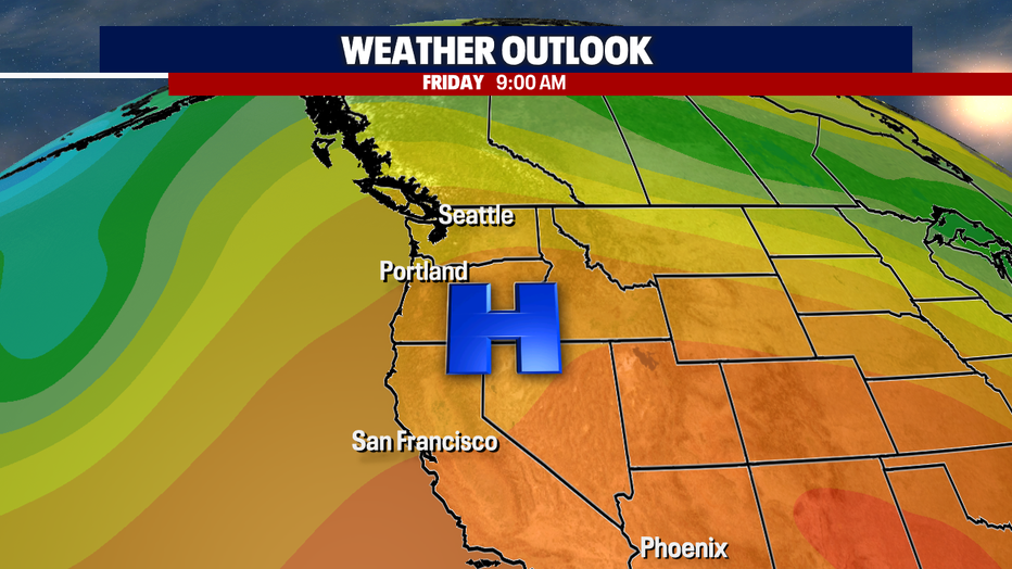
A map showing a ridge of high pressure settling in over the West Coast of the USA. (FOX 13 Seattle)
Temps will soar to near record levels in the coming days in the southwest and inland California. Highs will be close to 110 degrees in spots like Las Vegas and Pheonix.
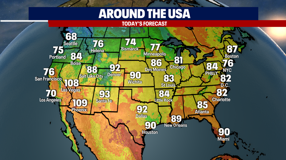
A map showing the forecasted high temperatures in major cities across the USA. (FOX 13 Seattle)
Back in Seattle, we have hit the dry season. Seattle averages nine days with measurable rainfall in June with even less in July and August. Though we can get "June Gloom" some years, this June is turning out to be very nice with a long dry and sunny stretch ahead.
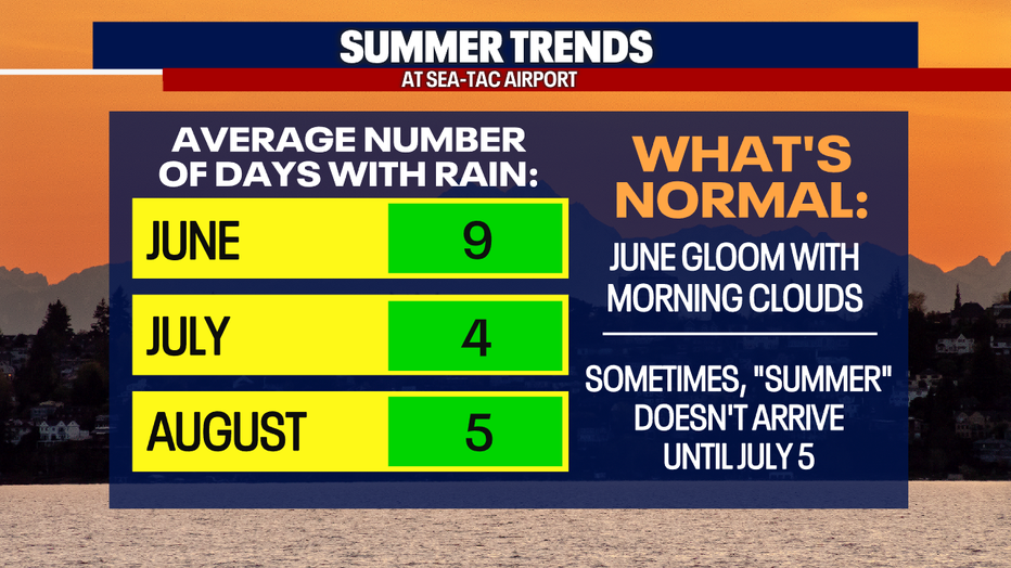
A graphic showing the average number of wet days in Seattle during the summer months. (FOX 13 Seattle)
Temps will be back into the 70s starting Thursday and will soar close to 80 degrees by Saturday. A weak system will bring mountain showers and more clouds to the lowlands Sunday, but it will still be very comfortable.
You should feel good about washing your car or starting outdoor projects today, with no lowland rain in sight.
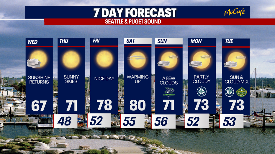
The 7 day forecast for the greater Seattle area. (FOX 13 Seattle)

