

Seattle weather: Gusty winds, heavy rain continue Tuesday

Seattle weather: More rain and wind heading into Tuesday
FOX 13 Seattle Meteorologist Claire Anderson has your latest western Washington weather forecast!
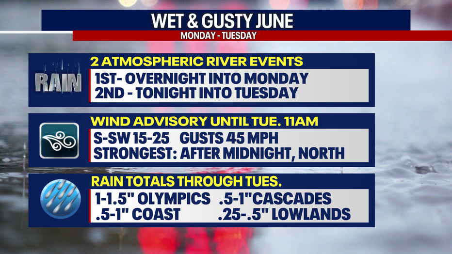
SEATTLE - The first round of our atmospheric event moved in on Monday, bringing plenty of rain and wind to the Pacific Northwest. The second round of moisture is expected tonight into Tuesday. Heavy rain at times is expected.
WET WEATHER AHEAD (FOX 13 Seattle)
Rainfall totals as of 5:00 p.m. were lower compared to Sunday, but one spot that did see a substantial amount of rain was Arlington. Over an inch and a third of rain from an early convergence zone.
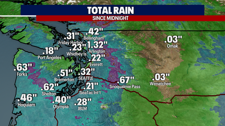
Rain Since Midnight Western Washington
Winds peaked earlier today with gusts up to almost 50 mph across Western Washington, bringing down trees and power lines.
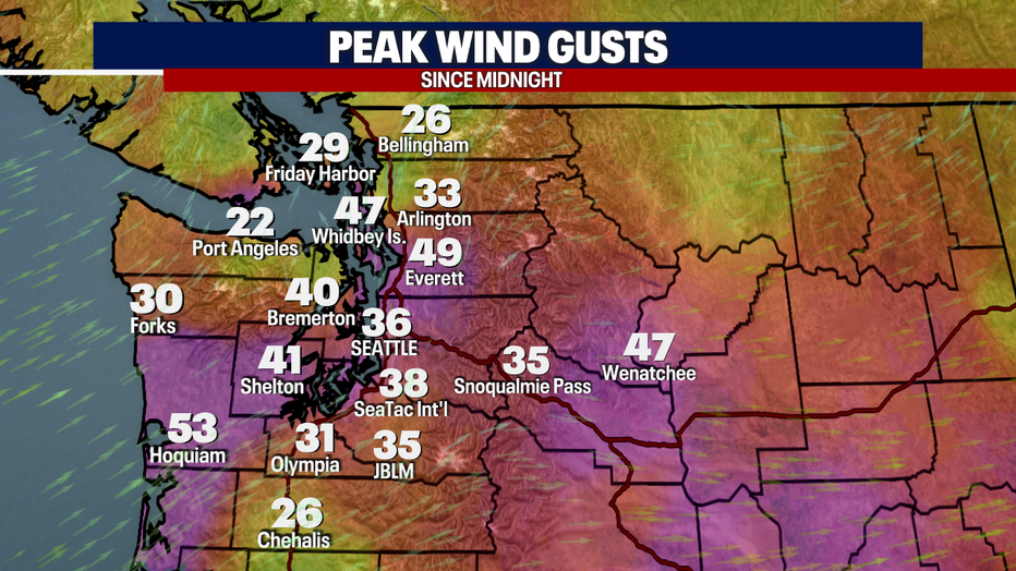
Peak Wind Gusts Since Midnight WWA
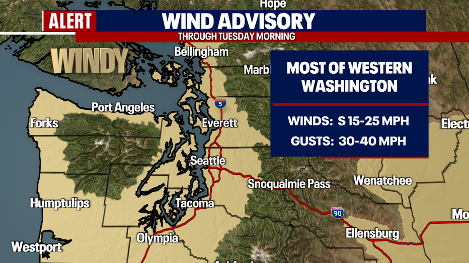
A Wind Advisory is in effect through 11:00 a.m. Tuesday with wind gusts up to 40 mph. Wind gusts today have been up to almost 50 mph. Strong winds are expected again overnight.
Wind Advisory
Tonight we will see another round of wind and rain overnight. Temperatures will be mild in the upper 40s and low 50s.
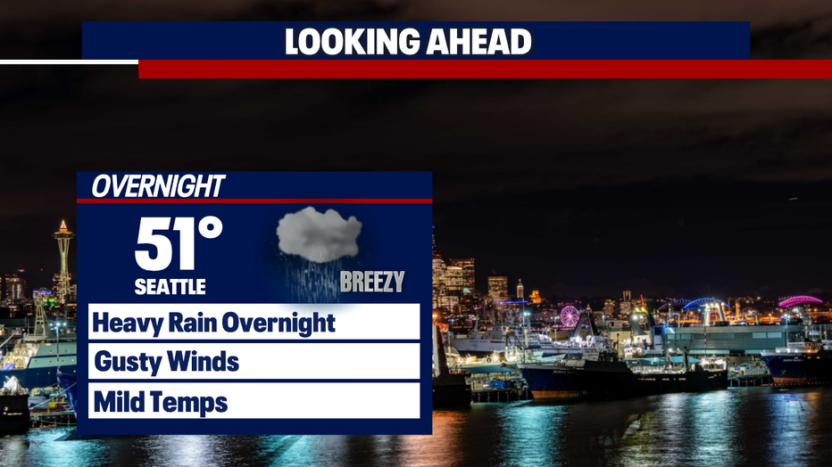
TONIGHT FORECAST PM
A wet start to the morning with the potential for urban and small stream flooding.
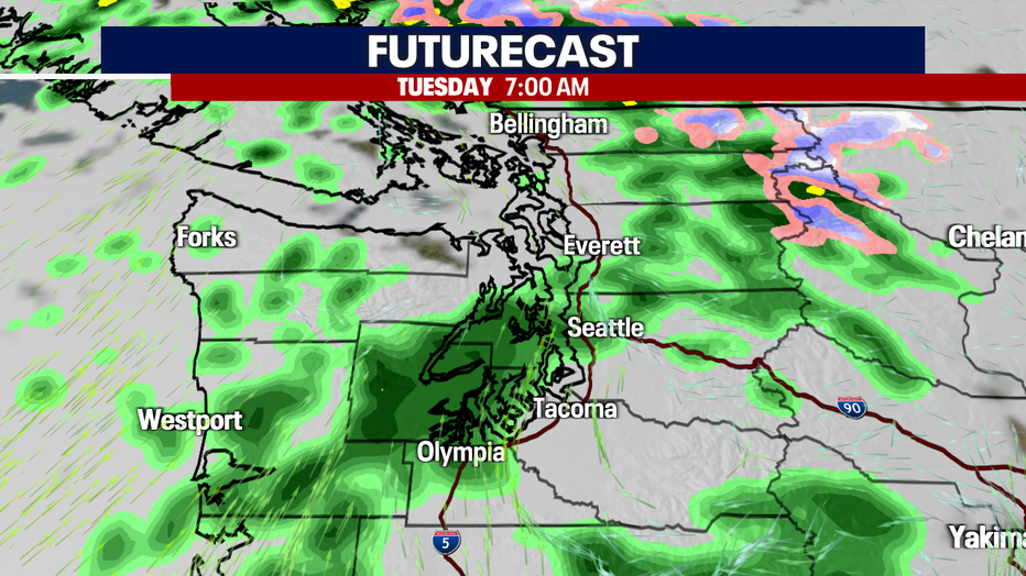
FUTURECAST 7am
A Flood Watch remains in effect through Wednesday morning as rivers could rise, and we could see potential minor flooding.
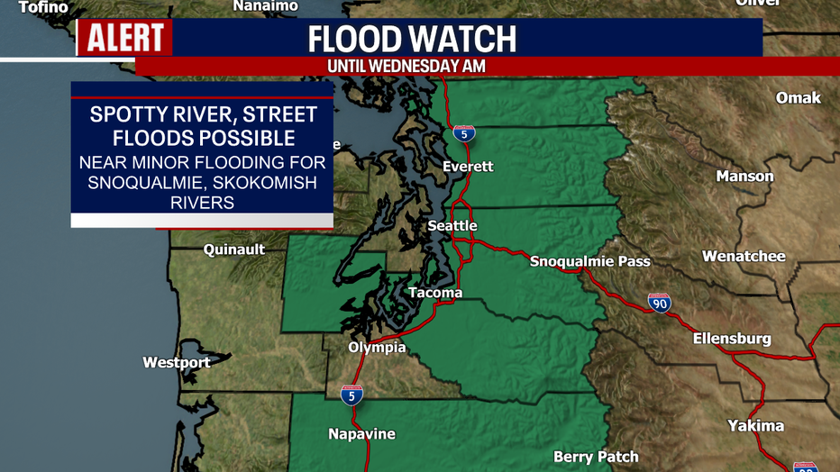
Flood Watch (FOX 13 Seattle)
Highs on Tuesday will be slightly warmer compared to Monday, but only by a few degrees and still below the seasonal average.
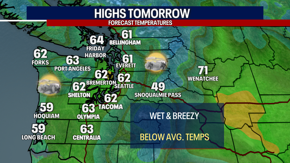
Regional Highs Tomorrow (FOX 13 Seattle)
Showers will be more scattered Tuesday afternoon with a few sunbreaks and a slight chance of a rumble of thunder. Skies will dry out by late Tuesday night into Wednesday.
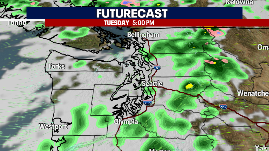
FUTURECAST 5pm
Temperatures will start to warm on Wednesday with more sunshine in the forecast. Above average highs and sunny skies into early next week.
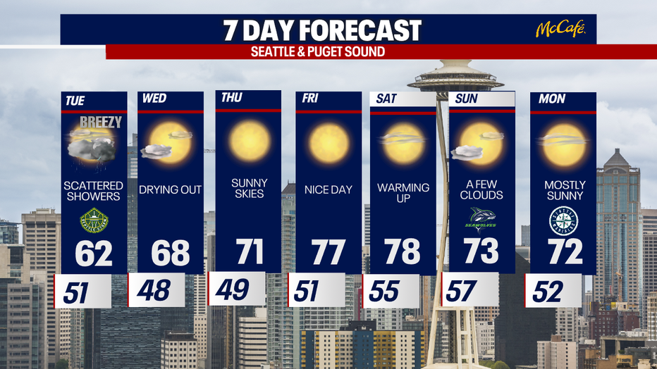
7 Day forecast