

Seattle weather: Showers today, fog and sun Thursday
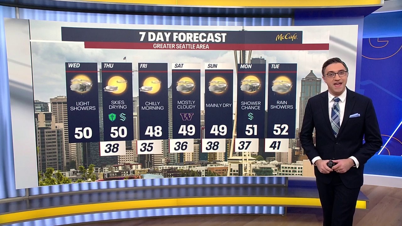
Seattle weather: Wednesday brings increasing clouds and light showers
A low pressure system moving into Oregon and northern California on Wednesday will kickup increasing clouds and a few showers for our southern areas.
SEATTLE - Showers will wrap up Wednesday evening and we will get back to drier and cooler weather to end the work week.
There will be some breezy easterly winds near the Cascade foothills this afternoon as offshore flow continues. The remaining showers will gradually fade tonight, with the best chance of light rain from Everett south.
Overnight lows will be chilly, in the low 30s to low 40s.
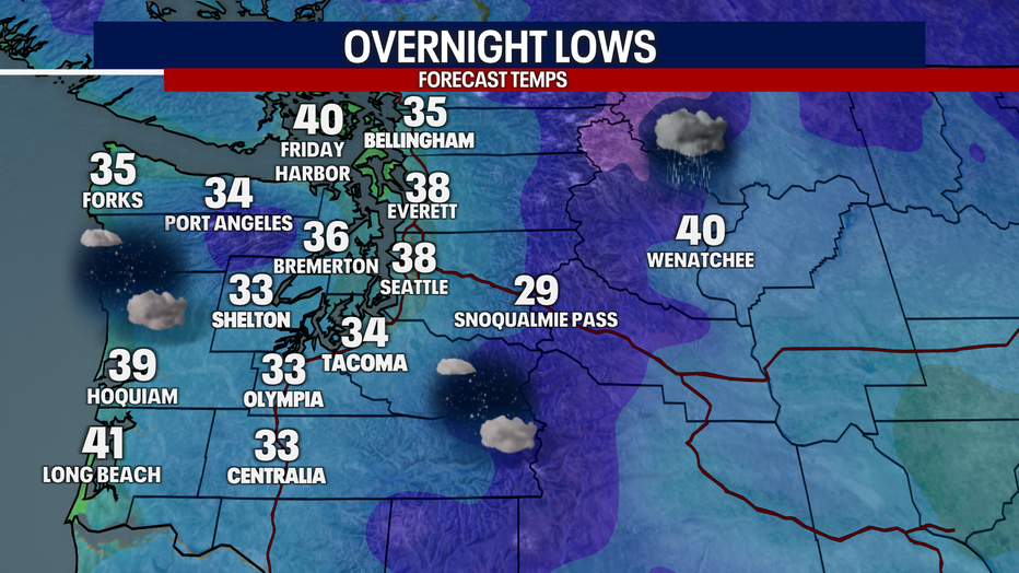
It will be cool and partly cloudy with patchy fog overnight in Western Washington. (FOX 13 Seattle)
Sunshine Returns Thursday and Friday
Why you should care:
As clouds thin overnight, areas of fog could develop across the Southwest Interior and in some of the river valleys Thursday morning. The fog should dissipate by afternoon, with plenty of sun and highs once again near 50 degrees.
High pressure will bring clearing skies and a better chance for sunshine on Friday, but some areas will start off with fog again. Friday morning lows will fall into the upper 20s and 30s, followed by afternoon highs near 50.
Weekend Forecast: A Few Showers Possible
Local perspective:
The forecast gets a little more complicated this weekend. An upper-level low is expected to develop and stall off the Oregon Coast. Bands of moisture rotating around that low could occasionally reach Western Washington, bringing scattered showers.
The position of the low will make a big difference. If it remains well offshore, Western Washington may only see a few passing showers. If it tracks closer to the coast, the chances for rain will increase.
Snow levels will hover around 2,500 feet over the weekend. If precipitation reaches the Cascades, that means snow could fall at all of the mountain passes.
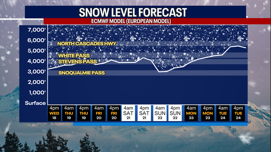
Snow levels will remain around pass levels in the Washington Cascades over the next week. (FOX 13 Seattle)
For now, it’s looking mainly dry for Saturday and Sunday, with only a few isolated showers. Stay tuned as we get closer to the weekend.
Another Front Arrives Tuesday
Big picture view:
A more organized frontal system is forecast to arrive Tuesday. Rain chances will increase with this front, and it could bring a more widespread round of precipitation to Western Washington. Snow levels will rise to around 3,000 to 4,000 feet Monday night and Tuesday. However, easterly winds through the Cascade passes could trap colder air near the surface, potentially allowing snow to linger at pass elevations even as snow levels rise.
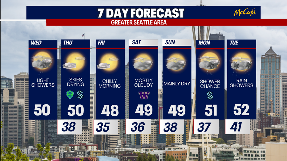
Showers will taper to the south Wednesday evening, with drier skies to end the week. (FOX 13 Seattle)
The Source: Information in this story came from various weather models interpreted by FOX 13 Seattle Chief Meteorologist Brian MacMillan and the FOX 13 Seattle Weather Team.
MORE NEWS FROM FOX 13 SEATTLE
FAA ground stop aftermath cancels thousands of Saturday flights: What to know
911 audio captures window washers trapped 532 feet up Bellevue building
GTA 6 release could trigger $1B U.S. productivity loss
1 dead after shooting in Redmond, 2 suspects sought
FDA approves daily pill shown to cut repeat stroke risk by 26%
To get the best local news, weather and sports in Seattle for free, sign up for the daily FOX Seattle Newsletter.
Download the free FOX LOCAL app for mobile in the Apple App Store or Google Play Store for live Seattle news, top stories, weather updates and more local and national news.