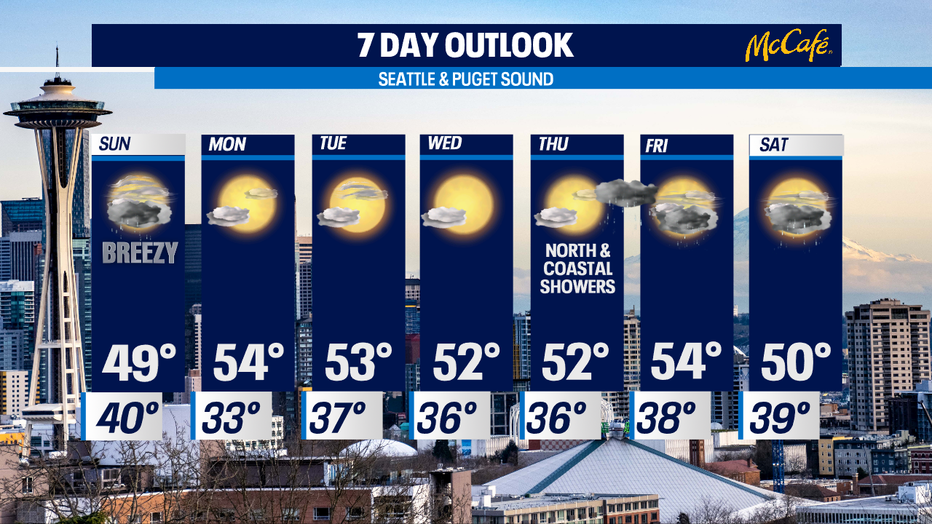
Showery and breezy as we close out the weekend, but spring like conditions will return this week!
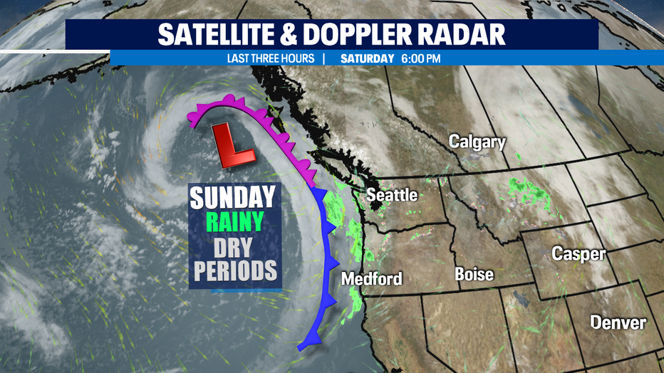
Seattle - The second half of the weekend features more rain, but there will be some dry breaks too. The coast may see a few thunderstorms as well with breezy to gusty conditions at times. Then, we'll start to clear out for a pretty nice spring like week ahead.
Tonight, showers turn to rain overnight. Lows sit right near normal in the upper 30s to near 40.
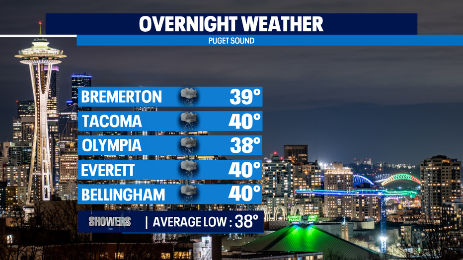
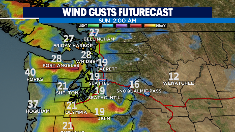
As the next front moves through Western WA overnight into early Sunday rain will spread inland. With this system some areas, like the SW Interior and Olympic Peninsula will see heavier rain rates with the chance of a rain/snow mix briefly before wrapping up. Gusty winds for the Coast and North Sound are also in the forecast. We expect winds out of the SSW sustained between 15-20 mph, with gusts as high as 30.
We'll quiet down as we move through the day with highs near 50. Seasonal average for this time of year is 52 but bounces up a degree come Monday.
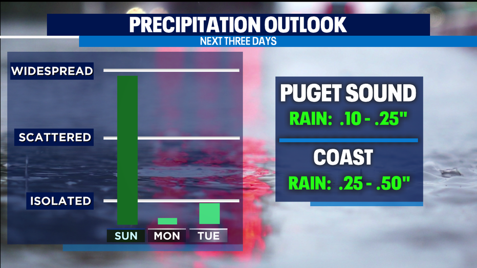
Not much on our "Precipitation Outlook" for the rest of the week. The Coast will see a few leftover showers on Monday otherwise mostly dry for Puget Sound. Tuesday we may see just a couple of pop-up showers over the Olympics and Cascades while everywhere else is dry.
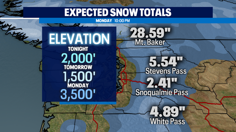
The Cascades will pick up a few more inches of snow over the next 24 hours. It's not much but it will help to freshen up the slopes! Our 2,000-1,500ft snow level Sunday will turn to a freeze level and jump up to 3,500ft as we scour out all of our moisture into Monday.
The extended forecast will be pleasant through the work week with plenty of sunshine! We expect some chilly starts with a little patchy fog in the usual spots.
Thursday the Coast and North Sound may see a few showers during the day with more widespread showers returning to the area late Thursday night into Friday.
Have a great rest of the weekend all! ~Erin Mayovsky, Q13 Forecaster