

Seattle weather: Spring warmth builds across Western Washington

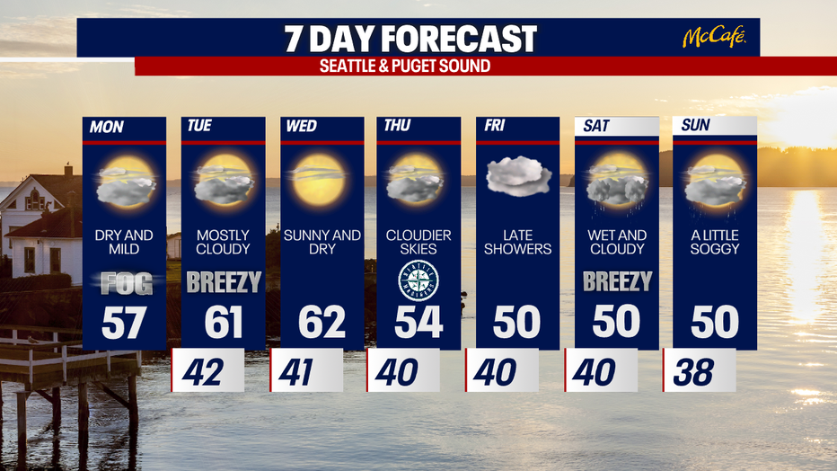
Get ready for a seriously gorgeous week! Highs climb to the low 60s Tuesday and Wednesday. By next weekend, wet and unsettled weather returns to Western Washington.
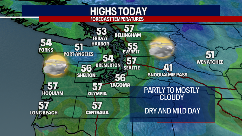
Today starts chilly around the region, but highs boost to the mid to upper 50s this afternoon. There should be a lot of sunshine this afternoon in the North Sound: the Central and South Sound may be battling some mid-level clouds today. Time will tell whether those clouds will be thick enough to obscure our sunshine.
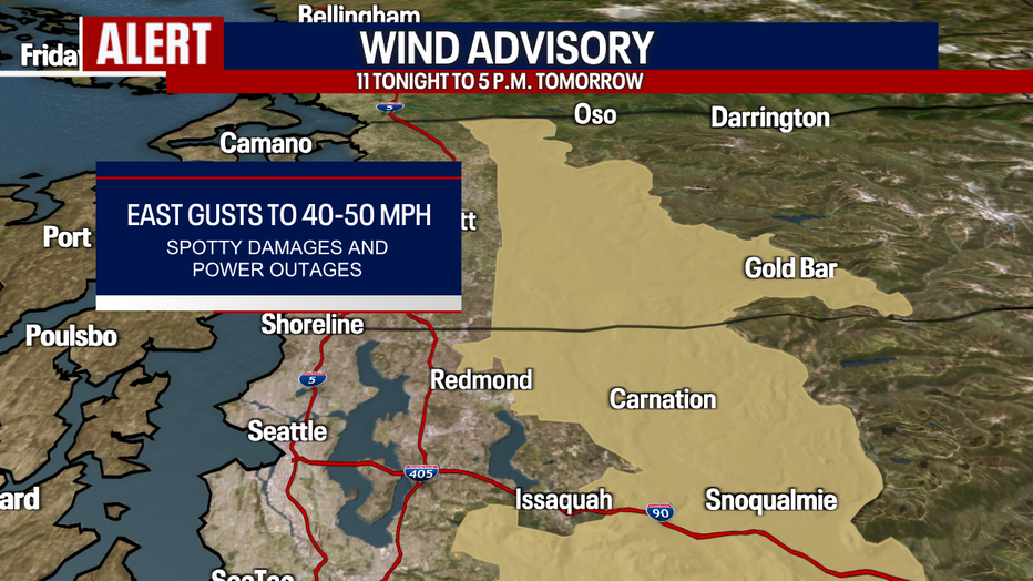
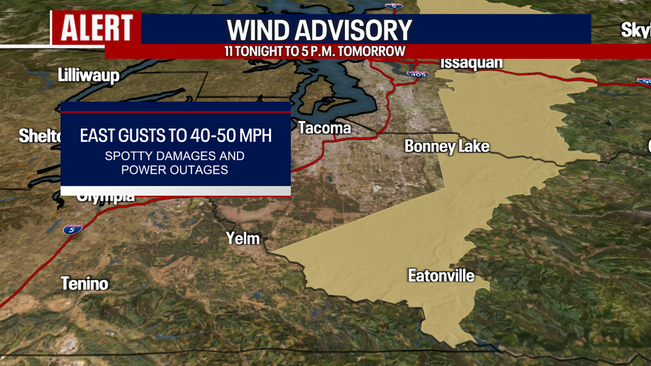
Tonight through Tuesday, winds increase over the Cascade gap communities (e.g. Gold Bar, Carnation, North Bend and Enumclaw). Easterly gusts to 40-50 mph could lead to minor damages and power outages. A Wind Advisory remains in place from 11 tonight to 5 p.m. Tuesday.
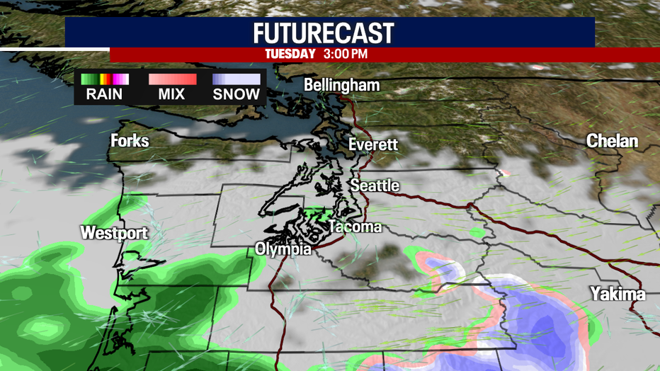
Tomorrow, there may be isolated to scattered showers in Southwest Washington and the South Cascades. Elsewhere, the weather should be dry and quiet. Here's a look at Futurecast:
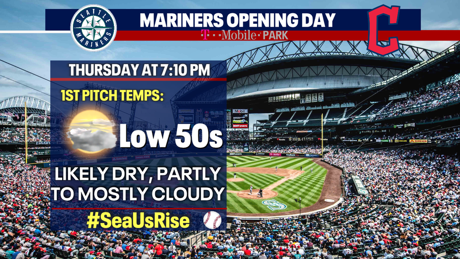
Easterly winds tend to bring us warm and dry weather, and that's exactly what we'll experience through Wednesday as highs crest into the low 60s. By Thursday, an onshore flow returns: these westerly winds will knock temperatures down by a few degrees. Thursday will be cloudier as well. The weather should be nice and dry for the Mariners home opener at 7:10. Enjoy and go Ms!
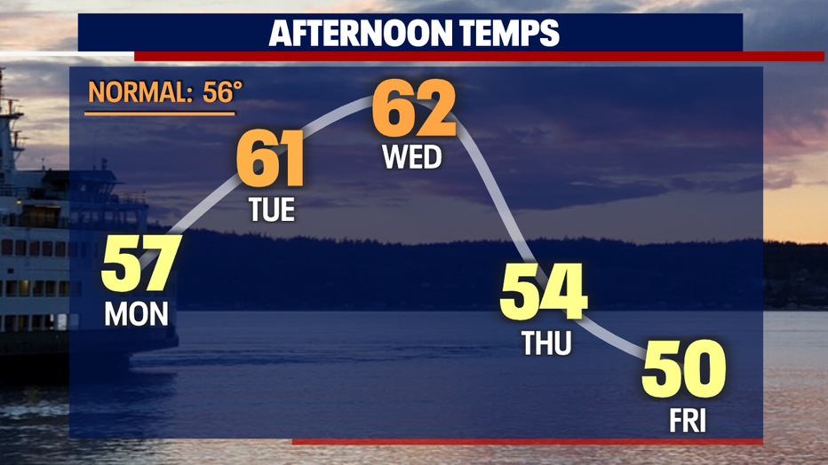
By late Friday, wet weather creeps back into Western Washington. You can plan on lowland rain, mountain snow and breezy conditions on Saturday. Sunday could stay damp as well.
Stay tuned for updates on this forecast! Enjoy the glorious sunshine and lovely spring weather :)
Take care,
Meteorologist Abby Acone
Follow me on Twitter @abbyacone, Instagram @abbyaconewx, TikTok @abbyaconetv and Facebook (Meteorologist Abby Acone)