Staying dry until Wednesday night in the Puget Sound area
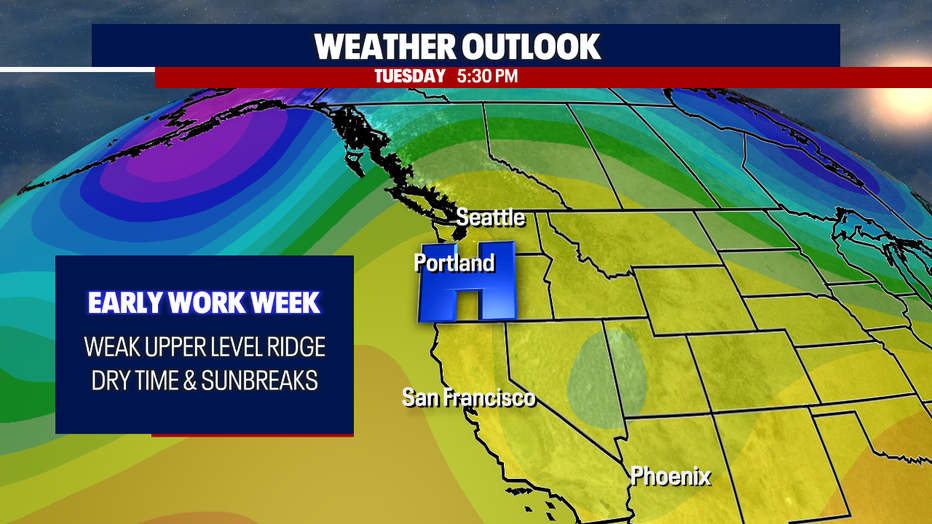
Seattle - A ridge of high pressure will build into the area over the next couple of days, bringing drier conditions and even a little bit of sunshine.
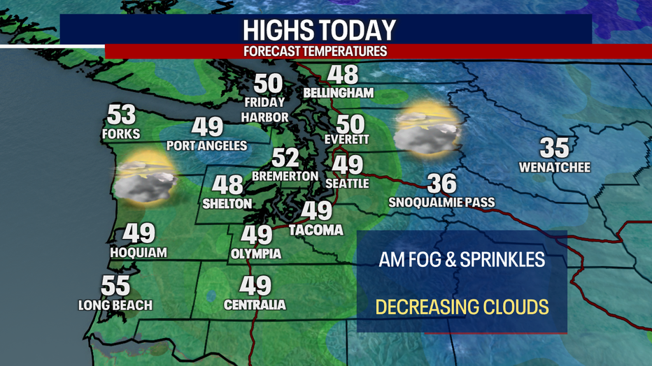
Some spots saw light showers and fog around the Puget Sound area this morning. After a mostly cloudy start, we should see some sunbreaks in the afternoon. Unfortunately, the sun angle is very low this time of year, so there will be some areas that really struggle to break through the cloud cover.
This has been a very wet start to December in Seattle. Over six and a half inches of rain fell in just the first ten days, with more than half the month left to go. That's almost an inch more rain than what an average December brings to Seattle.

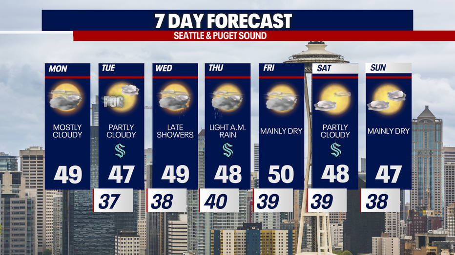
The ridge of high pressure will keep the area dry through most of Wednesday as it slowly shifts east. There should be a few more sunbreaks on Tuesday.
Wednesday night after dinnertime, a front will push through Western Washington, bringing widespread rain in the overnight period. The rain should wrap up by the morning commute Thursday.

Overall, we are looking at a very pleasant week ahead, with no major storms or lowland snow in sight for at least the next seven to ten days.