Seattle weather: Strong lowland wind gusts and blizzard conditions in the mountains

Seattle weather: Blizzard warning in Cascades, rain and wind in lowlands
FOX 13 Chief Meteorologist Brian MacMillan has a look at your forecast.
A strong low pressure system passing to the north will bring rain and strong wind to the lowlands and blizzard conditions to the mountains.
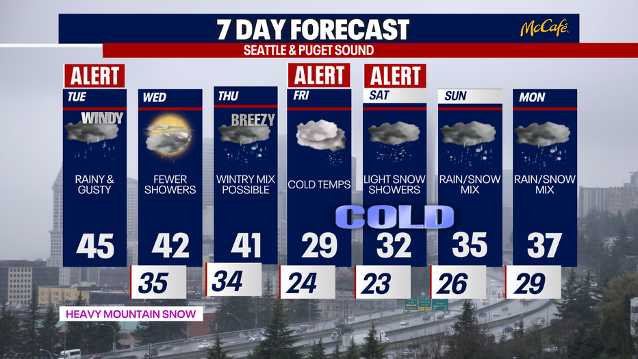
High temperatures will be in the mid 40s today as on-and-off rain showers hit the lowlands and snow continues in the mountains. Strong wind gusts will be present through the afternoon hours.
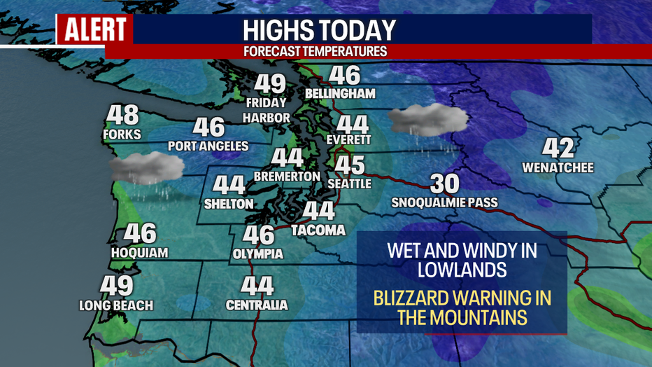
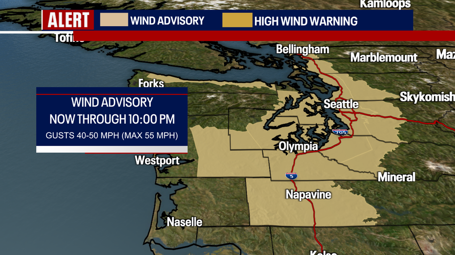
A Wind Advisory is in effect for the Puget Sound lowlands today. The strongest wind gusts for most will be hitting during the daylight hours, especially midday between 11:00 AM – 3:00 PM. Gusts for most of the Puget Sound area could reach 50-55 mph. This is potentially damaging wind which could bring down trees and large branches.
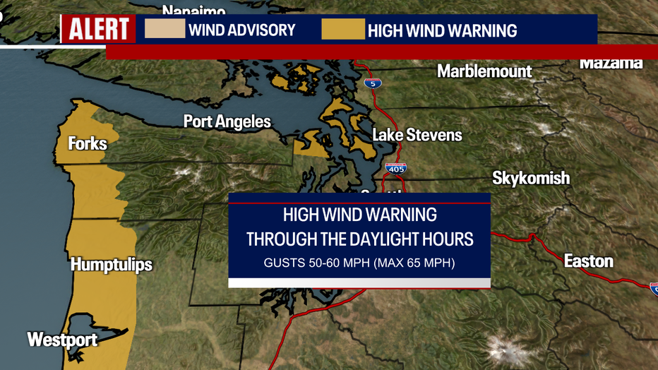
Winds will be strongest in the usual spots like the north sound and the Washington Coast where gusts could top out between 60-65 mph.
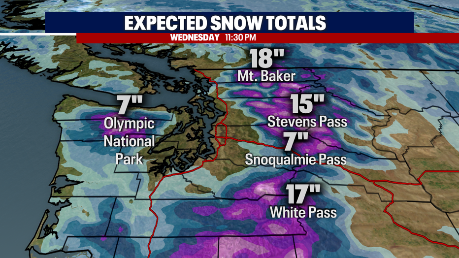
Skiers and snowboarders rejoice! The central and northern Cascade ski resorts have already seen almost two feet of snow with the potential for another foot to foot and a half by the end of the day Wednesday.
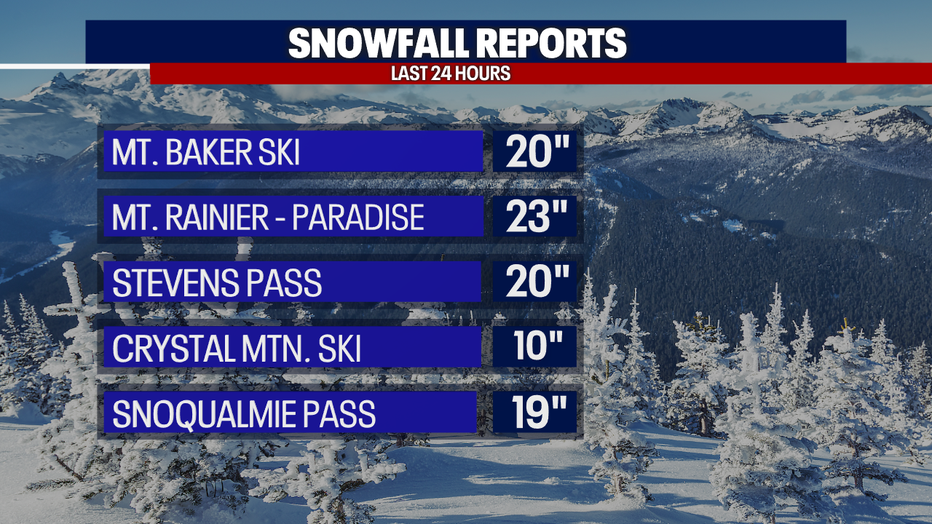
Snow will continue today and tonight and will taper off to light showers Wednesday.
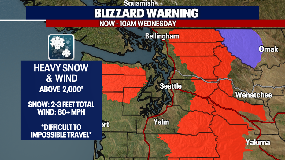
For the first time in 11 years, a Blizzard Warning has been issued in the Cascades and Olympics Tuesday into Wednesday morning. Travel will be difficult to impossible over the passes today. Delay your trip until Wednesday, and you'll have much better luck getting over the mountains.
Temperatures will plummet later this week as a cold air mass plunges south into the area. We are not expecting a lot of lowland snow right now, but the best shot at an inch or more in Seattle will be Thursday through Saturday. Thursday looks to be more "conversational snow"… mainly a rain/snow mix. Friday will be very cold with temps in the 20s all day, but it will stay mainly dry until the afternoon or evening hours. Friday night into Saturday will bring our best chance for lowland snow. An early bet would be around one to four inches of snow for the greater Seattle area Saturday, but stay tuned as we get closer and the forecast comes into better focus.
