

Monday's forecast: Heavy mountain snow, widespread rain, strong winds
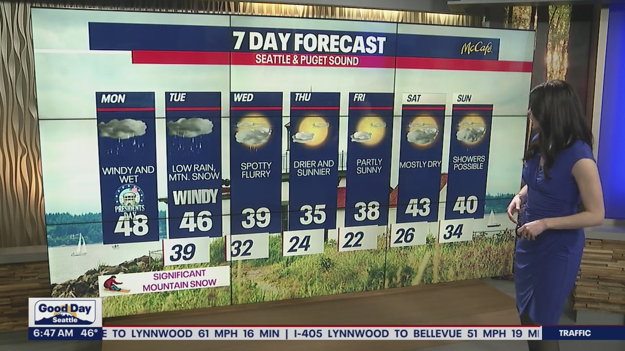
Week to start wet and windy, significant mountain snow
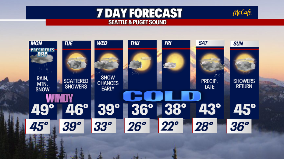
The workweek starts wet and windy with significant mountain snow. By Wednesday, temperatures take a nosedive; only reaching the mid to upper 30s through Friday.
Seattle - Talk about a mild night! Temperatures will fall into the mid-40s tonight (above normal) under cloudy skies. Scattered showers will persist along with breezy winds at times.
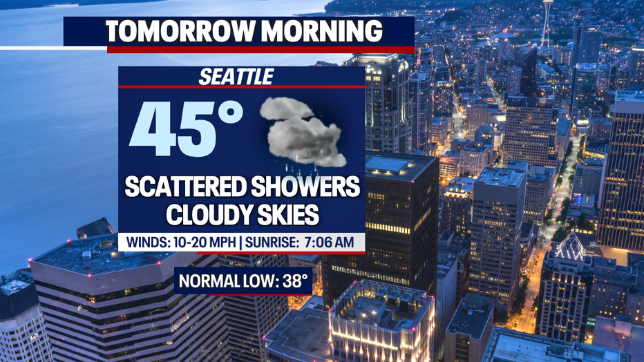
The winds will really crack up tomorrow evening as the snow becomes heavier for those in the mountains. Showers are to be expected all day with "mild" temperatures once again.
Here is a look at your FutureCast breaking down the precipitation on Monday:
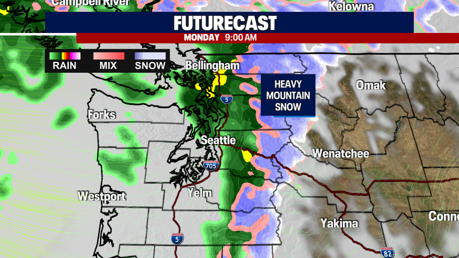
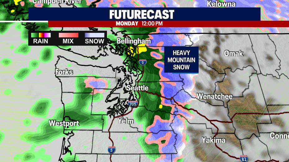
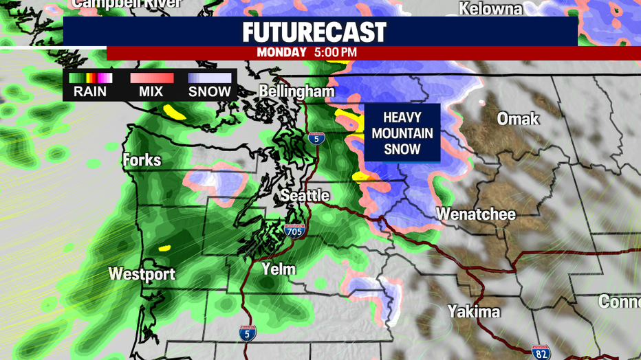
If you were planning on traveling thorough the passes, have a backup plan. Pass travel is expected to be difficult as the snow accumulates rapidly!
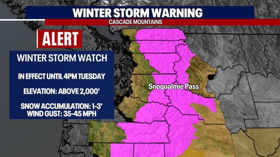
A Winter Storm Warning is in effect through Tuesday for those highlighted in the pink below. That included all those with an elevation of 2,000' and above.
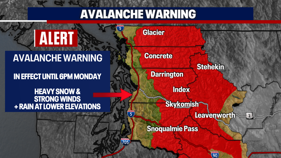
An Avalanche Warning is in effect through Monday evening for those highlighted in red below. Very dangerous avalanche conditions are expected so avoid warning areas.
Here is a look at your mountain alerts:
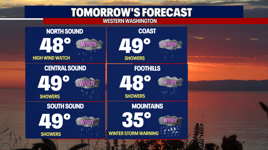
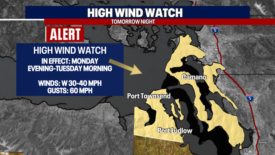
I mentioned that the winds will kick up for us. This is especially vital or those in the Admiralty Inlet area. A High Wind Watch will go into effect for those in the area with gusts up to 60 mph (potentially)!
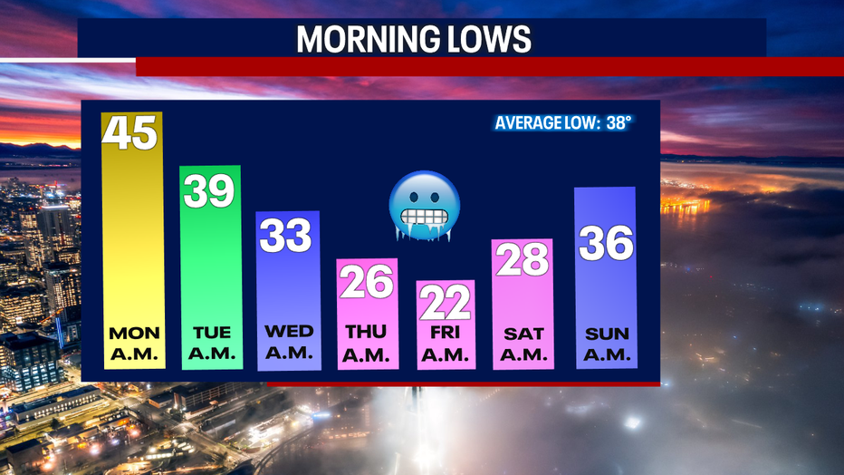
Once this system passes, we're in for a bid temperature swing! Cold air will rush into Western Washington by the middle on the week. This will give you a taste of what is headed our way (overnight lows):
The Cascades will remain under Weather Alerts through Tuesday evening. Showers will transition into lowland snow late Tuesday and early Wednesday morning. As of right now we aren't expecting any significant accumulation. The cold sets in right after that - with highs in the 30s and overnight lows in the 20s.
Have a good one!