

Warmer overnight lows expected
Seattle - Highs peaked in the lower 50s (52 degrees at Sea-Tac) this afternoon under sunny skies. It was a beautiful - other than the haze.
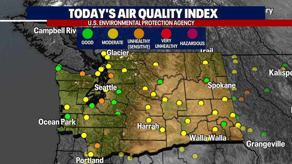
The air quality continues to deteriorate as this hour. Some locations have dipped into the unhealthy (for sensitive group) category in orange! This will begin to improve over the next 36 hours as we get ready for a new system to arrive.
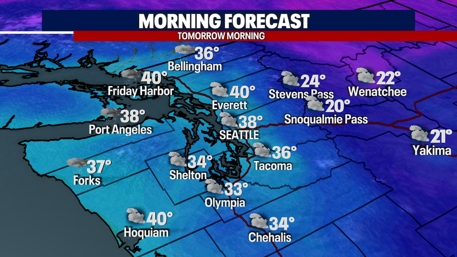
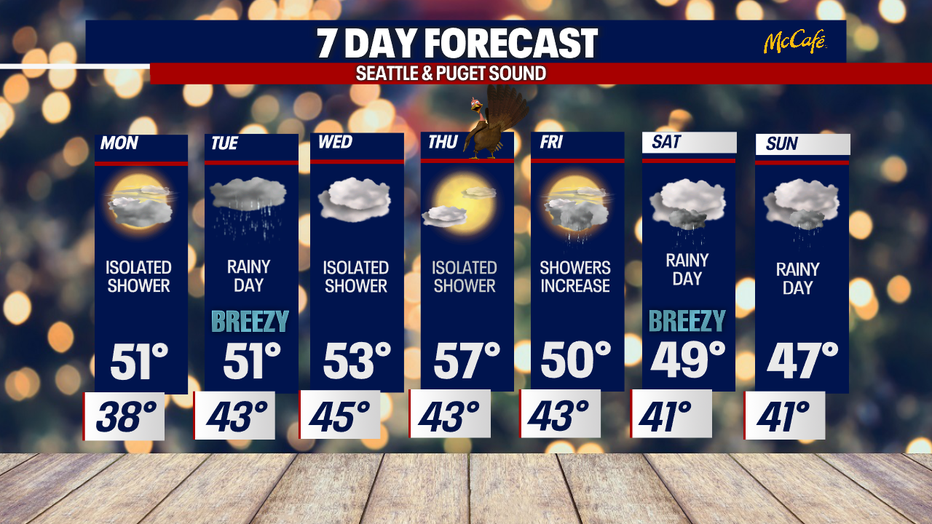
In the meantime, temperatures will be more mild tomorrow morning! However, as isolated showers continue overnight, watch out for icy pockets across parts of the South Sound. This is where temperatures will continue to hover around freezing tomorrow morning!
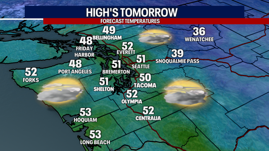
Afternoon highs will return to the lower-50s under mainly cloudy skies. Expect sunbreaks and mainly dry conditions throughout the day!
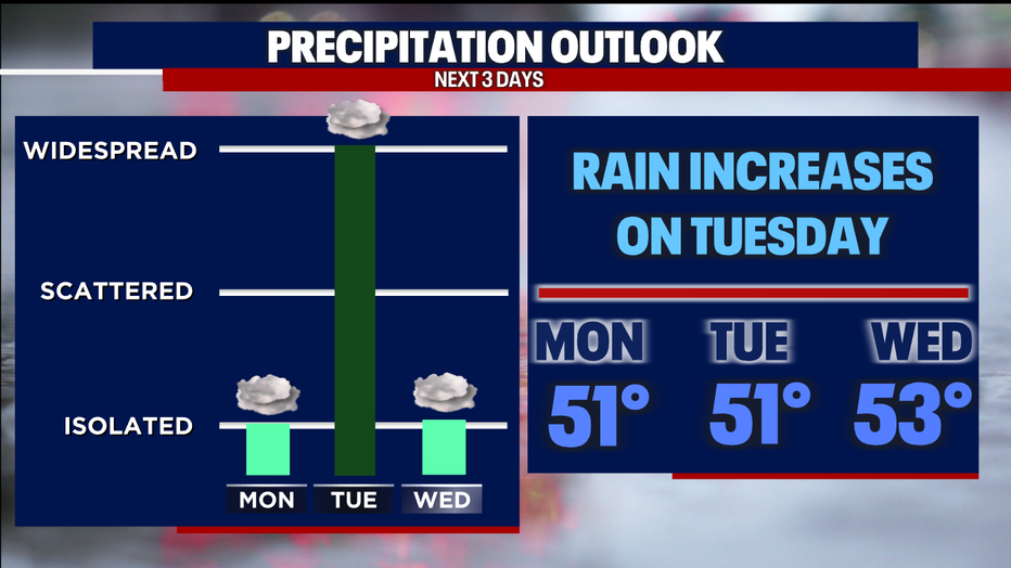
Ran chances increase significantly on Tuesday. Expect widespread light rain to increase throughout the morning. Rain accumulation will range between .25-.50" for most locations. Higher rain totals are expected across the Olympic Peninsula.
I'll leave you with a look at your 7-day forecast:
Have a good one!