

A beautiful holiday weekend on tap with slightly warmer highs

Beautiful holiday weekend ahead with cooler temps
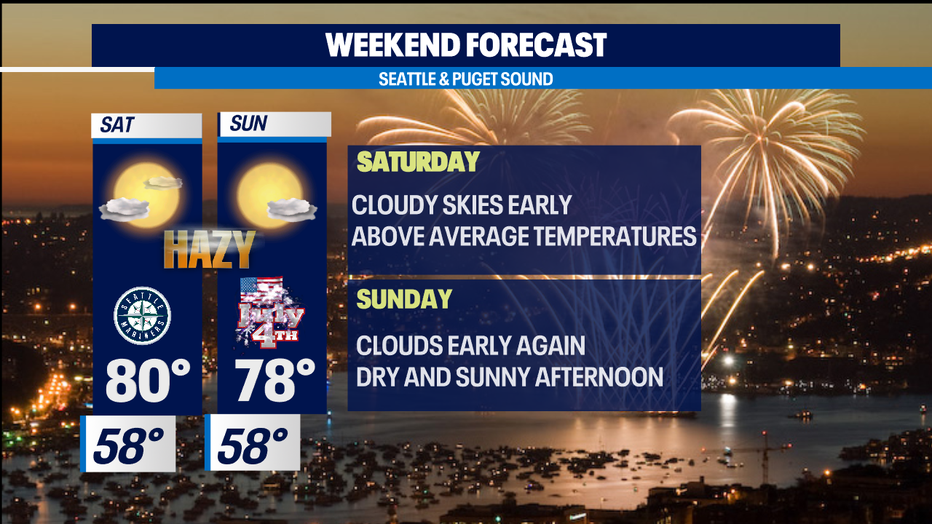
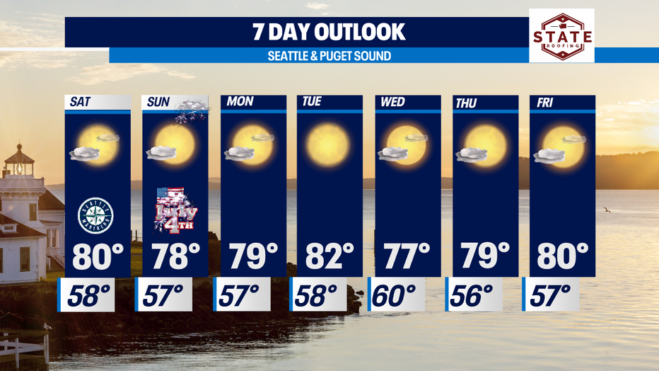
For the 4th of July weekend, expect high-70s to low-80s.
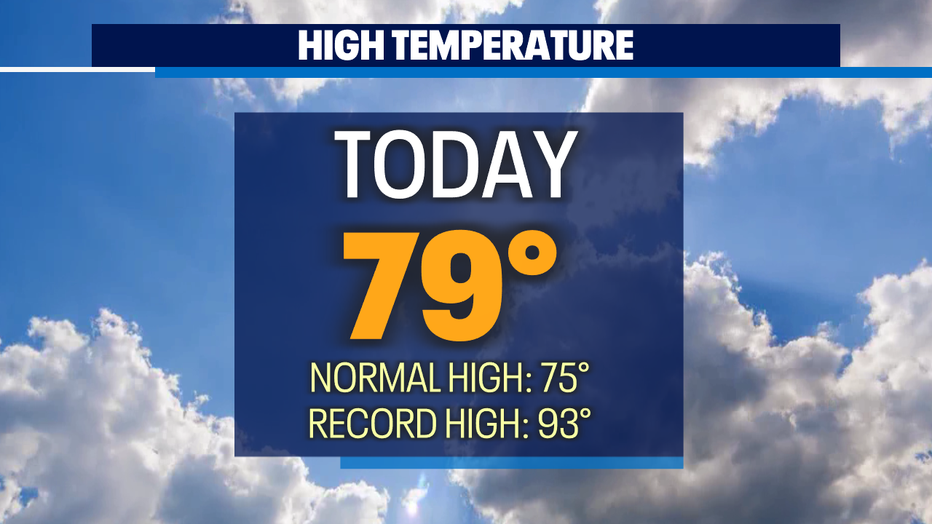
SEATTLE - We close out another day with above-average highs. The high at SeaTac Friday up four degrees warmer than our norm of 75 for this time of year. And thanks to the sea breeze our coastal communities were very comfortable in the 60s.
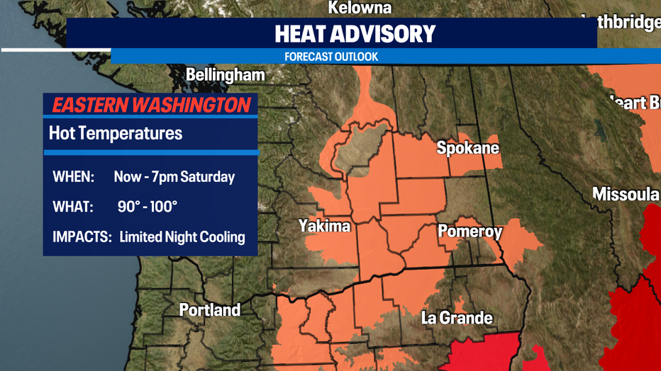
Farther east through the pass's temperatures in the 60s, but once you travel into Central WA highs soared into the 90s to 100+.
With the holiday weekend kicking off it is extremely important to know your surroundings and the threat of extreme fire danger around the Northwest. Our grounds are tinder dry and with no rain in sight this recipe can make for a dangerous situation for many. One little spark can ignite, fueling rapid flame spread across the area. Although there will not be a fireworks show high above Lake Union this year there are other areas displaying celebrations for Independence Day. Be safe when participating in activities over the weekend.
The forecast looks nice with temps slightly above average in the upper 70s to low 80s. Skies will start out cloudy but don't worry clearing will take over and give way to sunshine.
Eastern WA will remain under a "Heat Advisory" at least through Saturday. Temperatures will soar into the 90s to just over 100 with beautiful blue skies.
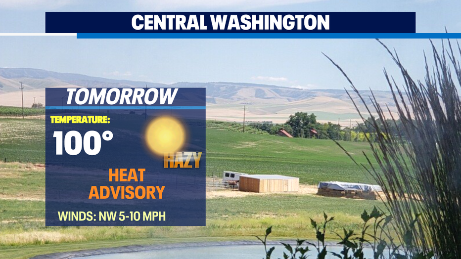
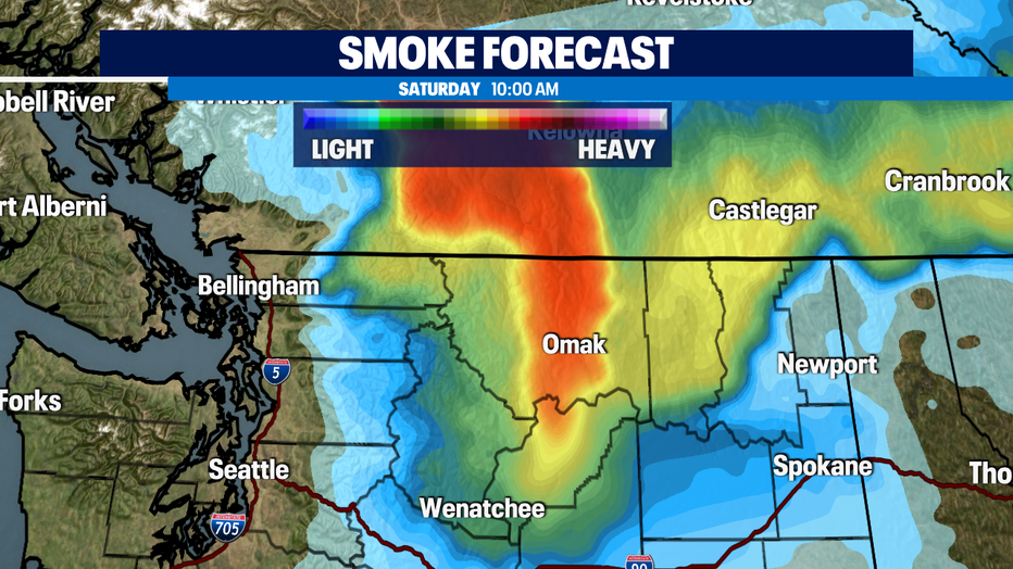
We're also keeping a close watch on the fires burning to the north of us in British Columbia. With a change in wind direction earlier today upper-level smoke will drift southward into Washington through the weekend. The good news is our strong marine push will keep the higher concentrated smoke to our east, but Whatcom and Skagit counties, the Foothills, and the Cascades will see hazy conditions.
Next week highs will top out between the upper 70s to low 80s with plenty of afternoon sunshine after morning clouds clear. We may see a few sprinkles for some areas mid-week, but for the most part we'll remain dry.
Have a safe and happy holiday all!
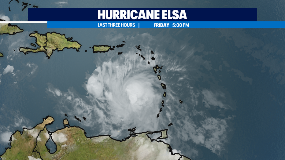
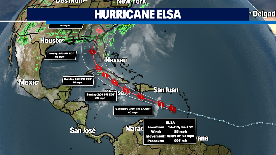
* The other big weather story: Hurricane Elsa. It is the first hurricane of the Atlantic season and spaghetti plots are in good agreement that it will head to Florida by early Tuesday and weaken into a Tropical Storm.
Q13 FOX WEATHER RESOURCES:
DOWNLOAD: Q13 Weather and News Apps
WATCH: Forecast and Radar
READ: Closures and Delays
CHECK: Latest Weather Alerts and Live Traffic Map
INTERACT: Submit your Weather Photo
DAILY BRIEF: Sign Up For Our Newsletter
FOLLOW: Lisa Villegas, MJ McDermott, Erin Mayovsky, Grace Lim and Scott Sistek