Seattle weather: A cool Wednesday, but warmer into the end of the week

Lots of sunshine in our forecast this week!
FOX 13 Forecaster Erin Mayovsky is tracking a week of sunshine and pleasant temps!
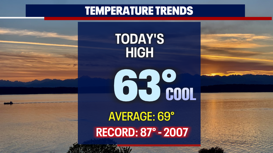
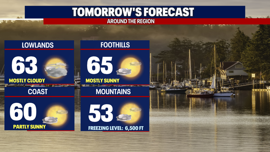
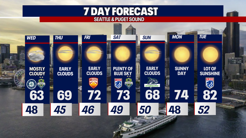
SEATTLE - Another cool day across Puget Sound. Highs only warming into the low 60s. The normal seasonal high for this time of year is now 69.
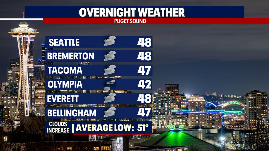
Overnight look for clouds to increase with temperatures falling into the 40s. Areas to the southwest, like Olympia and Shelton, will cool the most landing in the low 40s.
The average low for this time of year is now 51. So, low 40s will feel chilly for sure!
Onshore flow will remain with us through Thursday this week keeping us a little cooler with filtered sunshine.
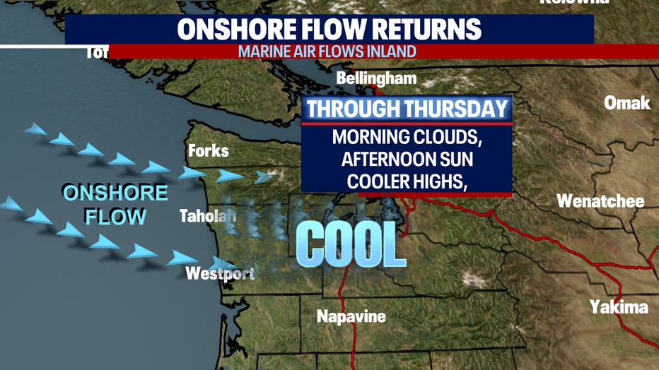
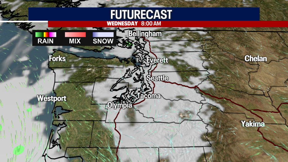
Highs Wednesday will struggle again to reach 65 across Western WA as we sit under mostly cloudy skies.
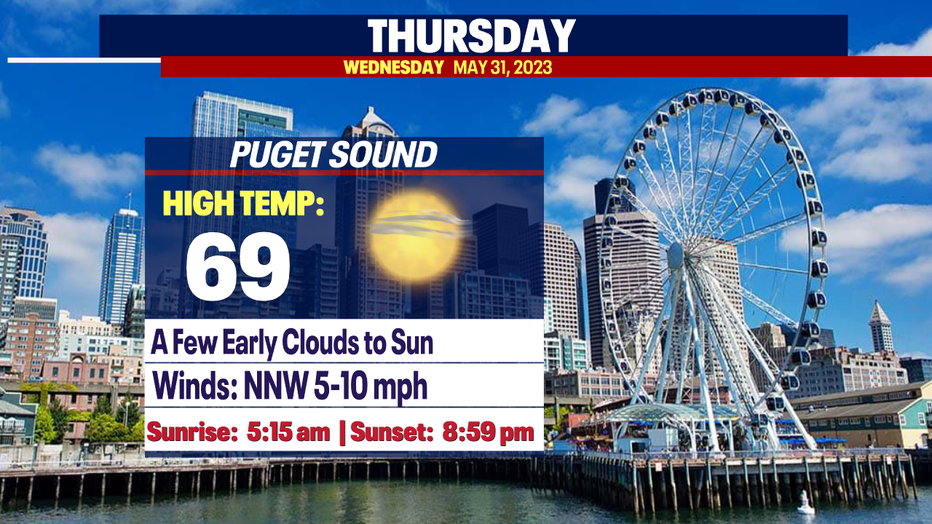
By Thursday, we'll start to see less cloud cover and slightly warmer highs as an upper-level ridge well to the east of us starts to move towards the Pacific Northwest.
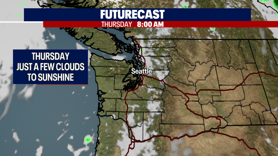
Highs Thursday warm to near 70 with plenty of blue sky.
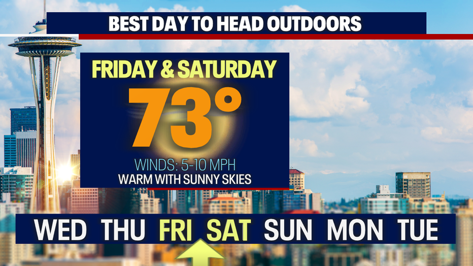
The best days to soak up some Spring sunshine happens as we head into the weekend. Both Friday and Saturday look really nice with highs warming above average into the low 70s.
After cooling off some on Sunday we'll heat up again Monday and Tuesday of next week. Highs warm into the mid 70s to low 80s. Enjoy!
Have a great night all! ~Erin Mayovsky, FOX 13 Forecaster
*Coast Forecast

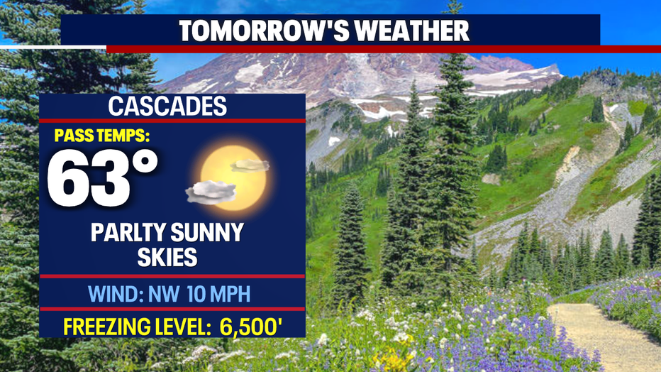
*Mountain Forecast
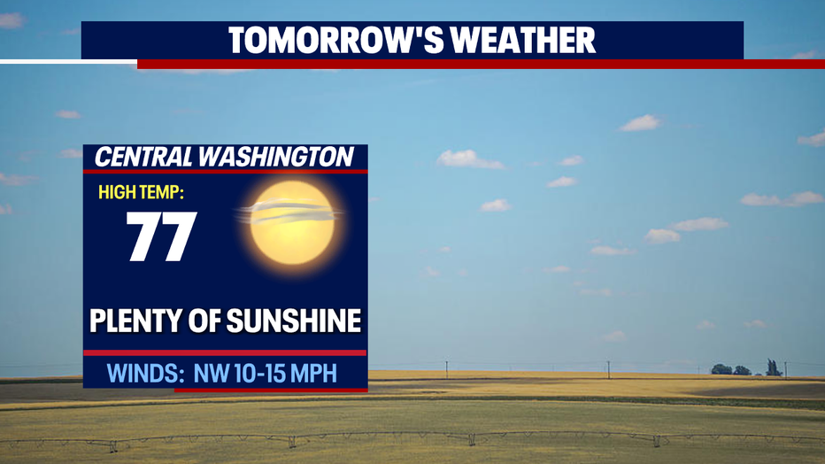
*Central WA Forecast
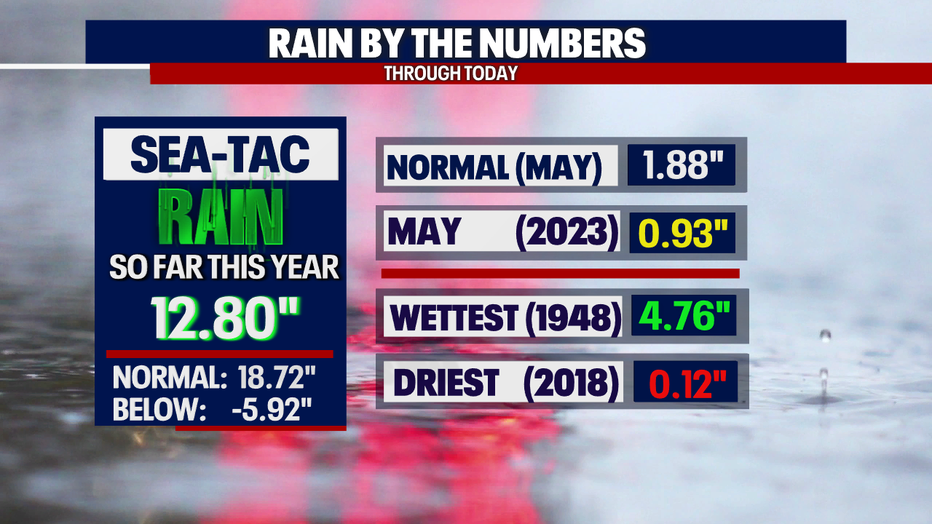
*SeaTac Rain Almanac