

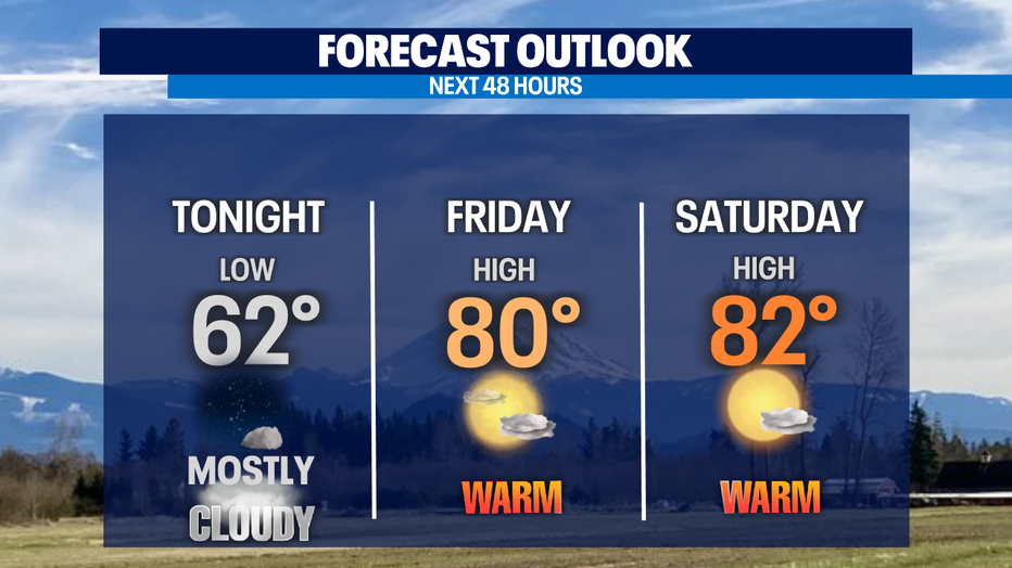
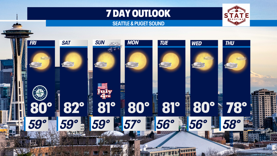
Above average highs continue, cooling off into the 70s and 80s for the holiday weekend

Above average highs continue, cooling off into the 70s and 80s for the holiday weekend
Morning clouds with afternoon clearing for the next several days. Highs will hang above average, but only by about 5-8 degrees and those temps are certainly much more comfortable than the 90s and 100s earlier this week.
SEATTLE - We're finally settling back into a more traditional weather pattern for this time of the year around the region.
Morning clouds with afternoon clearing for the next several days. Highs will hang above average, but only by about 5-8 degrees and those temps are certainly much more comfortable than the 90s and 100s earlier this week.
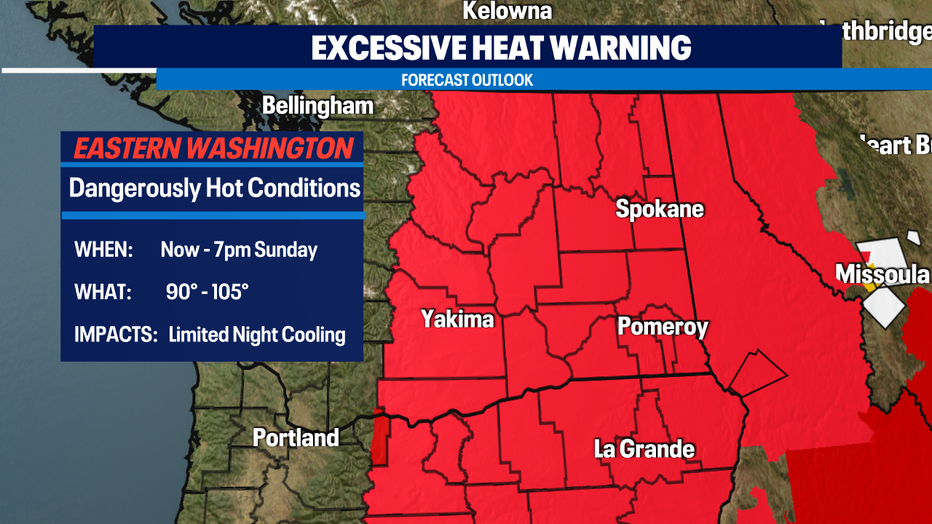
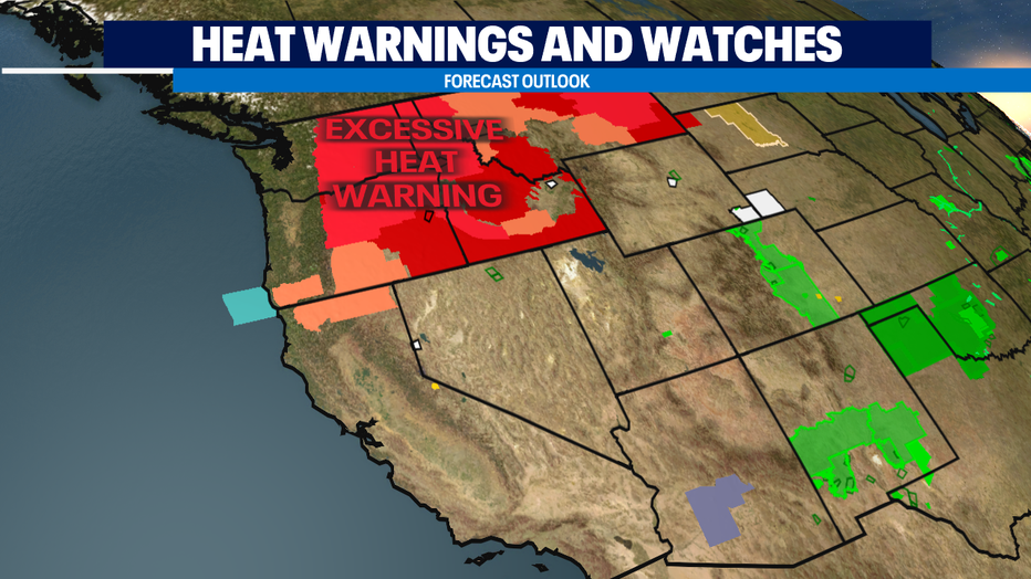
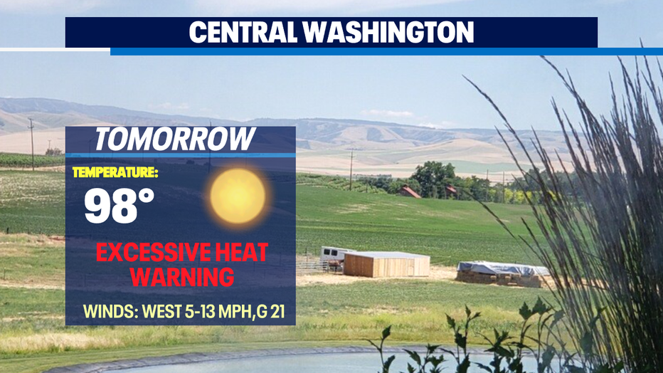
While Western WA is experiencing highs in the 70s and 80s Eastern WA is still under an "Excessive Heat Warning" through the 4th of July. Grounds across the state are very dry and this increases our risk of fires spreading rapidly. Please know your surroundings during this holiday weekend, know the restrictions and regulations in your community.
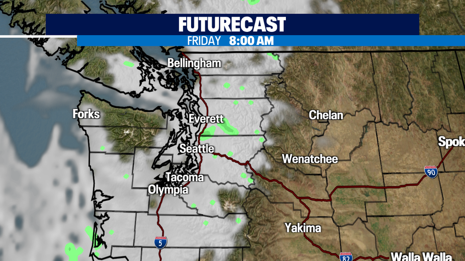
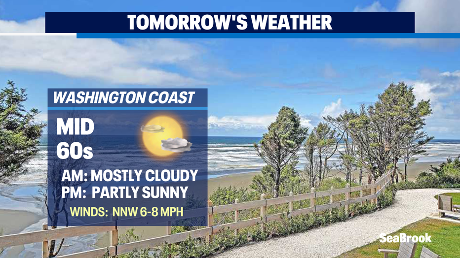
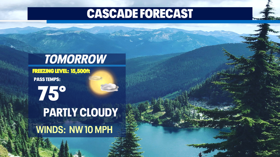
With a decent push of marine air most mornings will start with cloudy skies, a little fog for some with afternoon clearing. A few areas, like Snohomish County may see a little drizzle, but most of the precipitation will remain over the mountains.
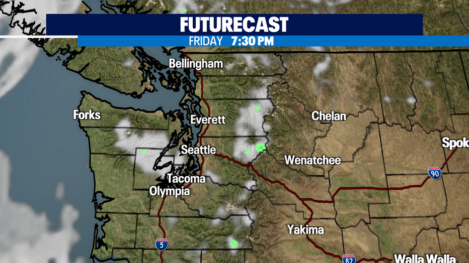
With summer in full swing, we're monitoring the smoke outlook. Some smoke from a fire in Northern CA is drifting into portions of the Eastside, so you may notice hazy conditions. By Friday afternoon one Hi-res model is also indicating smoke drifting south into Seattle from the Lytton fire in B.C. currently burning now. The smoke looks to stay aloft and not at the surface which is good news, so you may just notice haze. This is a good and early reminder to get those filters before it's too late.
The extended forecast looks pretty stable as temperatures will hang in the upper 70s to low 80s. Remember to practice fire safety, stay hydrated and keep the sunblock handy!
Be safe all!
*Beach Forecast
*Mountain Forecast
*Central WA Forecast
Stay connected with Q13 News on all platforms:
DOWNLOAD: Q13 News and Weather Apps
WATCH: Q13 News Live
SUBSCRIBE: Q13 FOX on YouTube
DAILY BRIEF: Sign Up For Our Newsletter
FOLLOW: Facebook | Twitter | Instagram