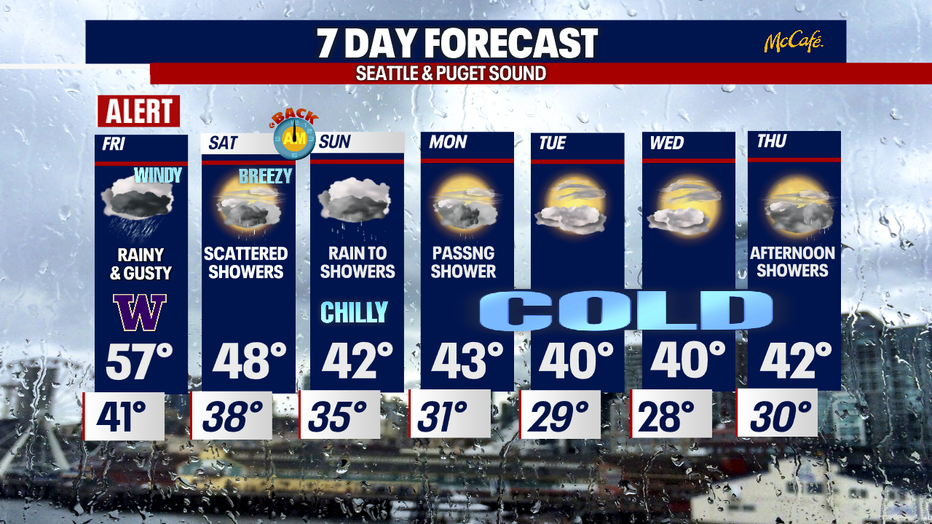
Seattle weather: Blustery conditions through Friday as rain, wind pound Western WA

Heavy rains and strong winds are coming our way
We've issued a Weather Alert Day for severe storms heading our direction. FOX 13 Chief Meteorologist Lisa Villegas and Forecaster Erin Mayovsky have the details.
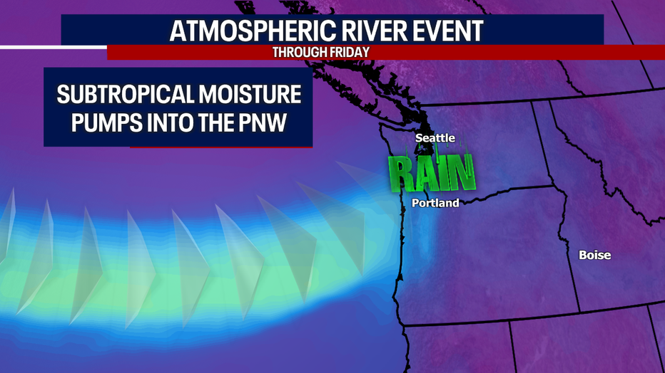
SEATTLE - It was a super soaker of a day Thursday, and that's just the start of what this atmospheric river will throw at us! Rain and wind will pick up Friday as this subtropical system slams the region. Rain totals range from nearly 0.50" to just under 4.00" for the lowlands with even more across the mountains.
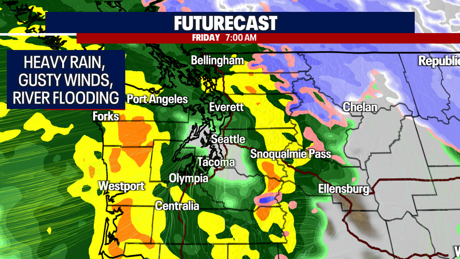
Here's a look at your soggy mooring commute around 7am. Notice Seattle to Tacoma in the "Rain Shadow", staying dry while everyone else is experiencing extremely wet weather. This all thanks to the Olympic mountain range blocking moisture from spreading into parts of Puget Sound.
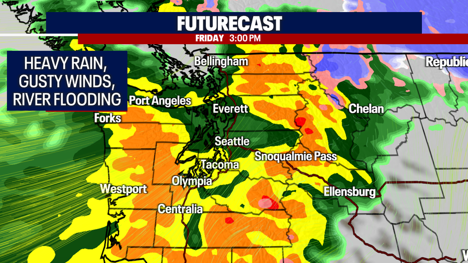
By 3pm rain is so fierce that it finally finds its way downtown, but notice precipitation is much stronger everywhere else.
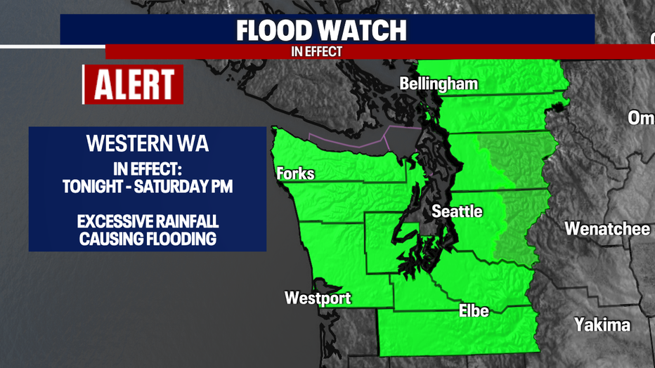
With such an intense amount of raining falling so quickly we're watch most counties for flooding. Area rivers, creeks, and streams will rise rapidly and flow at a steady, fast pace. Be aware of your surroundings, especially when driving as ponding could become an issue around local roadways.
The "Flood Watch" remains in effect through Saturday night before expiring.
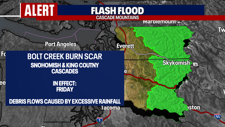
Also, a flash flood alert is up Friday for Cascade counties of Snohomish and King as burn scars from the Bolt Creek fire could become very dangerous as excessive rain may cause debris flows.
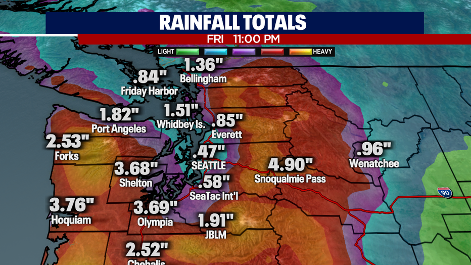
Here's a peek at rain totals through late Friday night. Notice the variance around the region. Check out Shelton and Olympia! This is where the AR is most intense, while other areas like Seattle only tally .47" during the same time.
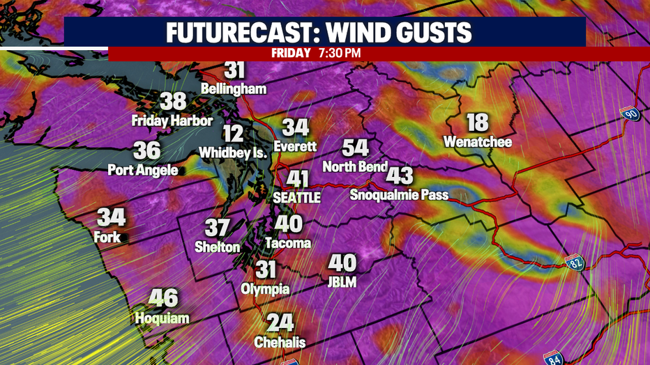
The winds are also a huge factor with this storm. A "Wind Advisory" and "Wind Watch" are up for the Coast, Admiralty Inlet, and the North Sound through early Friday and most likely have a good shot at extending the alert through much of Friday inland.
We expect gusts at the Coast and Admiralty Inlet up to 60 mph with sustained winds of 25-40 mph. These forceful winds will probably cause trees to come down and power outages for many. Stay tuned!

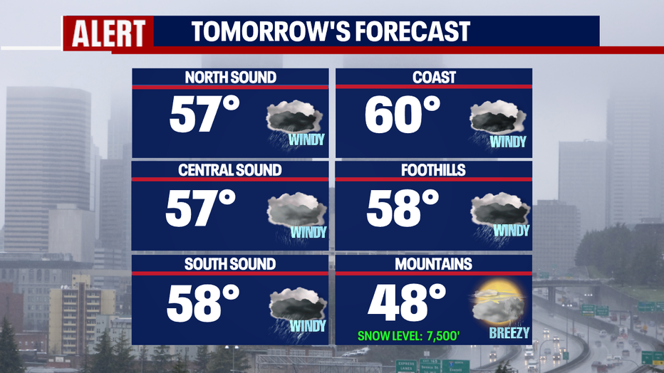
Highs on Friday are warm, landing in the upper 50s to near 60! And after half a foot to near a foot of snow in the Cascades Thursday, that snow turns to rain Friday as snow levels climb up to 7,500'. Much of the snow that fell will get washed away sending a steady flow of water into the lowlands.
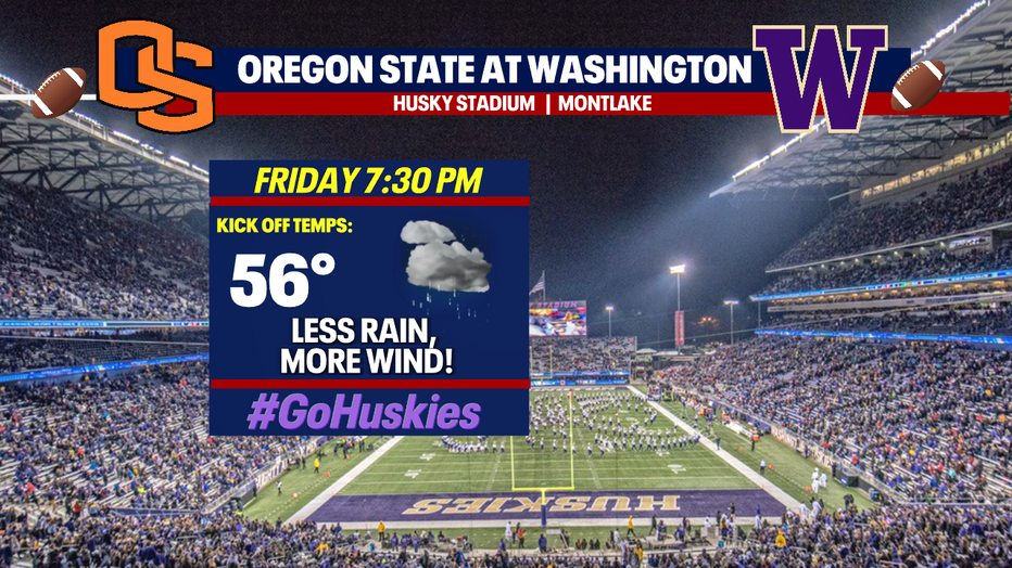
And if you are heading to the UW vs Oregon State match up on Montlake, you may just luck out and see a fairly dry game, but the winds will whip through Husky Stadium! #GoDawgs
Showers will finally let up Friday night and winds will start to relax.
We're forecasting scattered shower Saturday with the potential for a convergence zone to set up by the afternoon. Highs only warm into the upper 40s.
Rain will pick up overnight Saturday into Sunday while you sleep! And don't forget to "Fall Back"! Our new sunset time on Sunday is 4:44pm! Enjoy!
Showers will diminish on Sunday and highs will struggle to reach the low 40s. Brr! The cold air-mass will hang with us much of the week sending overnight lows into the upper 20s to low 30s with highs in the upper 30s to near 40. Yikes!
Snow levels will dramatically drop during this time between 500-1,000ft, but we won't have much moisture to mix in so at this time we're not forecasting a lowland snow event.
Have a great week! ~Erin Mayovsky, FOX 13 Forecaster