

Drier weather Monday afternoon through Tuesday

Seattle weather: Morning showers, drier conditions Tuesday
Seattle weather: Morning showers, drier conditions Tuesday
After waking up to spotty showers, drier weather is expected to take hold tonight through Tuesday. Our next chance for a little rain returns Wednesday (likely in the evening).
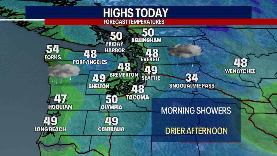
Highs this afternoon will wobble on either side of 50 degrees. You can plan on cloudy skies. Any lingering showers will gradually taper. Earlier this morning, light snow fell over some of the Cascade mountain passes.
The mountain snowpack this year has been exceptionally lackluster. Most of the Cascade basins are dealing with snowpack that's only in the 60th percentile of normal. I do have some good news to share for skiers and snowboarders: while we've been under the influence of an En Niño pattern this winter (giving us a milder season), a La Niña pattern is likely to follow next winter. This means we could have a much better season next year of mountain snowpack - and even higher chances for lowland snow than what we've had this year.
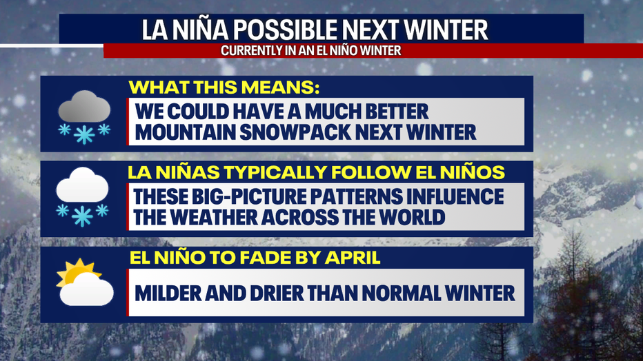

Ski resorts struggle, but La Niña is on the horizon
Ski resorts across the country are really struggling this year, because an El Niño weather system is bringing warmer temperatures and soggy precipitation to the resorts. However, a La Niña is possible next year -- which means there's a chance ski resorts could have a much needed rebound.
Tuesday looks like a gorgeous day. You can expect chilly, cloudy and foggy weather in the morning. The sun will make a strong showing in the afternoon.
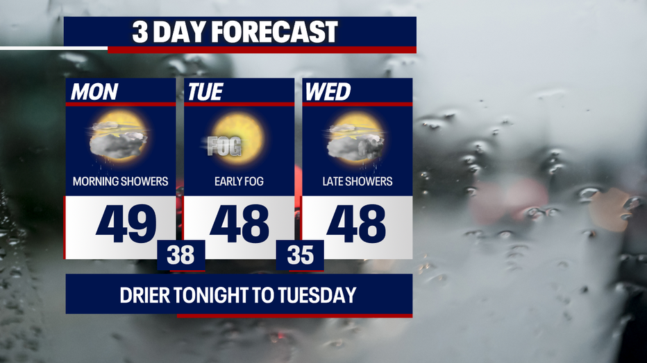
As of right now, much of Wednesday (Valentine's Day!) looks dry. Precipitation could return by the evening. There's a small chance for a light, isolated rain/snow mix late Wednesday into early Thursday in the lowlands. There's still some uncertainty about how things could play out, so stick with us for updates.
Friday through the weekend, highs soar slightly above average, reaching for the low 50s. There's a tiny chance for stray, light showers this weekend, but we're not predicting any big storms right now.
Beginning Tuesday and lasting through the remainder of the seven day forecast, there should be plenty of times of sun. Enjoy!

We love forecasting for you. Thanks for choosing FOX 13!
Warmly,
Meteorologist Abby Acone