Seattle weather: Staying warm and dry this week with extreme heat this weekend

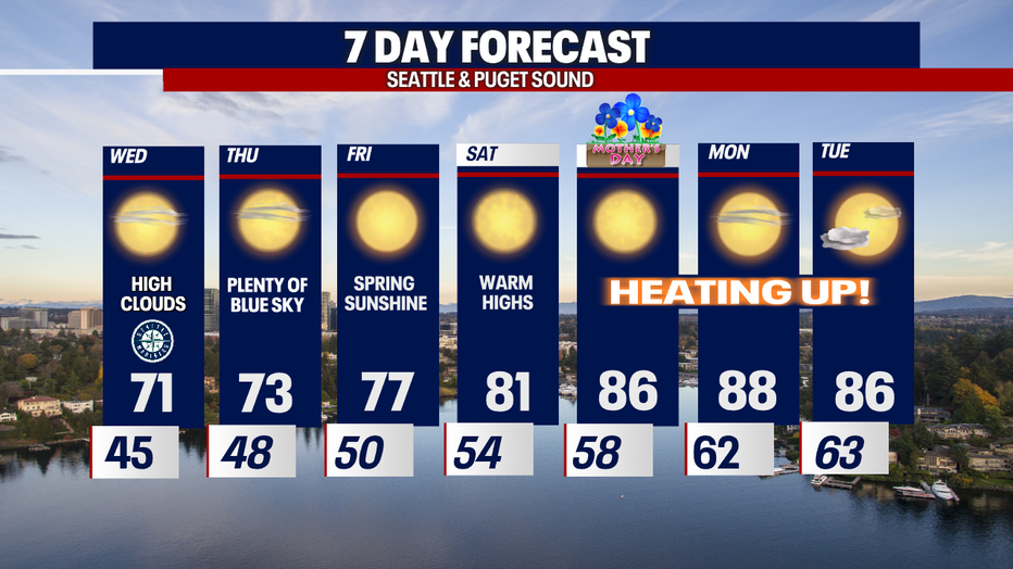
Record temps for Mother's Day
Temps will climb steadily this week, hitting upper 70s to end the week out before it gets into the mid 80s this weekend
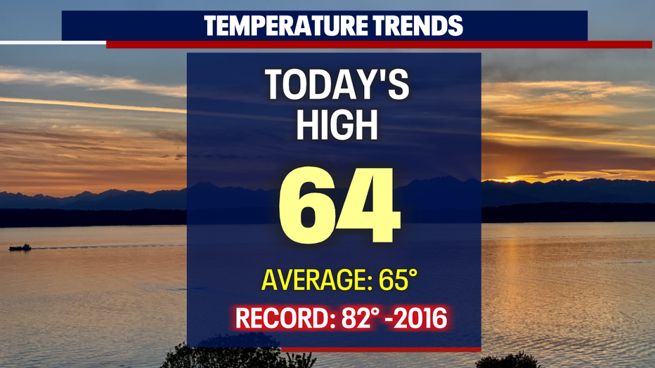
SEATTLE - Gorgeous conditions took over the Pacific Northwest today, and it only gets warmer going forward! Tuesday's highs landed close to average: SeaTac hit 64 at the airport.
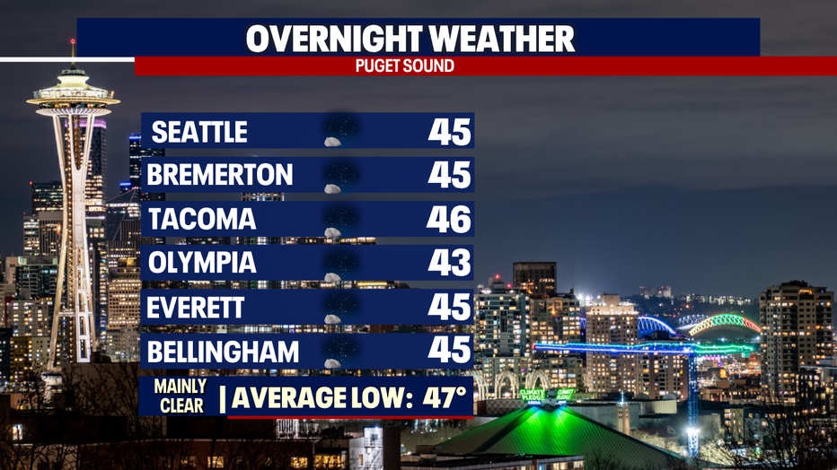
Overnight temperatures cool into the mid to upper 40s for most of us under mainly clear skies.
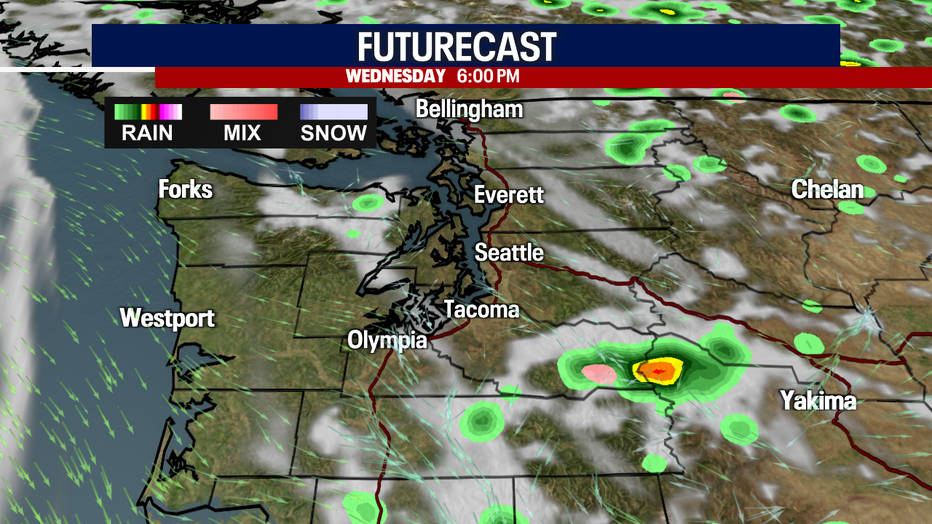
We're forecasting another stellar day for Western WA, but there is a chance of a thunderstorm firing up east of the Cascades as the atmosphere will remain a bit unstable Wednesday. And there's another chance for thunderstorms Thursday popping up over the mountains.
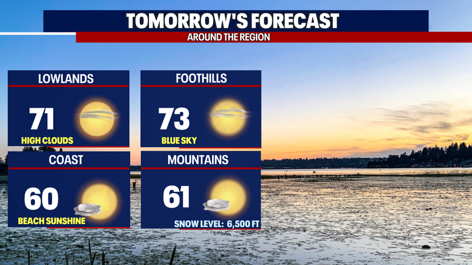
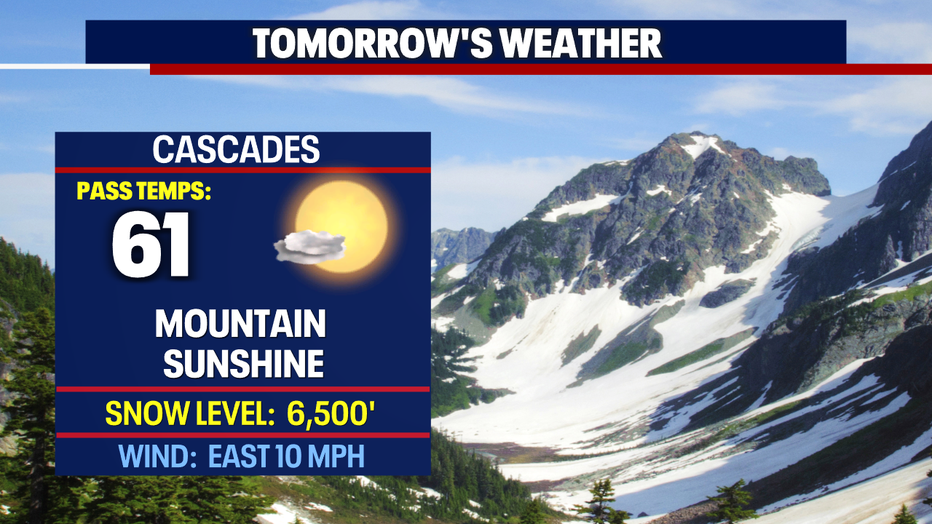
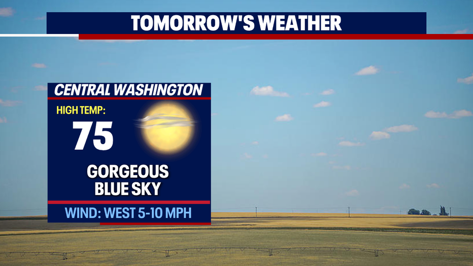
Skies are mostly sunny tomorrow with highs warming into the low 70s for Puget Sound with low 60s across the mountains.
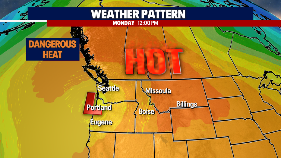
A strong ridge, a thermal trough and easterly winds help dry out the air and really heat us up pushing the mercury into the high 80s and potentially the low 90s. Our neighbors to the north in Canada will see dangerous heat across their region.
Enjoy the warm-up, but don't forget to stay hydrated, use sunscreen and limit time in direct sunshine to avoid burning your sun-deprived Northwest skin.
Have a great week all! ~Erin Mayovsky, FOX 13 Forecaster
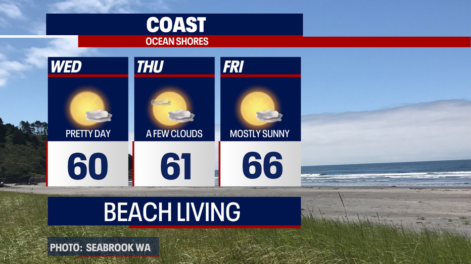
*Coast Forecast
*Mountain Forecast
*Central WA Forecast
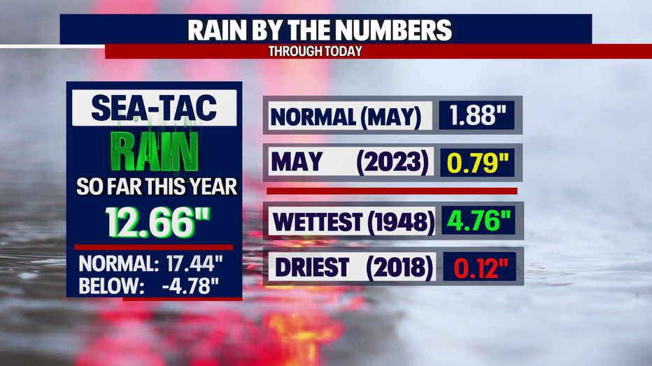
*Rain Almanac SeaTac