Seattle weather: Mostly dry day with late showers, highs in the low 60s

Seattle weather: Mostly dry day with late showers, highs in the low 60s
The forecast continues to swing back and forth between high and low pressure. We'll see a brief dry break overnight into Friday before the next system moves onshore.
SEATTLE - The forecast continues to swing back and forth between high and low pressure. We'll see a brief dry break overnight into Friday before the next system moves onshore.
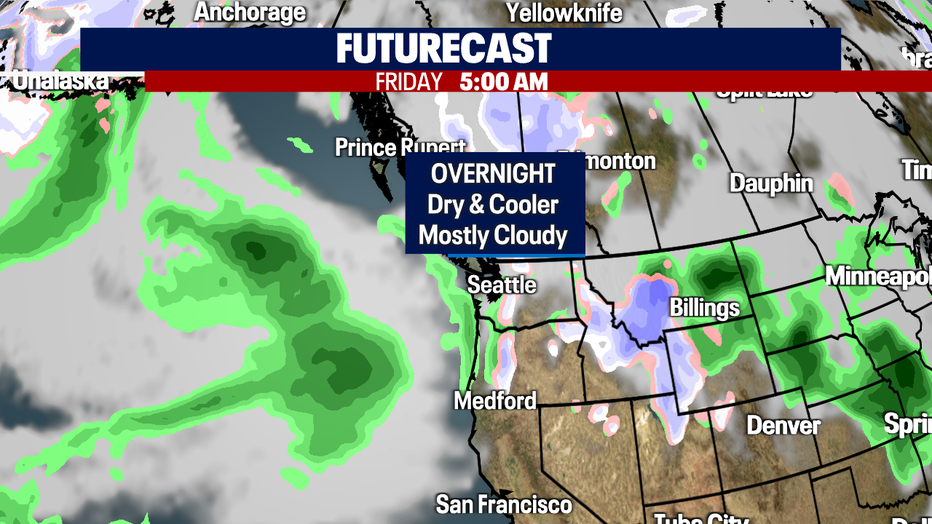
Lows will warm some, but will remain below-average around the region. Normal overnight temps should land near 45/46 for this time of year. Seattle wakes up tomorrow in the low 40s.

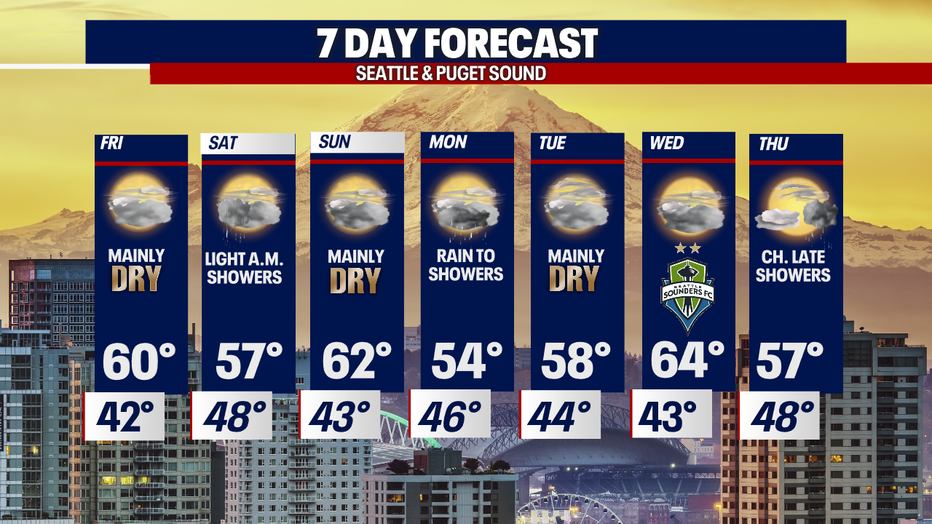
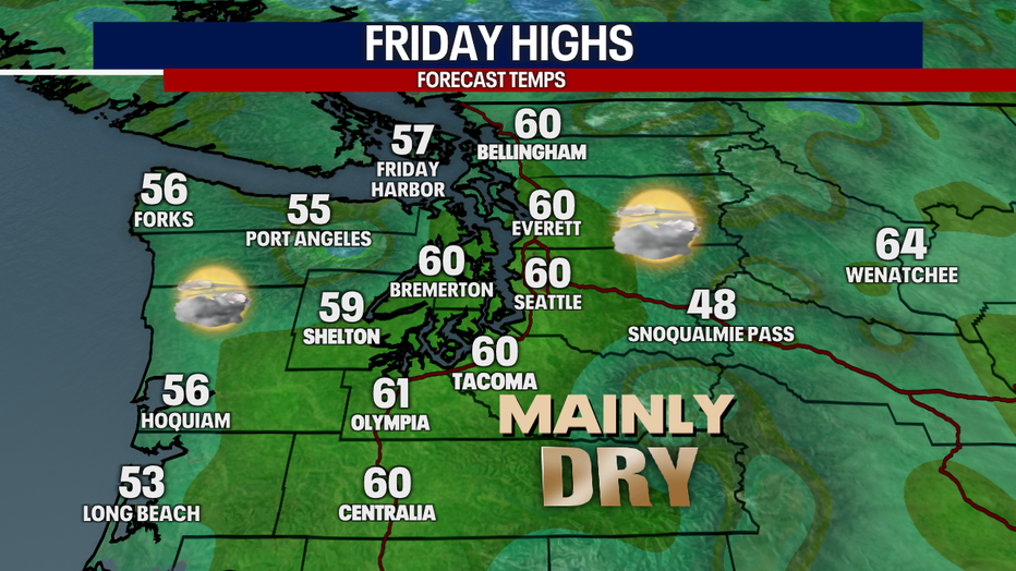
Friday starts out dry with partly to mostly cloudy skies. Look for increasing clouds throughout the day with rain returning into the overnight hours.
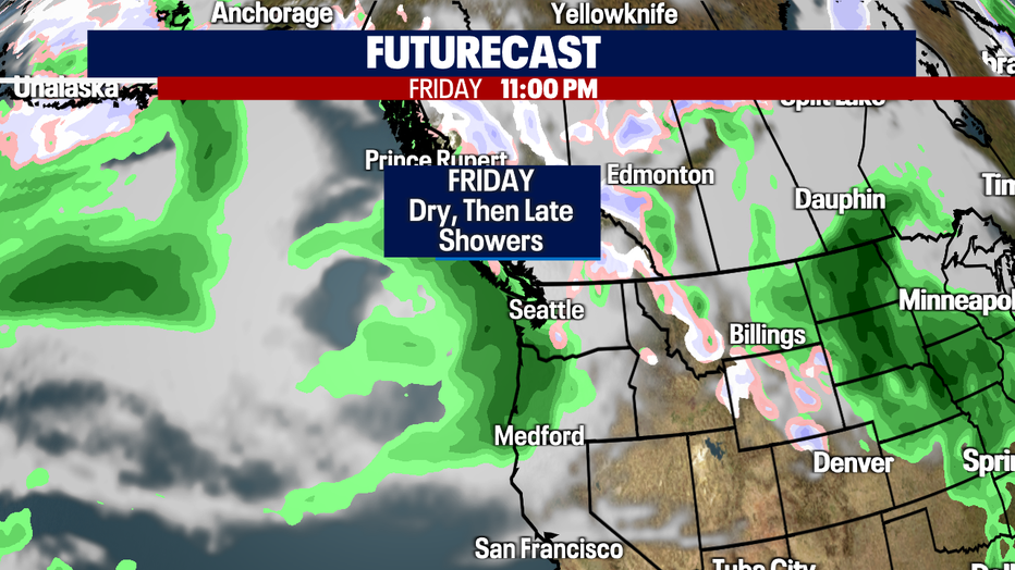
Expect slightly warmer highs Friday as high pressure controls our forecast. This ridge is short-lived and weakens late in the night allowing rain to return.
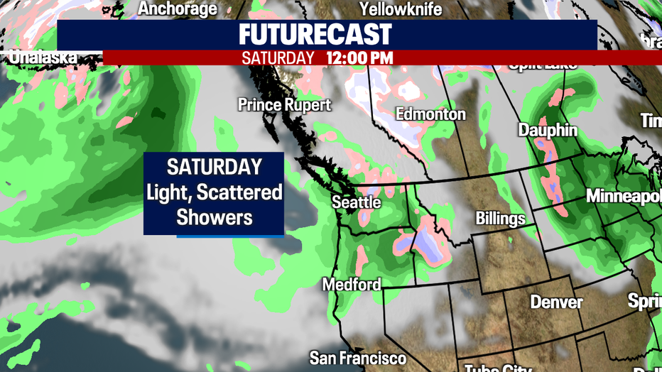
Most of us Saturday will see light, scattered showers passing through. Highs will drop back down into the mid 50s.
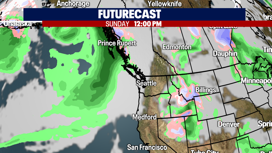
As showers fall apart Saturday, Sunday is the better day of the weekend to get out and enjoy as we swing back the other way with drier and warmer conditions. Highs inch back up to near average.
Additional systems will move into Western WA starting Monday, although we will see dry days in between. Highs will drop Monday into the mid 50s but climb again the rest of the week. Enjoy the up and down ride! Happy Spring!
Have a great night all! ~Erin Mayovsky, FOX 13 Forecaster