

Seattle weather: Early fog and sprinkles, afternoon sunshine Friday

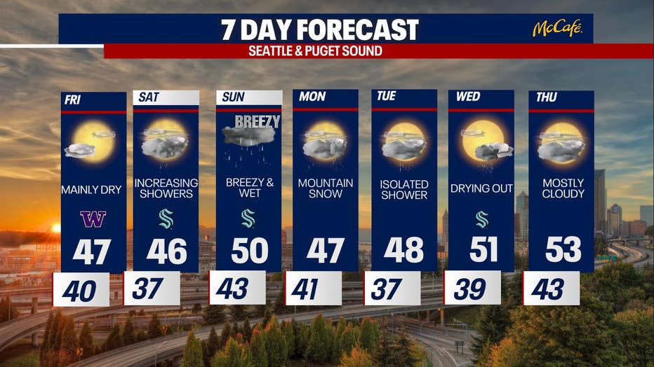
Dry Friday, rain returns through the weekend
FOX 13 Meteorologist Ilona McCauley has your 7-day forecast.
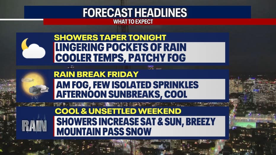
Highs today were a few degrees cooler with mostly cloudy skies and rounds of scattered showers. Temperatures peaked in the low 50s, and rain totals were highest around Arlington. Showers have slowly tapered this evening.

Highs today were a few degrees cooler with mostly cloudy skies and rounds of scattered showers. (FOX 13 Seattle)
Lingering showers overnight into early Friday will slowly dry out with areas of patchy fog. Skies will remain dry through Friday evening with more sunbreaks. Rain returns Saturday with more lowland rain and mountain snow.
Lingering showers overnight into early Friday will slowly dry out with areas of patchy fog. (FOX 13 Seattle)
Skies will clear to partly cloudy and allow temperatures to cool down into the mid to low 40s.
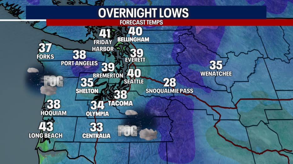
Skies will clear to partly cloudy skies and allow temperatures to cool down into the mid to low 40s. (FOX 13 Seattle)
A few lingering showers to start Friday morning with low clouds. Skies will clear through midday.
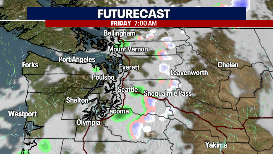
A few lingering showers to start Friday morning with low clouds and cloud. Skies will clear through midday.
Even with more afternoon sunbreaks, temperatures will remain cooler than average, peaking only in the mid to upper 40s.
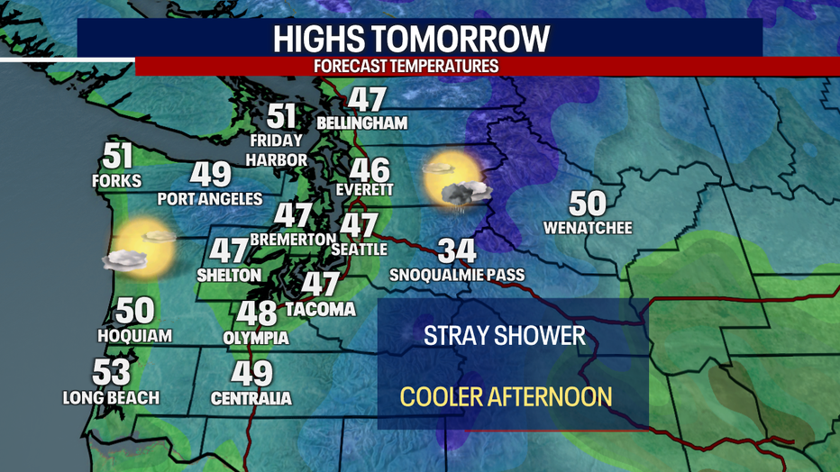
Even with more afternoon sunbreaks, temperatures will remain cooler than average, peaking only in the mid to upper 40s.
Great news for Dawg fans, the skies are looking dry for the game against UCLA with chilly evening temperatures.
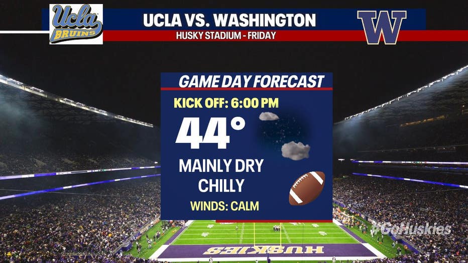
Great news for Dawgs fans, the skies are looking dry for the game against UCLA with chilly evening temperatures.
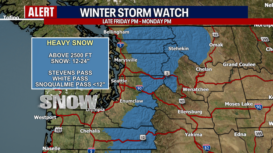
If you are planning on traveling over the passes this weekend, make sure to check the latest conditions. A Winter Storm Watch will be in effect late Friday through late Monday for 1-2 feet of snow, less than a foot around Snoqualmie. Showers will start as snow Saturday before snow levels rise by the evening hours as a warm front moves through. More snow will be in the forecast for the passes as snow levels drop back down Sunday into Monday.
If you are planning on traveling over the passes this weekend, make sure to check the latest conditions.
Lowland rain, mountain snow and breezy winds will be present Sunday into Monday. Another cold front moves through Monday, bringing more rain and mountain snow. It looks currently like a ridge of high pressure will build in by midweek, so we could see drier conditions return.
Lowland rain, mountain snow and breezy winds will be present Sunday into Monday.