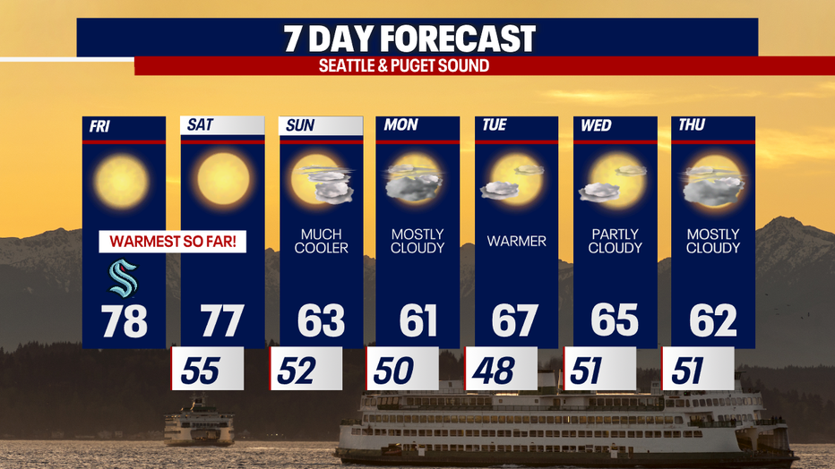
Seattle weather: Feeling like summer Friday and Saturday

Friday highs push into upper 70s to near 80
A strong ridge of high pressure is giving us a beautiful end to the work week and start to the weekend. Highs will cruise into the upper 70s to mid 80s across Western WA and that's something we haven't seen in 192 days!
SEATTLE - A strong ridge of high pressure will produce record setting temperatures Friday with highs close to 80 degrees.
Expect sunny skies all day long in Western Washington as we celebrate the warmest day of the year so far.
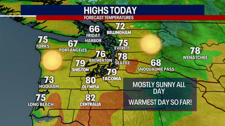
Offshore winds will help warm Western Washington into record territory Friday. High pressure to the east will produce downslope winds off of the west slopes of the Cascades. Many areas in the foothills and on the eastside will likely hit 80 degrees today. Temps will be cooler toward the water.

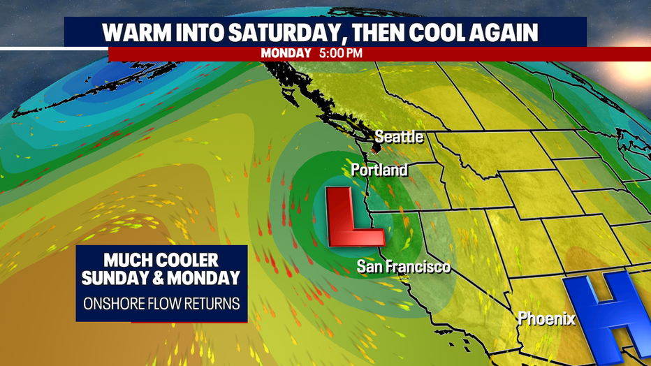
Sunday into Monday, the ridge will shift east, opening the door to cooler marine air Sunday and even the possibility for some light rain on Monday. Temps will fall into the low to mid 60s Sunday and will stay in the low 60s with clouds on Monday. Most of the rain will head south into Oregon and Northern California.
I don't see a major cool down as we head into May. The constant troughing and below average temperatures seem to be done for now. Enjoy these warm temps and this mostly dry week ahead!