Heavy mountain snow across the passes, rain and snow mix for the lowlands

Rain and snow mix for the lowlands, strong wind gusts across parts of North Sound
Moderate rain heavy rain developed Sunday night which melted a lot of snow.
It has been an active night! Moderate/heavy rain developed this evening which melted a lot of snow.
As this happened, ponding developed, and the slushy roadways created difficult driving conditions for some. The rain dragged the cold air down towards the surface and allowed for the snow level to drop this evening. Lowland snow has been reported across Snohomish, Kitsap, and Island county. It'll will continue to be possible tonight as the snow levels toggle back and forth so be on the lookout!
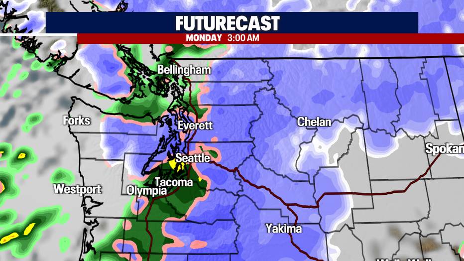
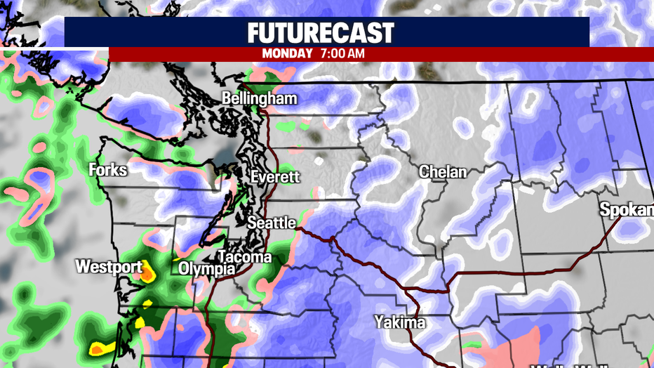
1"-2" of snow accumulation will be possible across parts of the lowlands (especially elevations around 500'). Most of this will take place overnight, and we should start to clear out just in time for that early morning commute. However, it'll continue to be sloppy out there so give yourself plenty of time for your drive out.
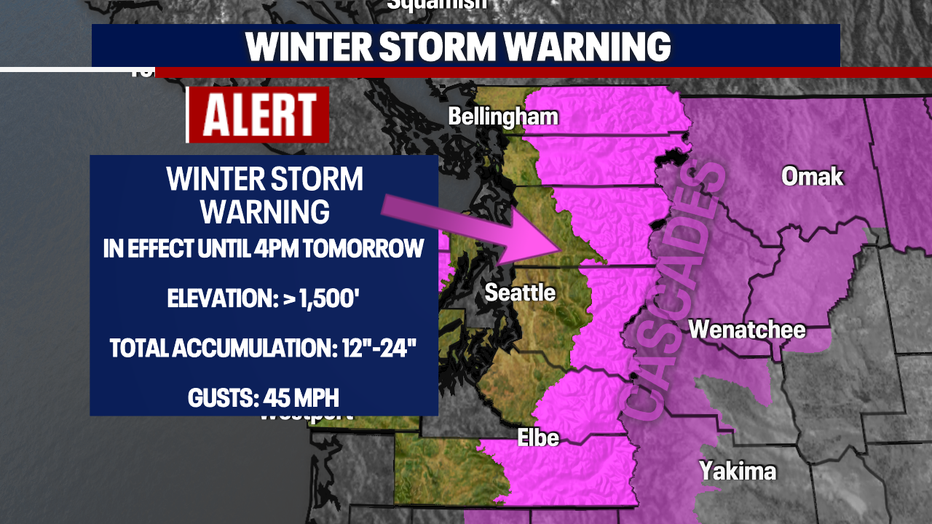
Now, if you're planning on traveling through the mountain passes tomorrow - check in on the conditions! Heavy snow totals are expected, and this will make traveling very difficult. A *Winter Storm Warning* due to heavy blowing snow is in effect and will continue through the day.
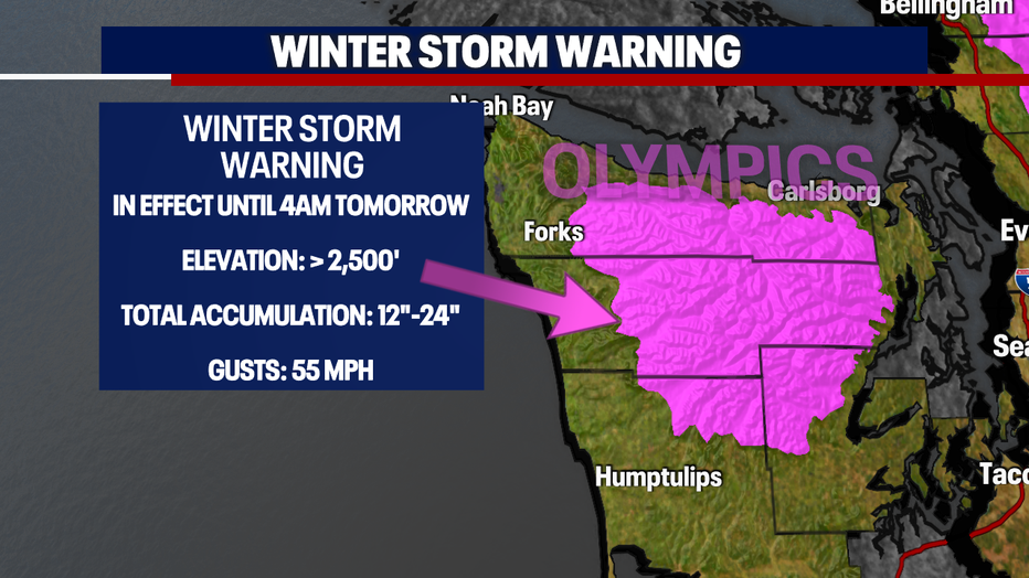
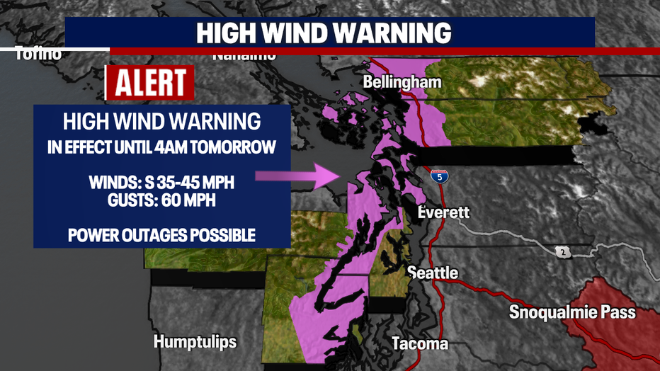
While we're continuing to expect a mix of rain and snow across Western Washington, the winds will be whipping. A *High Wind Warning* will remain in effect until 4am tomorrow morning for the area highlighted below. As this expires early tomorrow morning, the winds will calm down, but you'll notice some breezy conditions from time to time.
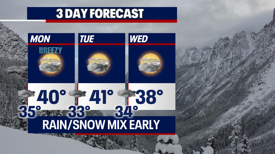
A mix of rain/snow (lowlands) will not only be possible tonight, but over the next few days. We'll continue to keep an eye on this!
MORE FROM FOX 13 WEATHER:
DOWNLOAD: FOX 13 Weather and News Apps
WATCH: Forecast and Radar
READ: Closures and Delays
CHECK: Latest Weather Alerts and Live Traffic Map
INTERACT: Submit your Weather Photo
DAILY BRIEF: Sign Up For Our Newsletter
FOLLOW: Lisa Villegas, Erin Mayovsky, Brian MacMillan, Abby Acone and Scott Sistek

