

Heavy rain, stray thunderstorms for greater Seattle region Saturday

Seattle weather: Rain, thunderstorms possible Saturday
FOX 13 Seattle Meteorologist Abby Acone has your latest western Washington weather forecast!
Heavy rain and stray thunderstorms are in the forecast for parts of western Washington Saturday.
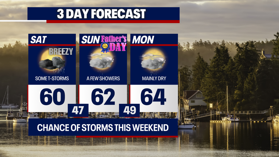
Highs in the 60s are forecast through Monday. (FOX 13 Seattle)
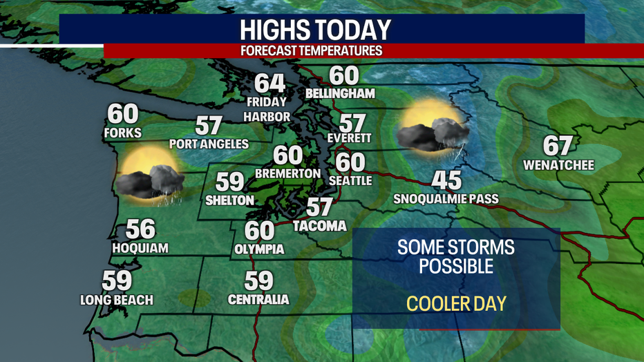
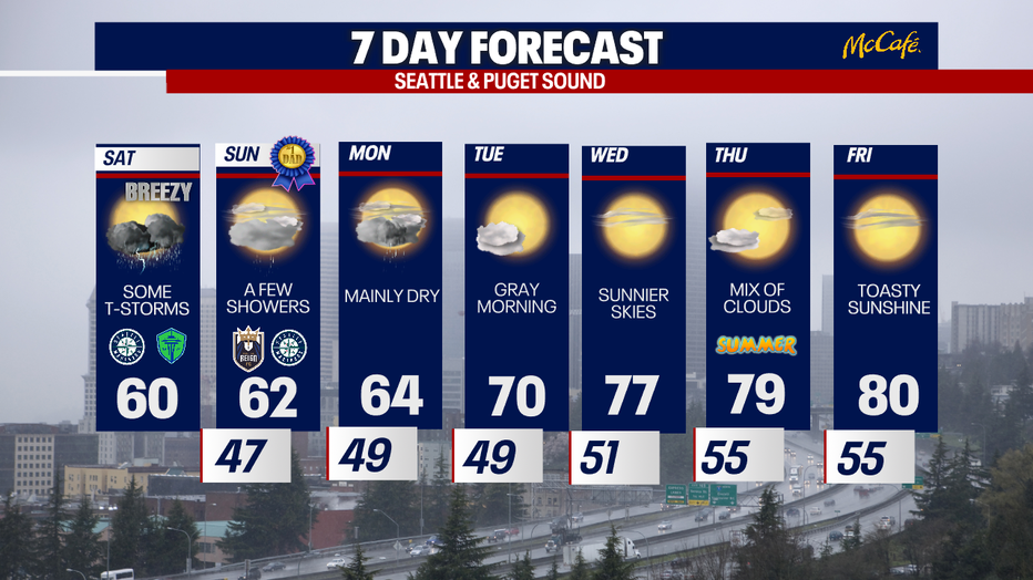
Highs this afternoon will be several degrees below average. The normal temperature for today at Sea-Tac Airport is 71. Today will be a strange weather day: we'll alternate between sunbreaks and locally heavy downpours.
Highs will reach the mid 50s to low 60s Saturday in Seattle. (FOX 13 Seattle)
Due to an area of low pressure hovering over the region this weekend, there could be lightning, small hail or graupel, gusts to 30 mph (max 35 mph) and drenching rain in areas. This is especially possible where a convergence zone develops this afternoon and tonight, most likely over north King County and Snohomish Counties.
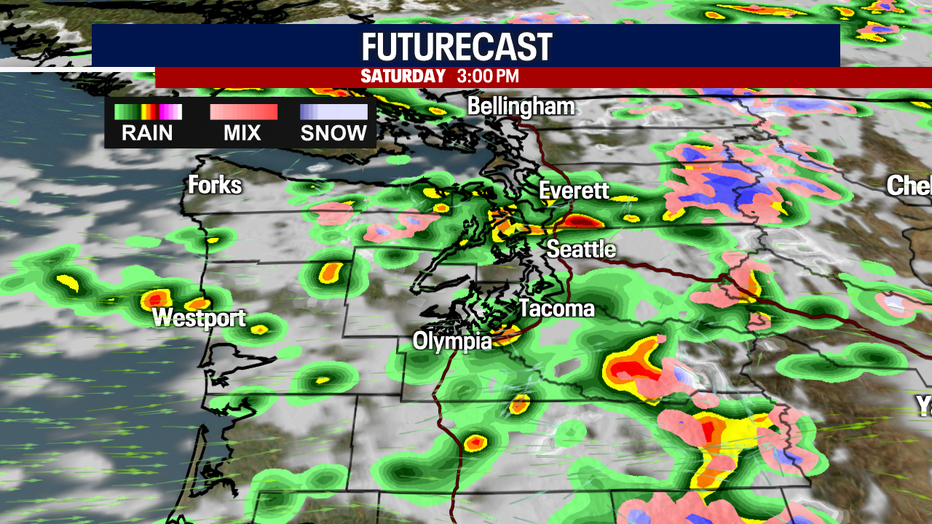
Scattered heavy downpours and thunderstorms are a possibility Saturday. (FOX 13 Seattle)
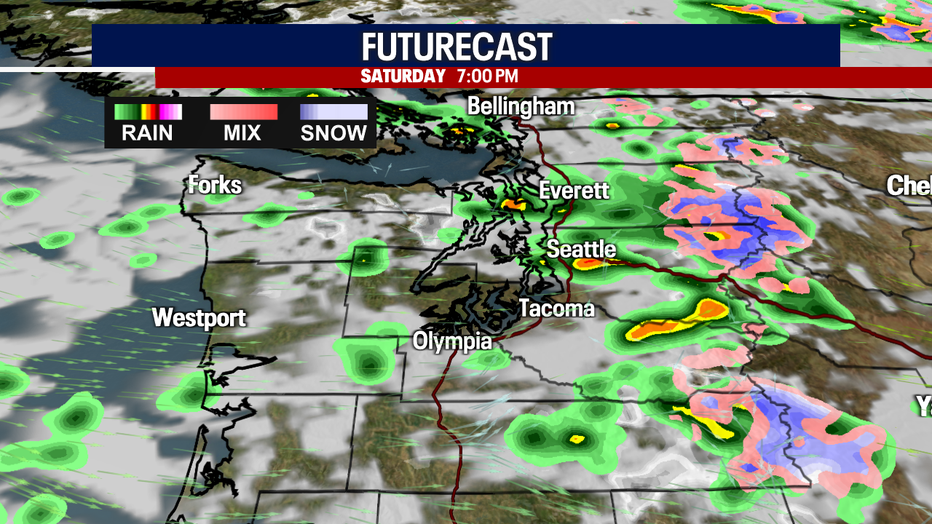
Lingering downpours are a possibility Saturday night. (FOX 13 Seattle)

A low pressure system will trigger wet weather in Western Washington this weekend. (FOX 13 Seattle)
Due to the cool weather pattern, there may be snow falling as low as 4,000 feet in elevation. If strong downpours materialize, there might be brief, spotty periods of snow falling at 3,000 feet in elevation. However, snow accumulations at this level are highly unlikely. The highest peaks of the Cascades could get fresh accumulation of snow.
Unfortunately, there's a heightened threat for debris flows and flash flooding over the Bolt Creek burn scar in the Central Cascades. Recently burned areas can't absorb as much moisture, so there's an increased risk for runoff. For this reason, the National Weather Service posted a Flash Flood Watch from noon today to later tonight.
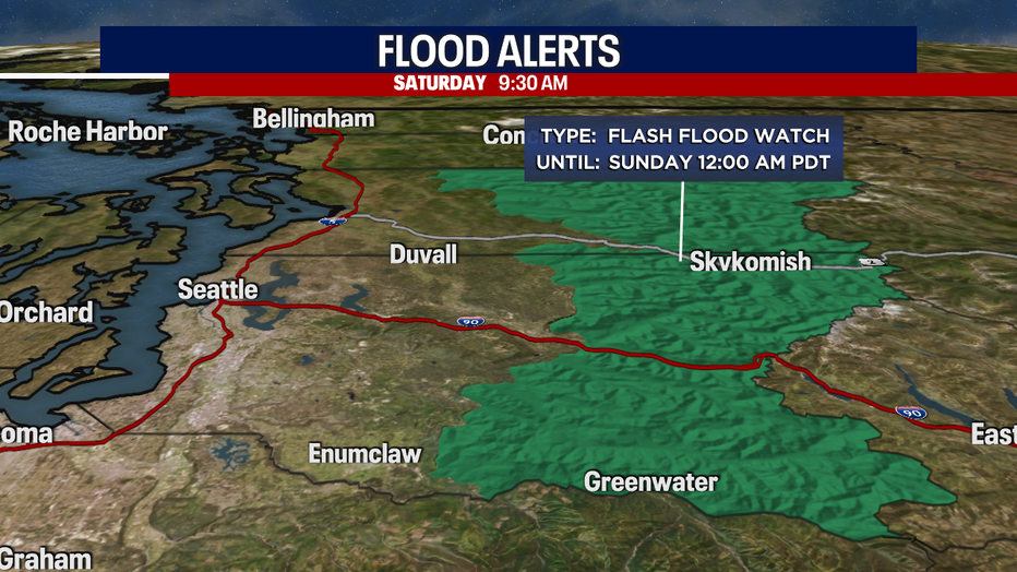
A Flash Flood Watch is in effect for the Bolt Creek burn scar. (FOX 13 Seattle)
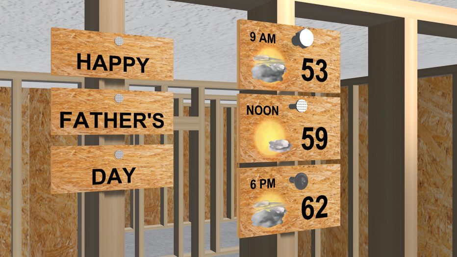
Far fewer showers are forecast Sunday in western Washington. Still, we can't rule out a stray thunderstorm. It'll be mostly dry for Father's Day!
Monday will be mostly dry but not entirely so. Tuesday will be lovely with sunshine following a gray start.
Temperatures rebound into the upper 70s Wednesday and Thursday. The 80s are a possibility on Friday!
Temperatures gradually warm this week in Western Washington. (FOX 13 Seattle)
Take good care,
Meteorologist Abby Acone
Follow me on Facebook (Meteorologist Abby Acone), Instagram @abbyaconewx, TikTok @abbyaconetv