Seattle weather: Light showers through midday Saturday, then clearing out and warming up
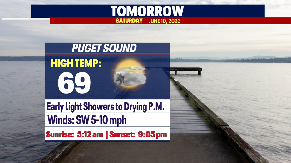
Seattle weather: Early showers Saturday, temperatures to start climbing
Seattle weather: Early showers Saturday, temperatures to start climbing
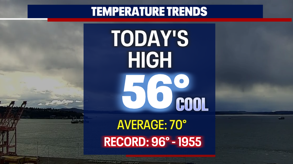
What a day! Showery, cloudy and cool! Friday's highs only warming into the mid-50s for Western Washington.
SeaTac hit 56 degrees at the airport, and that's 40 degrees cooler than the record high of 96 set back in 1955.
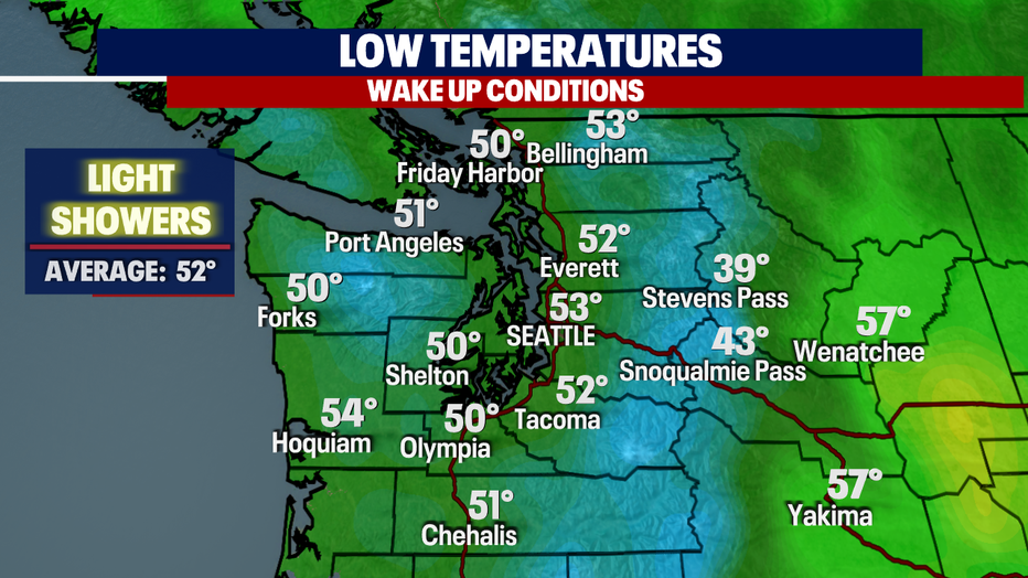
Overnight skies remain cloudy with light showers. Temperatures cool off a few degrees from where we landed Friday. Most of us will hang in the low-50s. Our average low is 52 for this time of year.
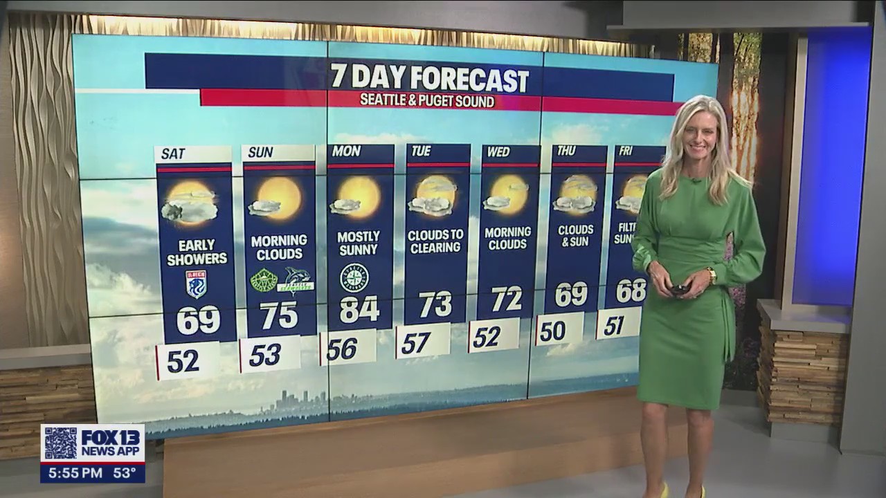
Saturday morning features cloudy skies with pockets of showers across the region.
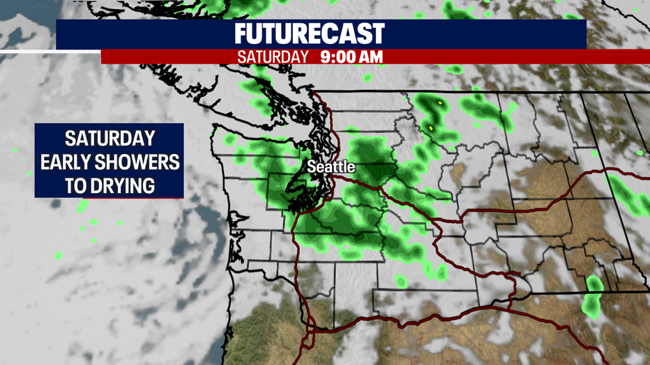
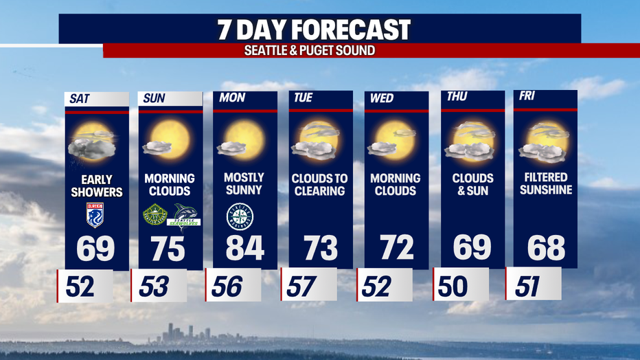
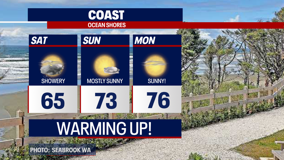
By Saturday afternoon into the evening hours, skies will dry out and start to clear for a little sunshine before sunset. Highs land near 70.
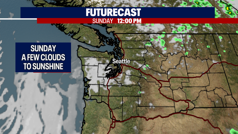
We expect to wake up to a few clouds Sunday, but overall, skies turn mostly sunny with highs warming into the mid-70s.
The heat keeps coming as we start the work week. So, if you're a fan of the 80s, Monday is the day for you. Temperatures are expected to reach near 85 for the metro area.
The 80s are short-lived though, we'll cool off into the 70s and potentially even the 60s by the end of next week! Enjoy!
Have a great weekend all! ~Erin Mayovsky, FOX 13 Forecaster
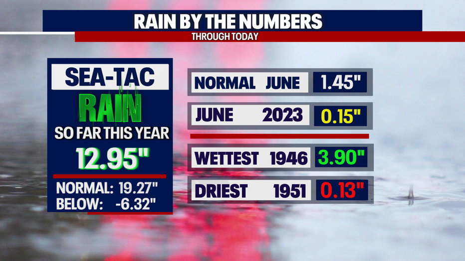
*SeaTac Rain Almanac
*Coast Forecast
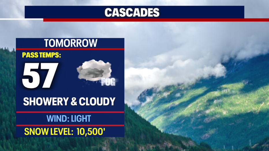
*Mountain Forecast
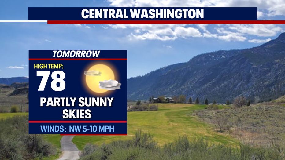
*Central WA Forecast