

Lowland rain and lots of mountain snow for President's Day weekend
Snow headed to the mountains
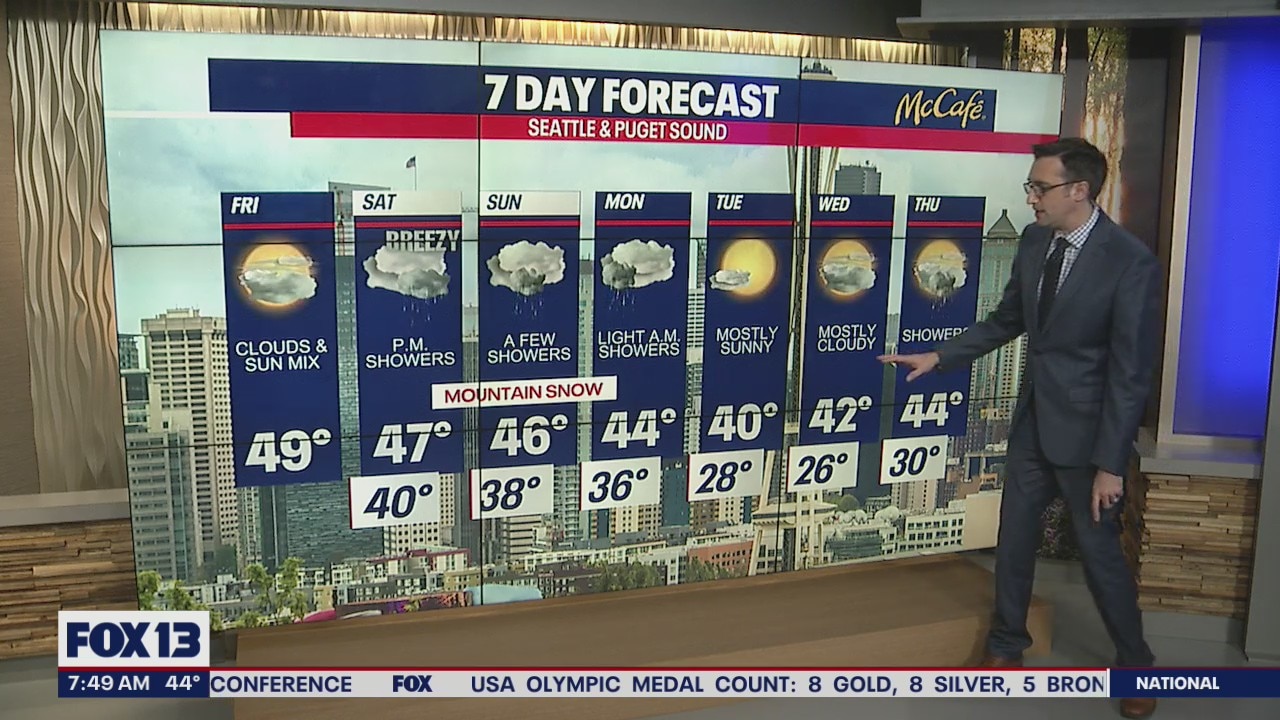
A strong system will move into the region starting Saturday delivering lowland rain, gusty winds, and heavy mountain snow.
SEATTLE - Happy Friday!
The Puget Sound area is ending the work week dry with a mix of clouds and sunshine. The strongest weather system of the month so far will move through the area Saturday into Sunday brining lowland rain and mountain snow.

With only 0.31" of rain so far through February 17th, this is the second driest February on record up to this point. A good soaking rain is not likely over the next 7 to 10 days, but Seattle will start playing catch up this weekend with some showers.

The big story over President's Day weekend will be in the Cascades. Snow levels will drop and Washington ski resorts will see 12 to 18 inches of snow through Sunday night. This incoming winter weather will make travel difficult over the passes Saturday evening and Sunday.

Showers will continue for the lowlands on Sunday and ease up as we get into Monday morning. There is a slight chance of a rain/snow mix on Monday morning, but I don't expect accumulating snow in the lowlands. Very cold air will push into the area on Monday and Tuesday. Starting Monday night, overnight lows will be in the 20s with daytime highs on Tuesday struggling to make it to 40 degrees.
Have a great weekend!
